Chip
-
Posts
72 -
Joined
-
Last visited
Content Type
Profiles
Blogs
Forums
American Weather
Media Demo
Store
Gallery
Everything posted by Chip
-
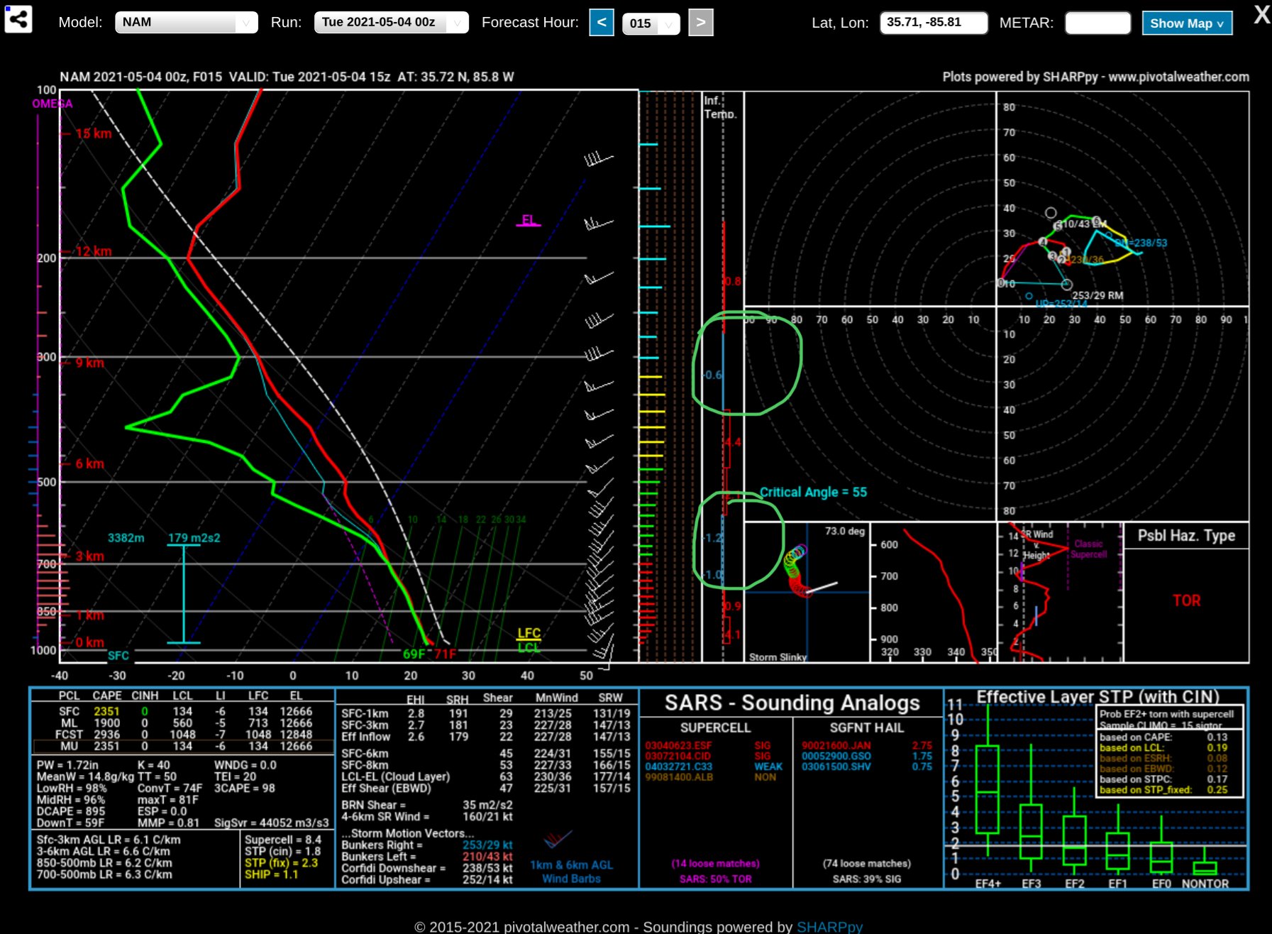
I think anything (tornadoes ) are going to have a hard time getting going with the backing of the winds in the mid levels. I’m even referring to later after this line passes. All the soundings that I’m looking at have pretty good backing in the mid levels.
-

-
Looks to be a messy storm mode based on the hodograph for tomorrow.
-
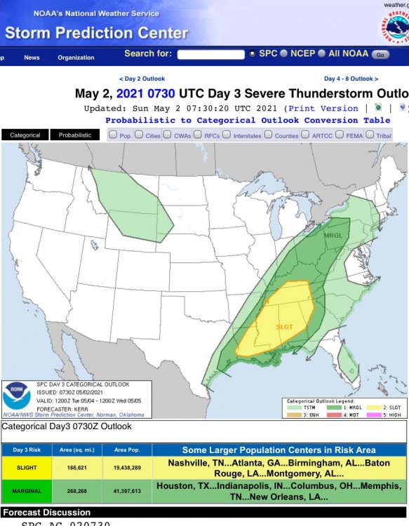
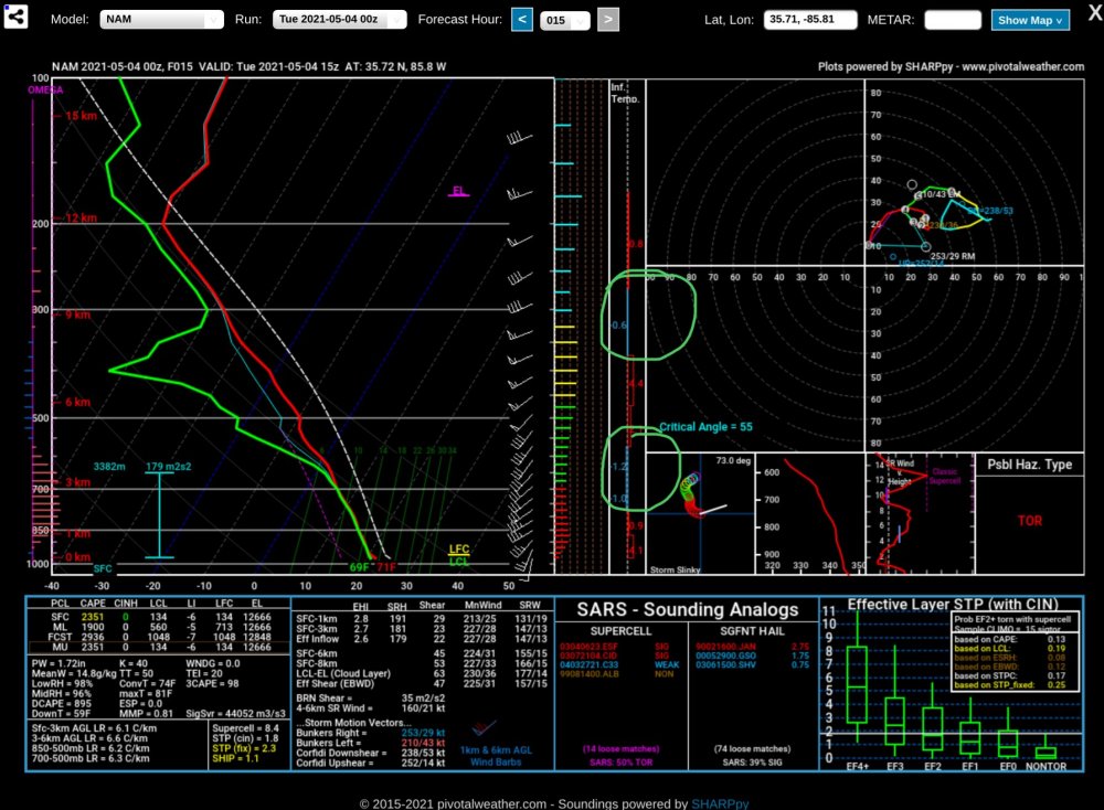
Near Plateau area of TN.
-
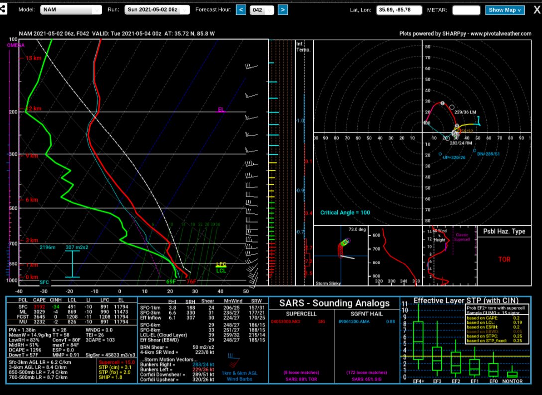
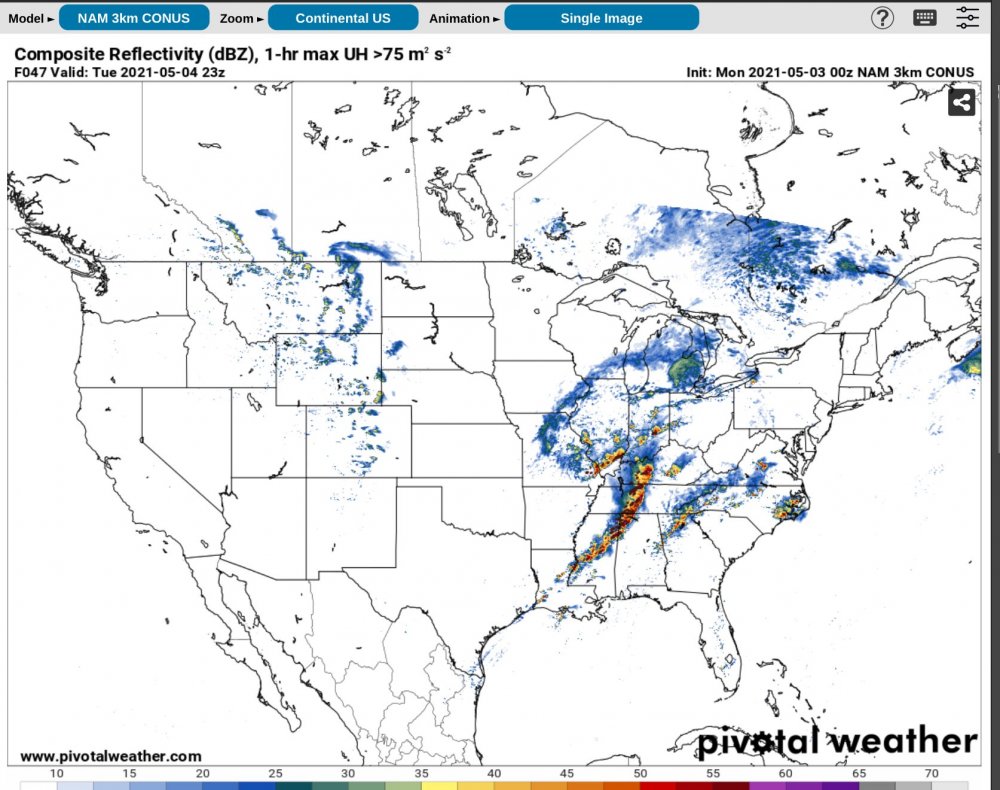
New NAM for tomorrow near Plateau AREA OF TN... 18Z HRRR shows the same
-
I agree totally. I think a lot of what happens tomorrow will be predicated on how much clearing we really do get.The models have been trending downward in my opinion… I can’t say I’m overly impressed honestly. Now that being said if the MCS clears really quickly then totally disregard my previous statement.
-
-
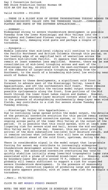
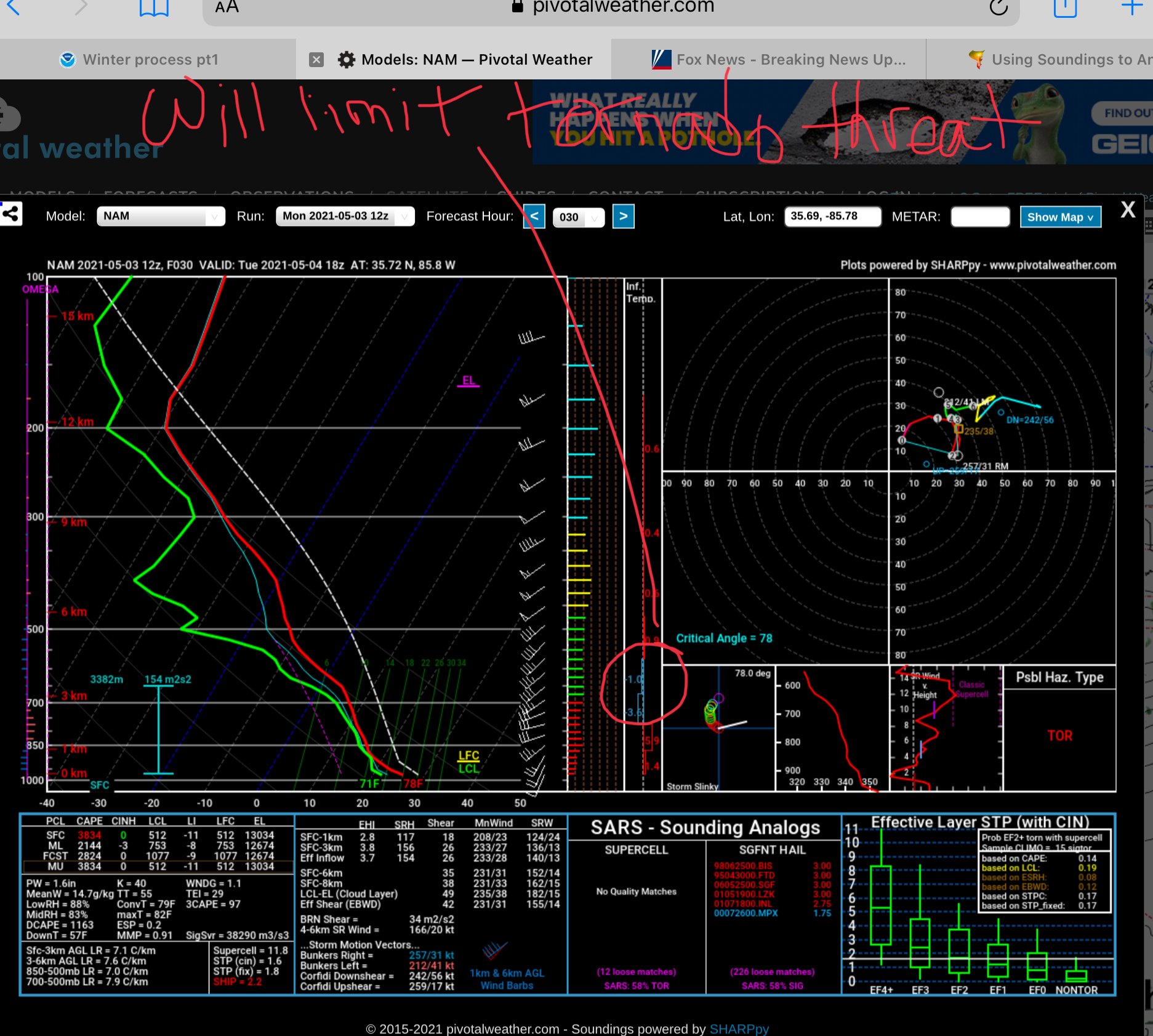
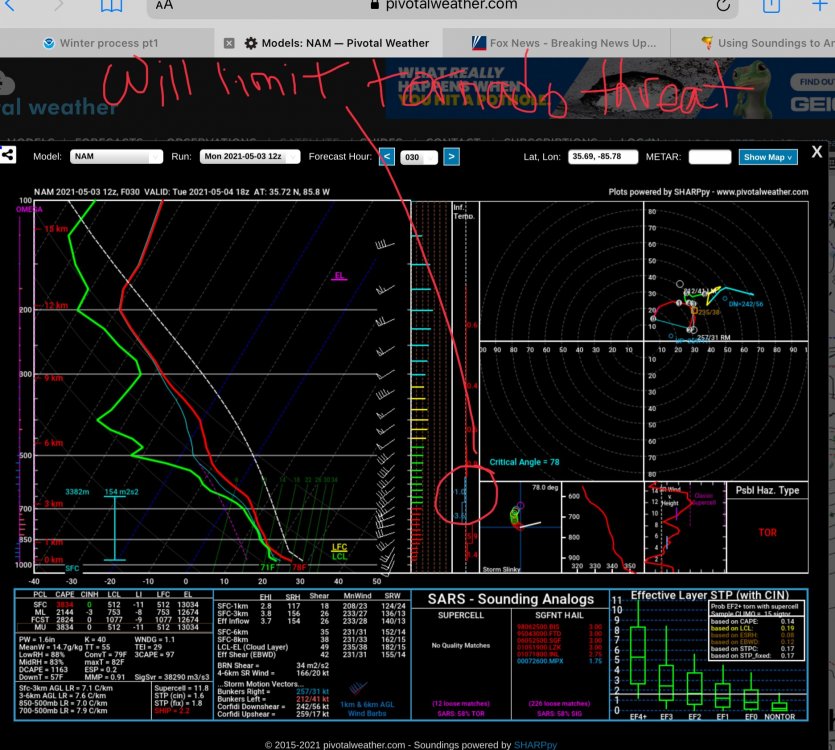
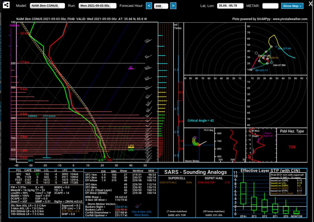
NAM Plateau area of TN. Well my current thinking is we are going to have a very strong line of storms that may produce a few tornadoes. These won’t be super cellular in nature in my opinion so that is good news as it should limit tornado potential overall. So I think the SPC is on point with 5% tornado potential. Just my two cènts.
-
-
-
-

-
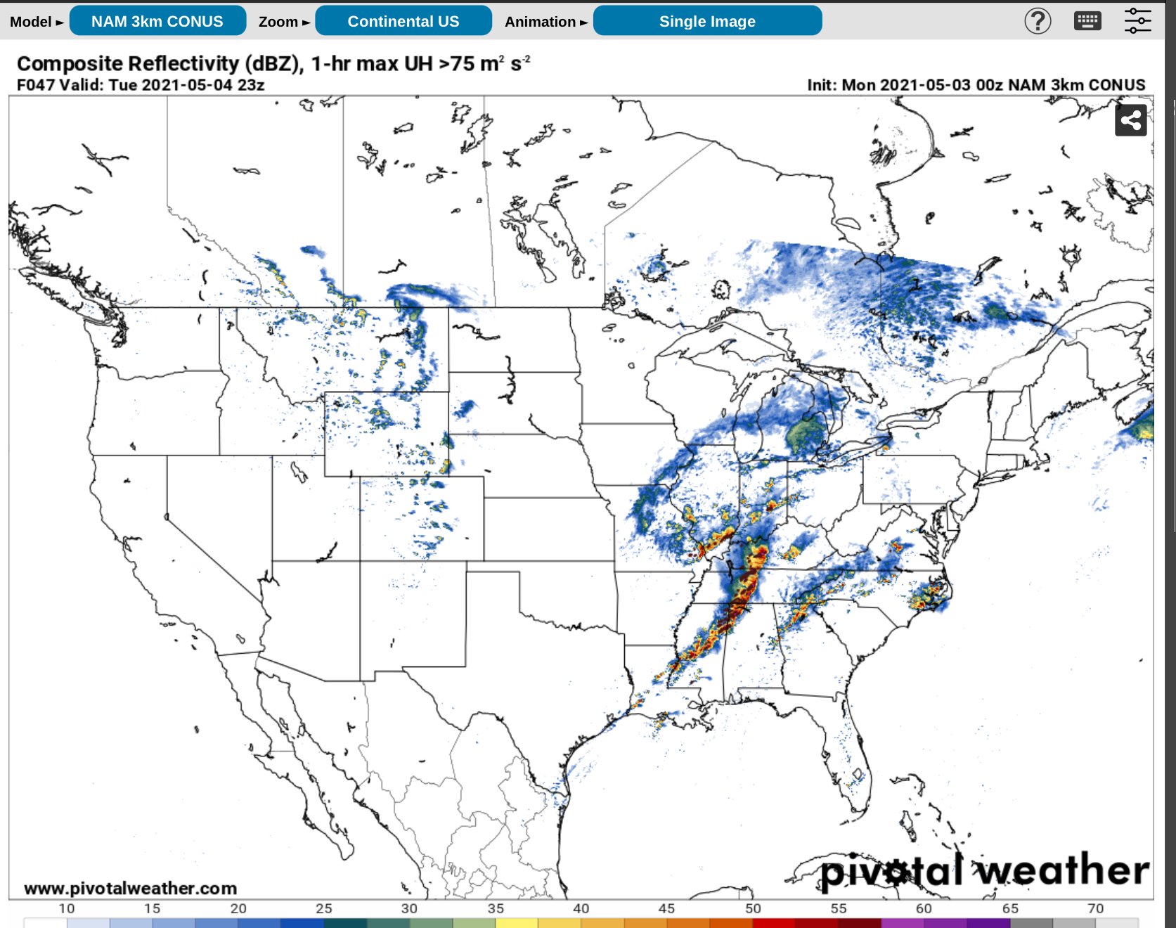
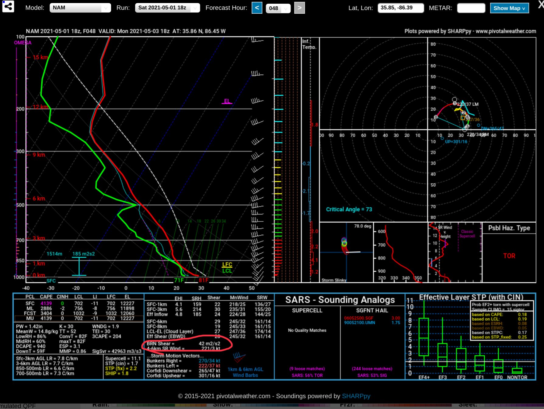
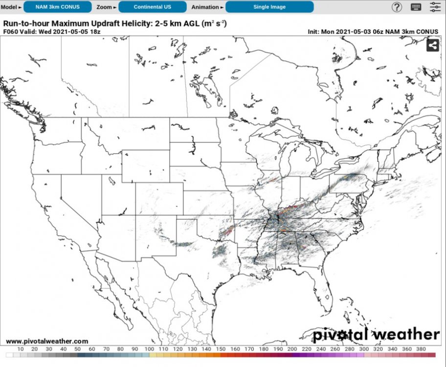
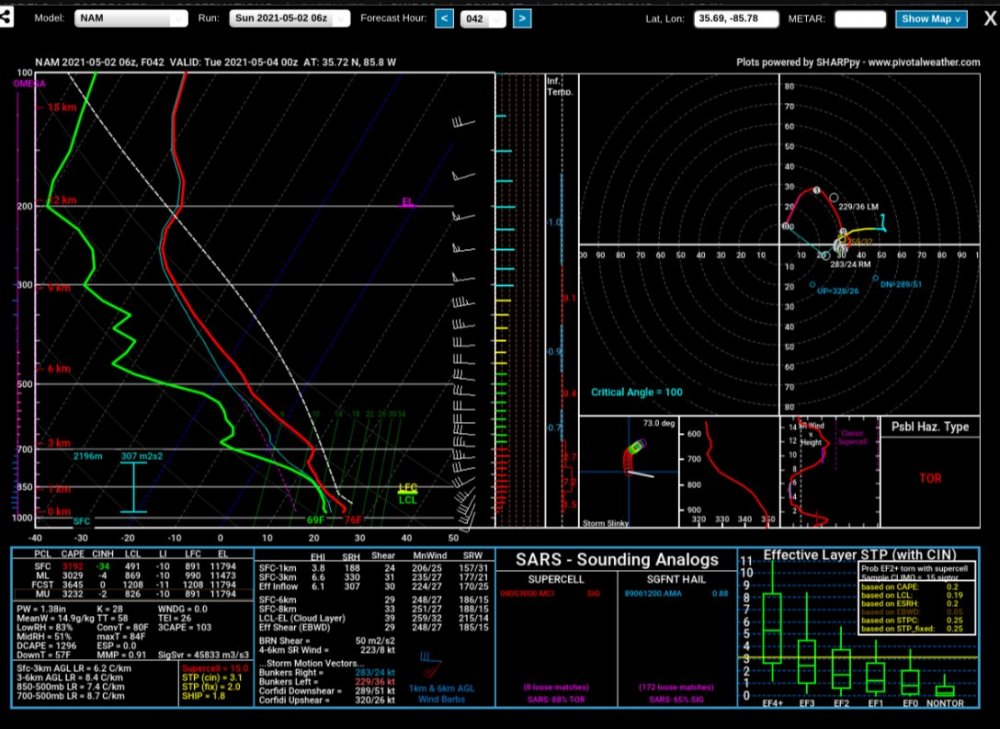
NAM CONS Near Plateau area of TN
-
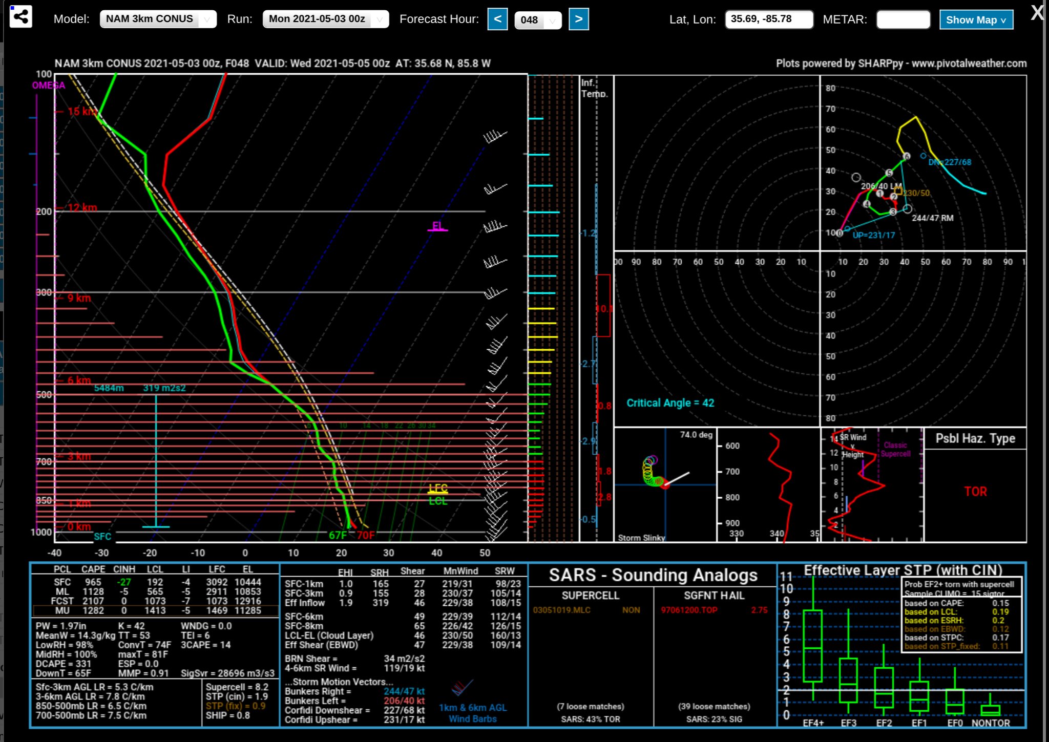
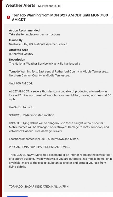
RAP Murfreesboro

-
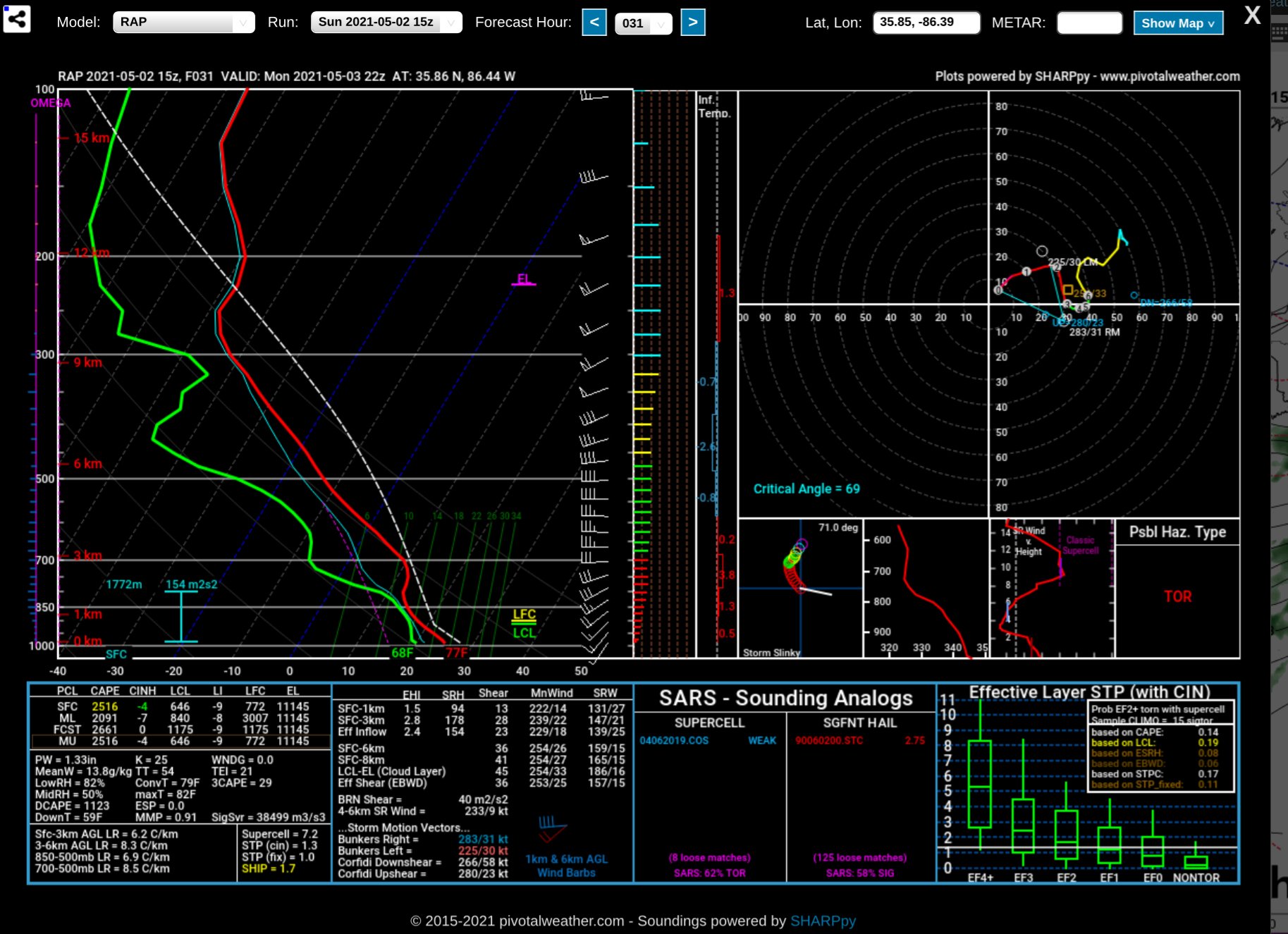
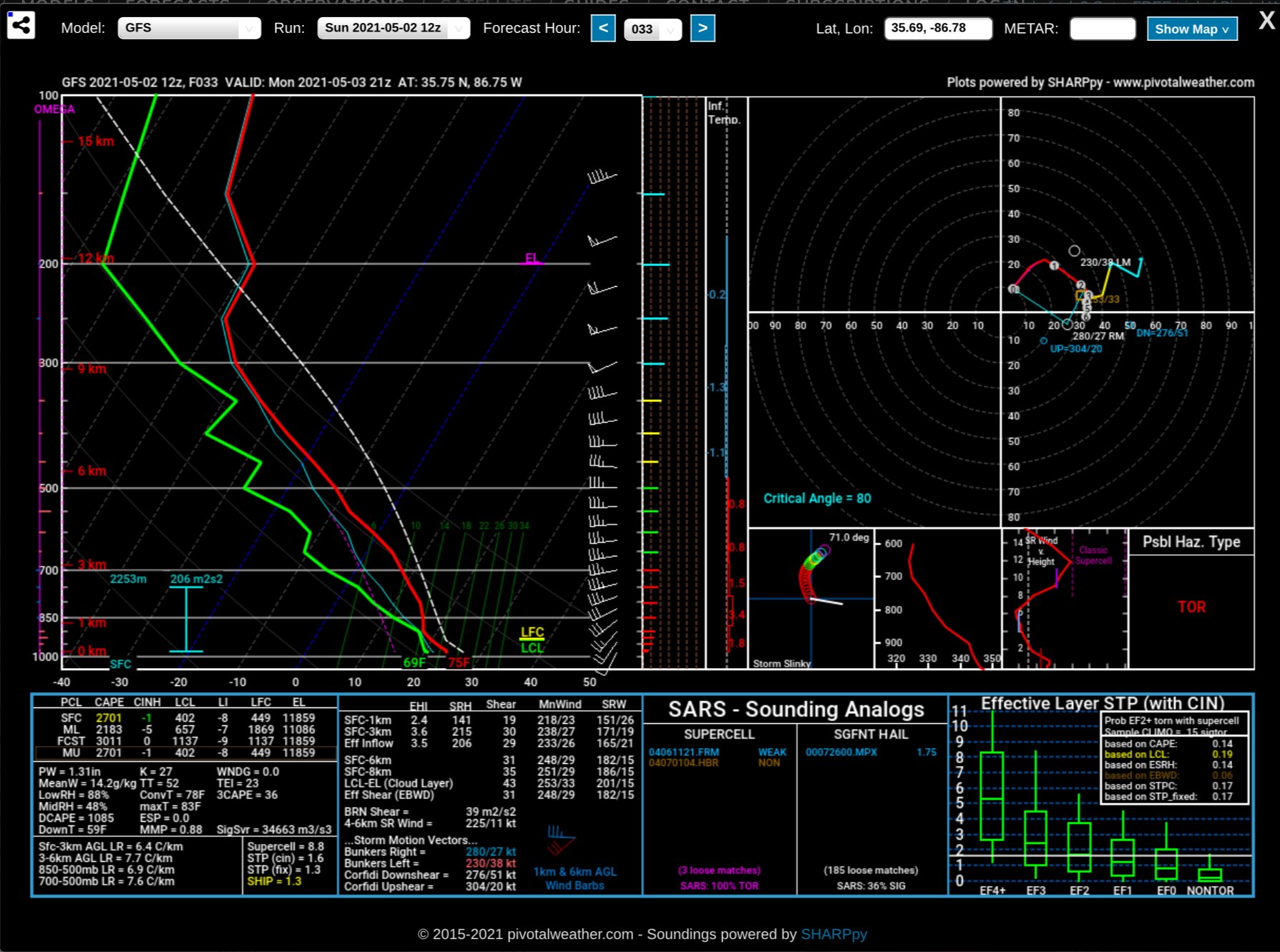
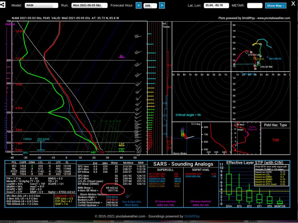
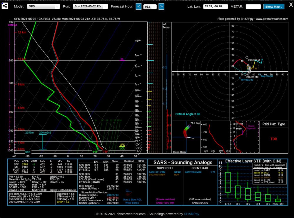
New GFS. Near Plateau area.. after reviewing all the information I honestly feel that we could have a few lower end tornadoes here. The Helicity values support EF 2 Tornado potential
-
-
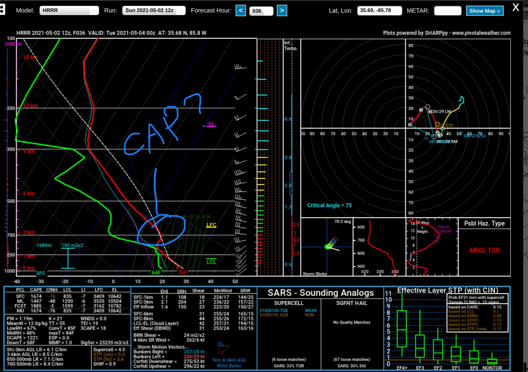
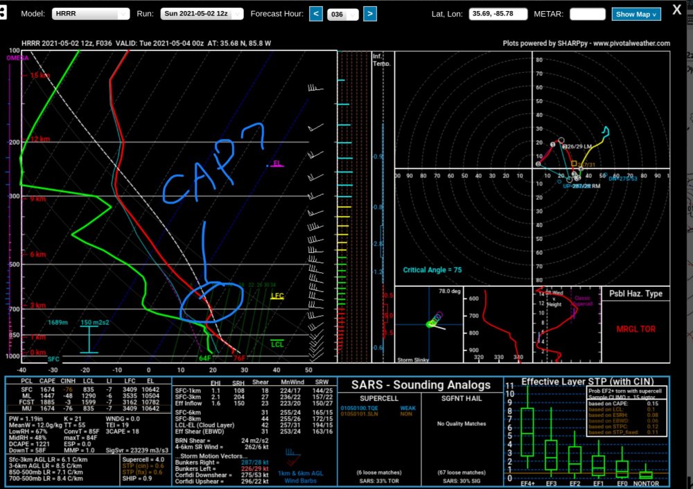
Is this a cap?
-
This has my attention...
-
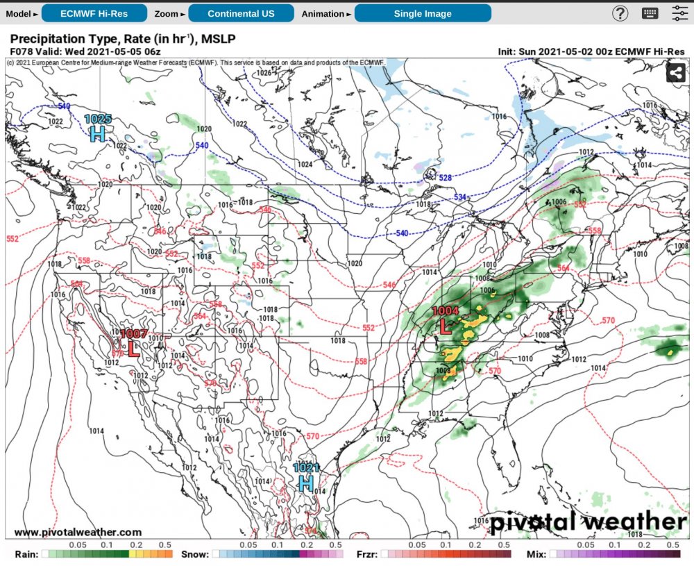
Euro shows this... which is why SPC seems unsure. All depends on low placement and development... Here is the Euro as an example.. other runs don’t necessarily show this same set up. This set up has more shear! Has parts of TN with over 60kts
-
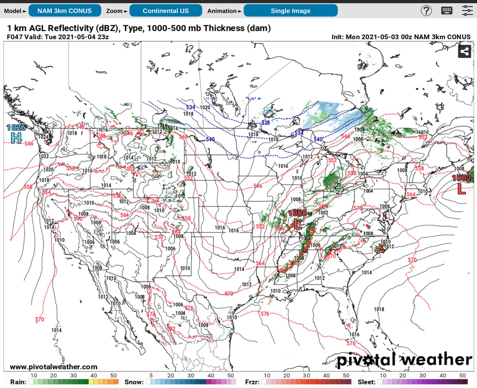
NAM More Bullish Near Plateau area
-
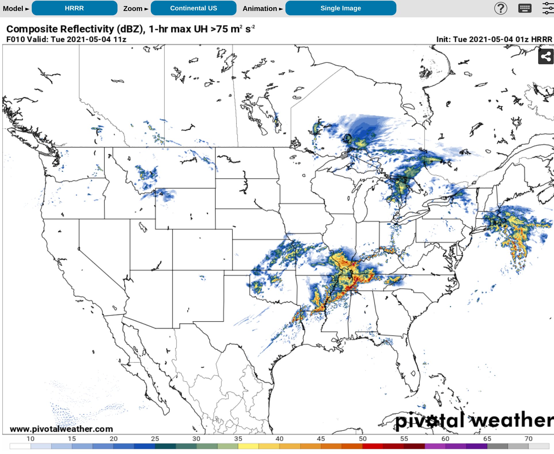
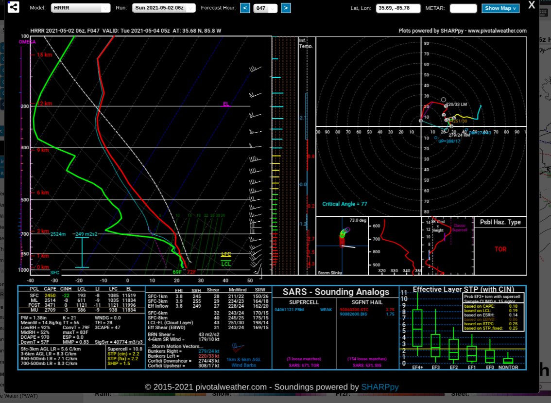
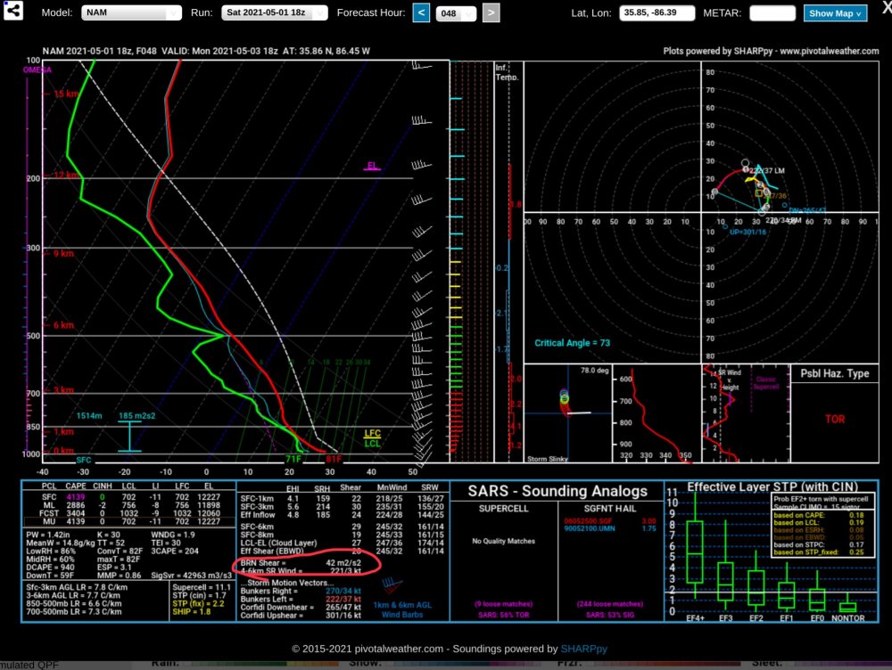
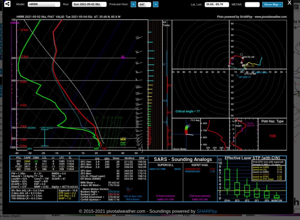
HRRR Near plateau area of TN
-