

WolfStock1
-
Posts
24 -
Joined
-
Last visited
Content Type
Profiles
Blogs
Forums
American Weather
Media Demo
Store
Gallery
Posts posted by WolfStock1
-
-
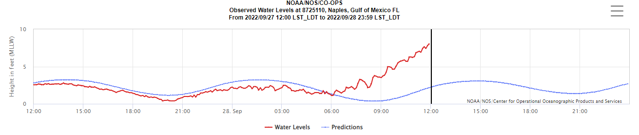
Anyone live along the Potomac, and can report if there's ice on / in it or not? Was thinking about going up that way for Sunday drive later. Always neat to see that.
-
1 hour ago, mattie g said:
Yes. If you park in long-term parking, you need to take the shuttle to the terminal. Depending on the time of day and which stop you get picked up at, it can take anywhere up about 15 minutes to get to the terminal once you get on the shittle.
Pretty sure they run 24/7, or at least as often as they need to get people to the terminals on time.
You can also get a really good deal parking at the Marriott nearby - did that for recent vacation. Shuttle runs every 30 mins IIRC. Parking much cheaper than DCA long-term. Not sure what service (booked by wife) - maybe Park N' Fly.
-
A bust here on SW side of Leesburg, even at 800' elevation. A white tinge on the ground, but generally rain. Oh well.
Just came from a funeral service in town - at 400' car said 42 degrees; then went down to 32 degrees at 800'.
-
59 minutes ago, WVclimo said:
I did some hiking this afternoon on Skyline Drive near Luray. Surprised to see that shaded areas on north-facing hills had some snow cover. I think that area should do well on Saturday.
I'm up on Hogback mountain (SW of Leesburg). On Monday we got snow all afternoon (though no accumulation), whereas just 200' lower in elevation it was all rain. Never seen it so clearly demarcated like that. Will be curious if the same thing happens this weekend.
-
 2
2
-
-
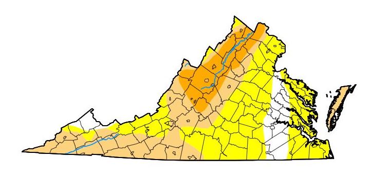
Virginia as of a few days ago: (will be getting worse)
-
On 11/4/2023 at 10:40 AM, MN Transplant said:
Cleanly the driest year in well over a decade in Loudoun Co. 2018 and this year are the two outliers.
(cocorahs data)
.thumb.jpeg.12d71266eda51a2a87945efa032d6ef7.jpeg)
That's a pretty cool data summary - where can I find that, if I may ask?
I'm in LoCo, and indeed it's been super-dry, again, for the past month+. Thought we were going to get some relief about a month ago, but back to drought, with no significant rain in the 10-day. Not a good fall to try to plant some grass. Oh well.
-
13 hours ago, stormy said:
Yes, be patient while working your way through this site, but, the information is here. https://waterdata.usgs.gov/nwis/gw
Thanks!
-
16 hours ago, midatlanticweather said:
Must be this one.
https://fireball.amsmeteors.org/members/imo_view/event/2023/5012
-
7 hours ago, stormy said:
The water table has dropped 11 feet in 3 months in Augusta/Rockingham.
Is there a good site to get water table readings? Thx.
-
23 hours ago, Kmlwx said:
NEXRAD data from the NWS is free for all. No licensing. However, the data feeds that NWS provides to apps like Radarscope are often just data - it's up to Radarscope or each individual provider to do color tables, and which products to offer. At the heart of it - Level 2 data, for example is just zeroes and ones until somebody makes it pretty.
Probably not a 100% 1:1 solution for what you're looking for but there may be a lesser known site around that could do something similar.
OK - seems like then that the functionality I'm really looking for was in the WU-specific "radblast" tool? (that takes this data feed and makes the maps, adds the options, etc.)
I've updated the OP to indicate.
-
On 8/31/2023 at 9:48 AM, Kmlwx said:
If you are just looking for basic radar - use the NWS LWX site and it is on there. Though you won't have a lot of options for different product types. Radarscope is best-in-class for mobile and if you are a higher end enthusiast you could also get GR2 or GR3 products on PC.
NEXRAD is not a term specific to Wunderground - it's just what WSR-88D was referred to (is?)
Thanks for the tip. I find the radars on the NWS extremely klunky though. Really not much ability to customize view with pan and zoom. One of the things I liked about the old WU method was I could have a super-quick gif that was specific to my location - e.g. zoomed right in to the area just around my house, so I could tell practically down to the second when it was going to start raining from a storm. (RadarScope provides this, but only on phone, and it requires manual panning around - not a single quick click.)
E.g. this was URL I used for the gif:
(lat/long changed to protect the innocent)
All I had to do was tweak that as desired, and bookmark it, and it provided a great way to quickly see local hi-res radar; no app required and no web page to load other than just the one super-quick gif frame.
IIRC there was a newer version that was created a couple of years ago, that provided higher resolution, and I'm guessing that has something to do with this. I'm guessing it's a licensing thing - like the people that put out the output charge more $ for it now, and WU wasn't willing to pay. Just a guess though.
(Yeah I know NEXRAD was not a Wunderground thing; just that that was the one site that seemed to pipe it through directly, with the NEXRAD name).
-
On 8/31/2023 at 1:20 PM, Stormpc said:
Download The Radar Now app. They just updated and now the nexrad local base reflectivities are back.
Thanks. Downloaded. I see it has a free 5-day trial - I'll check that out next time we get some storms through (in a few days). Looks like it has some promise. Still though - it's a phone app; I'm hoping to find a web link, that I can use on PC or phone.
-
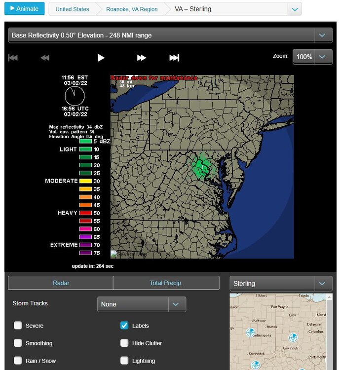
Query from a Wx enthusiast-but-not-professional -
I brought this up last year when the NEXRAD feed showed up as "down for maintenance" on the Weather Underground site. It came back for a while but then went down again, and has been showing up as "down for maintenance" ever since then - 17 months ago. Is the NEXRAD radar radblast thing gone, as something directly-accessible on web page?
I had some handy links to custom frames that pulled in the radar from the wunderground site, and loved that, but surprisingly for a popular website it's still there but still showing "down for maintenance" as of 3/2022.
I bought the RadarScope app on phone - that's pretty good, though is a bit more heavyweight and klunky, and I'm not sure if is actually the nexrad radar, and it's also not as flexible in the options for display (e.g. Rain/Snow checkbox). There is a decent site done by College of DuPage as well - also a bit klunky, and seems odd that one would have to use a small college website to get to that. Might there be something on a NOAA/NWS site, or major commercial site, that has it?
Thanks for any info.
-
33 minutes ago, Ernest T Bass said:
Yeah you would think there would be a thread in the SE Forum, but try the one in Tropical HQ if you haven't already.
OK thanks. Didn't realize that existed actually - I just have the Mid-Atlantic and SE forums bookmarked.
-
OK I'm a casual lurker to AmericanWx, but - what am I missing here? Why is there not a huge discussion about Idalia going on?
-
1
-
-
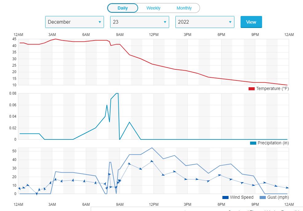
Speaking of that (chart two posts up) - the charts that used to be on Weather Underground site used to be *so* much better - they had the 20-minute granularity instead of the lame 1-hour granularity, and it had the dot-plots for the gusts, which were much easier to read and intuitive. Also if you scratched out the view to a week or a month, it still showed the gust data, which made it very interesting when looking back at storm events.
I wish I had saved a screenshot to show - thought I did, but can't find one.
Anyone know if there's any place to go to get those? Or am I stuck with manual data downloads and my own charting?
TIA
-
1
-
-
Got gusts up to 54 mph yesterday -
-
5
-
-
-
Well dang - looks like they've stopped again, as of last week. Was working fine for a couple of months!
-
So - found out the deal - just change N0Q to NCR in the link, and voila:
-
4
-
-
6 hours ago, WxUSAF said:
Hit play? Never had a problem in any browser
(smacks forehead)
OK so - the play button was just barely off the screen on the bottom - didn't see it, and the mouse scroll button didn't scroll down to it - it scrolls out not down when in that frame. If I move the mouse to the side and scroll down, it reveals the play button.
Thanks.
-
10 minutes ago, WxUSAF said:
Thanks, though the animation doesn't seem to work on that page. Tried in Chrome and Firefox. Maybe I'm missing something?
-
Hi all,
Not sure if this is the right place to ask this question, but figured I'd put it out there.
I have some links to nexrad radar that I've used for *years* (probably 15 or so), that now no longer work, apparently due to the recent changeout of the system feed -
https://www.weather.gov/media/notification/pdf2/scn21-96_sbn_super-res.pdf
I used links to the gifs of various zoom levels that were put on the wunderground site, tailored to my locations of interest. I like them because they were super-lightweight (load super-quickly on phone even when cell access was iffy), and also because I didn't have to zoom around to get to the spot I care about (where I live, family in other states, etc.). It loaded just the individual frame, not the whole web page. E.g. here's one:
They all show "down for maintenance" now on the wunderground site - most since 2/2 but some like this one since 3/2.
Might anyone know of an equivalent for the new feed? Or do I need to just use something like the NWS radar page (which is decent I suppose but very klunky / slow to load)?
Thanks.
Edit to add:
Here's an old feed from before it was changed some last year, showing a storm coming through last June. I like the simplicity!
.jpeg.ff24fbb8efae6d626e32799225ee64cd.jpeg)

January 2024 Banter
in Mid Atlantic
Posted
Thanks. Yeah - went up to Point of Rocks and there was a fair amount.