
Scottie16
-
Posts
525 -
Joined
-
Last visited
About Scottie16

-
Jan 30th-February 1st 2026 Arctic Blast/ULL Snow OBS Thread.
Scottie16 replied to John1122's topic in Tennessee Valley
Yes & we get lucky at times from Watts Bar . -
Jan 30th-February 1st 2026 Arctic Blast/ULL Snow OBS Thread.
Scottie16 replied to John1122's topic in Tennessee Valley
Moderate snow in Sweetwater, heaviest of the night. . -
Jan 30th-February 1st 2026 Arctic Blast/ULL Snow OBS Thread.
Scottie16 replied to John1122's topic in Tennessee Valley
Hour before. . -
Jan 30th-February 1st 2026 Arctic Blast/ULL Snow OBS Thread.
Scottie16 replied to John1122's topic in Tennessee Valley
Shortwave satellite has increased back into our area recently . -
Jan 30th-February 1st 2026 Arctic Blast/ULL Snow OBS Thread.
Scottie16 replied to John1122's topic in Tennessee Valley
Chattanooga looks to be getting in on more action soon. . -
Jan 30th-February 1st 2026 Arctic Blast/ULL Snow OBS Thread.
Scottie16 replied to John1122's topic in Tennessee Valley
May see snow later tonight from the bound of precipitation from middle Kentucky . -
Jan 30th-February 1st 2026 Arctic Blast/ULL Snow OBS Thread.
Scottie16 replied to John1122's topic in Tennessee Valley
Sun angle is something fierce. . -
Jan 30th-February 1st 2026 Arctic Blast/ULL Snow OBS Thread.
Scottie16 replied to John1122's topic in Tennessee Valley
Got right at 4 inches in sweetwater . -
Jan 30th-February 1st 2026 Arctic Blast/ULL Snow OBS Thread.
Scottie16 replied to John1122's topic in Tennessee Valley
Wind is starting to rip! It’s like a heavy fog of snow imbyZ . -
Jan 30th-February 1st 2026 Arctic Blast/ULL Snow OBS Thread.
Scottie16 replied to John1122's topic in Tennessee Valley
Really curious to see how that moisture that came from the Great Lakes interacts with this system once it arrives at 3 . -
Jan 30th-February 1st 2026 Arctic Blast/ULL Snow OBS Thread.
Scottie16 replied to John1122's topic in Tennessee Valley
Should change soon. I’ve got a moderate shower going on right now. . -
Jan 30th-February 1st 2026 Arctic Blast/ULL Snow OBS Thread.
Scottie16 replied to John1122's topic in Tennessee Valley
Lower level water vapor filling back in. . -
Jan 30th-February 1st 2026 Arctic Blast/ULL Snow OBS Thread.
Scottie16 replied to John1122's topic in Tennessee Valley
Went into a light flurry lull for 30ish minsZ light snow has returned. 1/2 inch so far . -
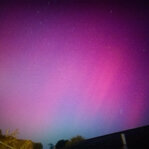
Jan 30th-February 1st 2026 Arctic Blast/ULL Snow OBS Thread.
Scottie16 replied to John1122's topic in Tennessee Valley
. -
Jan 30th-February 1st 2026 Arctic Blast/ULL Snow OBS Thread.
Scottie16 replied to John1122's topic in Tennessee Valley
ULL finally moved and allowed the cold air to come off the plateau. You can see it on the lower level water vapor. I just dropped from 28.8 to 26.2 in under 10’mins .
