

STxVortex
-
Posts
196 -
Joined
-
Last visited
Content Type
Profiles
Blogs
Forums
American Weather
Media Demo
Store
Gallery
Posts posted by STxVortex
-
-
GOMSDash delivery service, we'll drop an ocean on you!
-
28 minutes ago, bigtenfan said:
What is the record for ACE for a single storm in the Atlantic Basin?
Wikipedia states it was a little known 1899 long duration Cat 4; Ivan, Irma, and Isabel place too [hmmm, something about 'Is'?].
I think Sam is going to be pretty high on ACE despite it's so far small size. Sam has been a named storm for eight days now and will probably go on another eight to ten days at least [NHC is on TCDAT3/FcstDisc #28 this morning, how many more to go?].:
QuoteThe highest ever ACE estimated for a single storm in the Atlantic is 73.6, for the San Ciriaco hurricane in 1899, likely because it was a Category 4 hurricane which lasted for 4 weeks. This single storm had an ACE higher than many whole Atlantic storm seasons. Other Atlantic storms with high ACEs include Hurricane Ivan in 2004, with an ACE of 70.4, Hurricane Irma in 2017, with an ACE of 64.9, the Great Charleston Hurricane in 1893, with an ACE of 63.5, Hurricane Isabel in 2003, with an ACE of 63.3, and the 1932 Cuba hurricane, with an ACE of 59.8.[8]
-
Looks like NOAA9 is going to make a high level pass right over the top now. NOAA9 is on the western periphery of Sam and just changing course, now heading ENE at 14Kgpm [ ~200mb, ~FL46].
-
14 minutes ago, WxWatcher007 said:
That's the flight to sample the environment, while NOAA2 will sample the center. Not sure how many passes they will get given the distance from their takeoff location.
NOAA9 had been haulin' ass at ~515kts at FL40+, just slowed down to 354kt and went up ~3Kft in alt. NOAA2 is just entering Sam's western periphery, much lower and slower.
-
 1
1
-
-
NOAA9 recon is already in Hurricane Sam.
-
NOAA2 recon is only about 120-150nm from Sam's eye now, that must make for an interesting and scary ride, there is no land for a very long distance.
Looking at Sam's position and projected track I would hope that there are no yotties leaving the islands for European destinations attm; Sam will be traversing the common sea routes. Sam is bad news even for the largest of ships, let alone the 30-100 foot boats used for the transatlantic crossings.
-
Well, little Nicholas was the hurricane that barely could, a 'cane for just a few hours before making landfall WSW of Sargent Beach, TX.
Minimal effects so far, but Nicholas may bring some very significant rainfall totals to the Houston area well into Louisiana, none of which need it. [I'm glad to have dodged a wet windy bullet this time, as Nic just grazed my homeport]
"000 WTNT34 KNHC 140553 TCPAT4 BULLETIN Hurricane Nicholas Intermediate Advisory Number 8A NWS National Hurricane Center Miami FL AL142021 100 AM CDT Tue Sep 14 2021 ...
NICHOLAS MAKES LANDFALL ALONG THE TEXAS COAST... ...HEAVY RAIN, HIGH WINDS AND DANGEROUS SURGE ONGOING... SUMMARY OF 100 AM CDT...0600 UTC...INFORMATION ----------------------------------------------
LOCATION...28.8N 95.7W ABOUT 20 MI...30 KM NE OF MATAGORDA TEXAS ABOUT 25 MI...40 KM WSW OF FREEPORT TEXAS MAXIMUM SUSTAINED WINDS...75 MPH...120 KM/H PRESENT MOVEMENT...NNE OR 25 DEGREES AT 10 MPH...17 KM/H MINIMUM CENTRAL PRESSURE...991 MB...29.26 INCHES WATCHES AND WARNINGS --------------------
CHANGES WITH THIS ADVISORY: The Storm Surge Warning from Port Aransas, Texas to Port O'Connor, Texas including Aransas Bay and San Antonio Bay has been discontinued.
SUMMARY OF WATCHES AND WARNINGS IN EFFECT: A Storm Surge Warning is in effect for... * Port O'Connor Texas to Sabine Pass * Galveston Bay and Matagorda Bay A Hurricane Warning is in effect for... * Port O'Connor to Freeport Texas A Hurricane Watch is in effect for... * Freeport to San Luis Pass Texas A Tropical Storm Warning is in effect for... * North of Port Aransas to Port O'Connor * North of Freeport to Sabine Pass A Storm Surge Watch is in effect for... * Sabine Pass to Rutherford Beach Louisiana A Storm Surge Warning means there is a danger of life-threatening inundation, from rising water moving inland from the coastline, during the next 36 hours in the indicated locations. For a depiction of areas at risk, please see the National Weather Service Storm Surge Watch/Warning Graphic, available at hurricanes.gov. This is a life-threatening situation. Persons located within these areas should take all necessary actions to protect life and property from rising water and the potential for other dangerous conditions. Promptly follow evacuation and other instructions from local officials. A Tropical Storm Warning means that tropical storm conditions are expected somewhere within the warning area. A Storm Surge Watch means there is a possibility of life-threatening inundation, from rising water moving inland from the coastline, in the indicated locations during the next 48 hours. For a depiction of areas at risk, please see the National Weather Service Storm Surge Watch/Warning Graphic, available at hurricanes.gov. A Hurricane Warning means that hurricane conditions are expected somewhere within the warning area. A Hurricane Watch means that hurricane conditions are possible within the watch area. Interests elsewhere in southwestern Louisiana should monitor the progress of Nicholas. For storm information specific to your area, including possible inland watches and warnings, please monitor products issued by your local National Weather Service forecast office.
DISCUSSION AND OUTLOOK ---------------------- Hurricane Nicholas made landfall near 1230 AM CDT (0530 UTC) on eastern part of the Matagorda Peninsula, about 10 miles (15 km) west-southwest of Sargent Beach, Texas. At 100 AM CDT (0600 UTC), the center of Hurricane Nicholas was located near latitude 28.8 North, longitude 95.7 West. Nicholas is moving toward the north-northeast near 10 mph (17 km/h) and this general motion is expected to continue through tonight, followed by a turn toward the northeast and a slower motion by late today and an even slower eastward motion on Wednesday. On the forecast track, the center of Nicholas is expected to move slowly over southeastern Texas today and tonight, and over southwestern Louisiana on Wednesday. Maximum sustained winds remain near 75 mph (120 km/h) with higher gusts. Weakening is expected during the next couple of days as Nicholas moves over land. Hurricane-force winds extend outward up to 25 miles (35 km) from the center and tropical-storm-force winds extend outward up to 115 miles (185 km). A station at San Luis Pass, Texas recently reported a 1-minute sustained wind of 56 mph (91 km/h) gusting to 67 mph (107 km/h). The latest minimum central pressure is 991 mb (29.26 inches) based on reconnaissance dropsonde data. HAZARDS AFFECTING LAND ---------------------- Key messages for Nicholas can be found in the Tropical Cyclone Discussion under AWIPS header MIATCDAT4, WMO header WTNT44 KNHC and on the web at hurricanes.gov/graphics_at4.shtml?key_messages RAINFALL: Nicholas is expected to produce storm total rainfall of 6 to 12 inches, with isolated maximum amounts of 18 inches, across the upper Texas coastal areas into Wednesday. Life-threatening flash flooding impacts, especially in urbanized metropolitan areas, are possible across portions of the upper Texas Gulf Coast into far southwestern Louisiana. Across interior southeast Texas into southern-central Louisiana and southern Mississippi, rainfall totals of 4 to 8 inches with locally higher amounts near 10 inches are expected into Thursday. This rainfall may produce areas of considerable flash and urban flooding. The potential for minor to isolated major river flooding exists across the entire region especially in smaller river basins and urban areas. STORM SURGE: The combination of a dangerous storm surge and the tide will cause normally dry areas near the coast to be flooded by rising waters moving inland from the shoreline. The water could reach the following heights above ground somewhere in the indicated areas if the peak surge occurs at the time of high tide... Port O'Connor, TX to High Island, TX...3-5 ft Matagorda Bay and Galveston Bay...3-5 ft High Island, TX to Rutherford Beach, LA...2-4 ft Baffin Bay, TX to Port O'Connor, TX...1-3 ft Aransas Bay and San Antonio Bay...1-3 ft Rutherford Beach, LA to Intracoastal City, LA...1-3 ft Sabine Lake and Calcasieu Lake...1-3 ft Corpus Christi Bay...1-3 ft The deepest water will occur along the immediate coast in areas of onshore winds, where the surge will be accompanied by large and dangerous waves. Surge-related flooding depends on the relative timing of the surge and the tidal cycle, and can vary greatly over short distances. For information specific to your area, please see products issued by your local National Weather Service forecast office. WIND: Tropical storm conditions are expected within the warning area across the central and upper Texas coasts through this morning. Hurricane conditions are possible in the Hurricane Watch area for the next few hours. Hurricane conditions are expected in the warning area for the next few hours. TORNADOES: A tornado or two will be possible today along the upper Texas and southwest Louisiana coast. SURF: Swells generated by Nicholas will continue affecting portions of the northwest Gulf coast today. These swells are likely to cause life-threatening surf and rip current conditions. Please consult products from your local weather office.
NEXT ADVISORY ------------- Next complete advisory at 400 AM CDT.
$$ Forecaster Blake"
-
Nicholas looks to be probably making landfall around Port Aransas, Rockport to Mustang, Matagorda Islands, Port O'Connor, Palacios or maybe a smidge to the east. I'll figure it'll be a hurricane by then, the GOM water temperatures and heat index is just too hot.
I cleared out after securing the boat as best as I could over the weekend [~Lat: 28.08°NLon: 97.05°W , Current conditions at Rockport Aransas County Airport (KRKP) ]. It ain't gonna be a 'nuther Harvey but this stuff gets old.
I've amped up the WX monitoring now that I'm 'home', so FYI, some useful links :
Radar :
Current conditions at Port Isabel, Port Isabel-Cameron County Airport (KPIL)
Yeehaa, here we go ...
-
1
-
 1
1
-
-
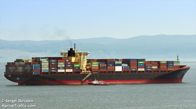
The vessel that recorded those record high wind speeds is the Seacor Eagle, a small platform ship, 42x28m. So it's anemometer looks to be maybe 15-20m above sea level, good enough.
Edit: The "Young Wind Tracker" instrument pictured earlier is first class equipment.
Marine Traffic link/info:
Latest Position
Position Received: 2021-08-29 04:50 UTC
Vessel is Out-of-Range
Area: USG - Gulf of Mexico
Current Port: FOURCHON
Latitude / Longitude: 29.13876° / -90.19744°
Status: At Anchor
-
4
-
-
3 hours ago, jojo762 said:
This has to be a record for strongest sustained, and gusting winds RECORDED in a hurricane... right?
Could well be, few anemometers last past 100-120mph.
However, keep in mind that the standard anemometer height is 10 meters off the ground surface and with no obstructions within a prescribed distance.
Depending on the size of that ship their anemometer may be located 40-50+ meters high, where the winds are generally stronger [just look at the hurricane hunter data, like a dropsonde, the measurements vary by height]. So these measurements may have some bias to compensate for.
If we had this ship's identification information we could look up it's specs.
-
Current conditions at
Galliano, South Lafourche Airport (KGAO)
Lat: 29.44°NLon: 90.26°WElev: 0ft.
Rain and Windy
78°F
26°C
Humidity 93% Wind Speed E 63 G 92 mph Barometer 28.49 in Dewpoint 76°F (24°C) Visibility 0.75 mi Heat Index 81°F (27°C) Last update 29 Aug 1:35 pm CDT -
1
-
-
3 minutes ago, Moderately Unstable said:
I would frankly be surprised if he's even hit 100. Lots of stuff starts flying once you hit triple digit winds. It's very much "obvious". One easy way to tell--the deciduous trees he's been filming are not toppling over, or even swaying wildly. Those tree types don't handle wind well--palm trees evolved the way they did specifically to handle wind. He's barely seen hurricane strength yet. He will, and he will quickly learn what real strong winds actually look like.
Those are mostly mesquite and maybe some live oaks, about the toughest trees there are. Check out the ones around Rockport and Lamar, TX. Lots of them are bent and twisted, but healthy.
The good citizens of Rockport made a helluva racket when some developers wanted to cut down some groves of them that had been there forever. The developer mostly lost. Although the HEB grocery did get built, but the parking lot is full of trees. That HEB shows in a lot of Hurricane Harvey pictures. I actually took a nap there as Harvey approached after securing my boat. Then I got out just before it hit, under similar, but lesser, conditions as Jokko.
-
1
-
-
The Jokko guy webcam is a couple hundred yards from this airport ASOS WX station:
https://forecast.weather.gov/MapClick.php?lat=29.2328&lon=-89.9975#.YSuC19fPz5p
Galliano, South Lafourche Airport (KGAO)
Lat: 29.44°NLon: 90.26°WElev: 0ft.
Rain and Windy
78°F
26°C
Humidity93%
Wind SpeedNE 58 G 76 mph
Barometer28.76 in
Dewpoint75°F (24°C)
Visibility0.50 mi
Heat Index81°F (27°C)
Last update29 Aug 12:35 pm CDT
-
3
-
 7
7
-
-
5 minutes ago, intentionallove said:
Beast camera revived!!
It did, for 17 seconds so far...
-
R.I.P. Grand Isle cam [courtesy of Mr. Humphress and Mr. Hartman.
3:42:38 of webcam delight.
-
I hope that the GI webcam has been recorded for posterity. Oh no! It just died!
-
1
-
-
2 minutes ago, Crazieman said:
Grand Isle camera is the blue shed moment.
This needs to be repeated for every hurricane. Make, model, and setup.
Been waiting for to hear somebody mention the Rockport, TX blue block chithouse [actually a carwash shed close to Alby's-- yumm]. Got a place there.
-
1
-
-
1 minute ago, Will - Rutgers said:
yeah i don't think i've ever seen footage like this, this thing is in an EF3 washing machine and it's still transmitting. i still see the shape of the house in the background. but for the most part the camera is solidly in the drink.
That beachhouse across the canal has been frittering away for hours now. Just amazing.
-
That poor dang webcam is almost gooonnnne...
-
1
-
-
5 minutes ago, Will - Rutgers said:
Grand Isle itself is 7' above sea level, so i guess 14'.
though right now the sea level is rising quickly. actually it's pretty hard to see much of anything with all the spray and waves. the house in the background is still standing but i'm just kind of watching to see if it outlasts the camera.
really can't believe anyone would choose not to evacuate with these conditions coming but i say that every big storm
I'd like to know the make and model of that webcam, and the other equipment and setup. Tough stuff.
-
2
-
-
1 minute ago, sojitodd said:
So is that 7 feet above ground level? I wonder what the elevation above sea level is?
Not much. About 3-6 feet judging from the tide station at the USCG station upisland.
-
1
-
-
4 minutes ago, wxeyeNH said:
Grand Isle about to get into the eyewall. I expect the Humphress feed will end soon
Amazing webcam feed. The water is up at least 3 feet, cam has been taking splashing the last 20-30 minutes. The eyewall will probably take everything away.
-
7 minutes ago, Tatamy said:
At the rate conditions are going downhill at that location I doubt it will be on for more than another 30 minutes or so. I give a lot of credit to who ever set it up. That feed ranks with the overnight footage seen from the eye of Gonzalo in Bermuda in 2014. Perfectly calm, pitch black conditions with frogs.
Huge amount of garage, storage room, kitchen debris has been rocketing past the cam. Wind has shifted alm90deg. Was SE, right to left in the canal, now it's SW.
-
6 minutes ago, BuffaloWeather said:
About to make landfall just west of Grand Isle
That point is Bay Farellon, real close to Grand Isle.
Hurricane Ian
in Tropical Headquarters
Posted
There was a mission designated "training" that flew an odd flight path, N-S-W-N-W-S, and stayed well to the NW of Ian's core, mostly below Biloxi ...repeated a couple times, maybe that was it? edit-- Now that I can see the timeZulu, that wouldn't be 0400h...