

Billypg70
-
Posts
52 -
Joined
-
Last visited
Content Type
Profiles
Blogs
Forums
American Weather
Media Demo
Store
Gallery
Posts posted by Billypg70
-
-
48 minutes ago, Brick Tamland said:
Latest Euro ensembles had two big dogs for NC and the rest had nothing outside the mountains around the 19th and 20th. Yesterday the GFS had a storm here during the same time frame. Maybe they are starting to sniff out something.
U know business is picking up when u see Brick posting...
Things just got real ppl...
Good to see u man...
-
 1
1
-
-
I get the negative feelings but I Agree whole heartily with Buckeyefan1.
The next few weeks r the best pattern we have had since Dec 18.
In which I got 6 inches.
It doesn't mean it's going to snow but,
No matter the pattern it all comes down to timing.
I'll take the pattern that's being shown and hope we get lucky on timing.
I think a lot on this board will be happy by the middle part of Feb.
-
2
-
-
1 hour ago, Tacoma said:
I agree, would love cold and snow but for now am okay with warm and no rain.
It's the unusual warmth that's causing the severe weather & we need the rain.
If u want a gradual step down process to cold,
To prevent the severe storms...
I'm ok with that but,
We need cold so we can prevent these types of events in winter.
Prayers to all victims.
-
32 minutes ago, griteater said:
Without a doubt. The hope is Miller A, but think Miller B is the bigger threat (if something does in fact work out)
Grit
I've got a question.
I was born in 70.
Maybe it's just child romanticism but was there not times in the 70's & early 80's when it was cold coast to coast? ( Except maybe SoCal or S Fla)
Say 77, 79, & Christmas 82?
If so what were those indicies that allowed it to be cold continental 48?
And can we not have those setups now?
-
19 minutes ago, wncsnow said:
Definitely different. The arctic air present here hasn't coincided with a southern slider since Jan 88.
That was the storm of my life and I'm now 50.
19 minutes ago, wncsnow said:Definitely different. The arctic air present here hasn't coincided with a southern slider since Jan 88.
-
1
-
-
I'm in Greer it snowed here for about 20 to 30 mins then changed to sleet for another 20 mins or so.
It was supposed to get to 45 here today our high was 41.
It has cleared here since.
Gsp was 32/28 @ 10pm definitely colder than what was forecast.
-
1
-
-
I'm in Greer it snowed here for about 20 to 30 mins then changed to sleet for another 20 mins or so.
Now nothing.
It was supposed to get to 45 here today or high was 41.
The temp at 4 was 39/23....
-
27 minutes ago, burrel2 said:
There will be enough cold air for whoever gets under the heaviest bands just north west of the 850mb low Friday morning.
its well below freezing everywhere but near surface and near surface doesn’t matter if it’s ripping 2-3 inch per hour rates.
also, we’ve only seen the global model depictions for surface temps and they aren’t that far off... 40/32 before precip starts and most settle around 33-36 outside of the mountains. Won’t be surprised to see the hi-res models show 31-32 under the heavier bands when they get in range. (Assuming the low track and intensity doesn’t change much).
I managed a nice 3 inch snow last year during the middle of the day thanks to heavy rates when no models had me dropping below 34-35 (including short range models). And that system didn’t have anywhere near the dynamics at play like this one will.
Remember that storm well.
Ppl at the same Elevation & Longitude as me further west got much more than my inch here in NE GVL county.
Why?
Because of timing.
It hit u guys early morning hours in the case of NGA it was prior to sunrise.
In some cases in NGA they had 6-8+ inches.
It started here around 11am and didn't change over to snow til 12 noon.
Timing looks to be good here in the Western Carolinas & NGA thus far.
-
15 minutes ago, strongwxnc said:
I was 4 and recall looking outside and seeing that it was 3 degrees and and was wondering why is was not snowing... Somethings never change.
I'm old enough to remember both of those Christmas's.
83 was by far the coldest one of my life and I'm 50 now.
I was 13 that year and u could spit and it freeze before it hit the ground.
In 89 it was heart breaking watching the coast have a blizzard while ppl 100 miles inland had clear skies.
Both very cold.
Great pattern we are in.
I totally believe this year we are going to have several area wide big snow storms.
-
2
-
 1
1
-
-
On 5/13/2020 at 11:06 PM, jburns said:
.
forestall?
Thank you,
You are correct.
-
On 5/13/2020 at 2:24 PM, Upstate Tiger said:
Hey, I am one of those old men. I was just telling my grandson the other day about one of our epic winters of the past. He looked at me skeptically and said "Sure Poppy. I guess next you will tell me that the Weather Channel used to talk about the weather, MTV actually played music videos and people used to go to stores to buy stuff." Kids today, they can't even remember when Clemson sucked at football.
You had me till the very last sentence.
We used to have epic winter's.
It's sort of rare now if we get more than 6 inches even NW of 85.
I have loved this very cool spring.
I'm an old cheapskate now and look forward to saving on the cooling bill.
Hopefully from some of the posts today we can forestall the hot weather a few more days or longer.
-
 1
1
-
-
5 hours ago, tarheelwx said:
North GA and SC Upstate in the sweet spot!
TW
Those numbers are wrong in MBY.
N GVL county had probably 5 or 6 inches fall but the BL was so warm it never accumulated to more than a dusting at a time.
Each time it let up,
Which was often it would melt.
It was a few years maybe a little longer that Burger did the average Snow Fall for the majority of areas in the Carolinas,
Maybe Georgia too???
He had GSP at 6.9???
If that number is accurate I don't think we have had more than that since 14.
-
24 minutes ago, Tacoma said:
I can't believe I had to cut my grass a week ago, the earliest I ever cut my grass was the end of March, this is crazy.
I cut grass mid to late march last year.
I have yet to cut it this season.
Only wild onions are growing in my yard.
Had 3 snows,
Not one was more than a dusting.
A couple could've been several inches had it been colder at the surface.
I give this winter an F
2012 was the only one worse...
No snow at all.
-
40 minutes ago, Iceagewhereartthou said:
Wow, according to that map I would have been in either the 2-4 or 4-8 in stripe for MBY in the upstate. Caesar's Head would have been in the 8-12. I would have been fairly young but I have no memory of that system. I do seem to have a vague memory of a third big snow in the 87/88 years so maybe that was it?
There was snow in the Upstate with this system but it was mostly cold rain literally 33 and rain.
I think most of NW SC from Northern GVL, Pickens, & Oconee counties saw a dusting to as much as a foot in the highest peaks along the border.
Just into NC it was a completely different story.
It was a legitimate blizzard.
WLOS has its tower on Mt Pisgah had over 2 feet.
It was an amazing storm in the extreme western sections of WNC.
Of course JAN of 87 & 88 we had 1 foot plus totals at GSP.
The 88 storm was amazingly cold.
As a senior that year we missed around 2 to 3 weeks of school.
When we finally went back there was still snow on the road.
-
1
-
-
1 hour ago, Upstate Tiger said:
Yep. I was a senior in high school in Easley S.C. in 83. Front came through on Wednesday and brought flurries after a warm week. Thursday was gray and cold with a strong NE wind. We had baseball practice in 42 degree windy weather that day. Try hitting a baseball with an aluminum bat in that weather. Friday morning the snow hit. 10” of wet snow. Some of the biggest flakes I’ve ever seen. Was an El Niño winter. Except that big snow it really wasn’t a snowy winter.
Yes their were trees with leaves out already.
And their was massive damage to trees and powerlines because it was a heavy wet snow.
Literally stuck to the side of our house and just about everything else.
-
1 hour ago, ragtop50 said:
1960, 1980, 2000...
Continue that trend....we are due !
Not all were March but big snows those years
My mom & late G'Ma talked a lot about that March with 3 consecutive snows on Wednesday.
I remember the one in 80 and also a few in the early 80's.
80, 82, & 83 had huge snow storms.
The one in 83 was late March our fruit trees had fruit on them and we had between 8-10 inches of snow that killed the fruit and damaged the trees badly.
-
1
-
-
11 hours ago, Wow said:
No offense but that's a terrible pic LOL
Is that a UFO?
-
5 minutes ago, mackerel_sky said:
Always! I’ve seen numerous times TR has 4-5” on the ground and I’ve got rain! December’18 , perfect example
Btw that storm i had 6 inches
It was great....
-
1
-
-
1 minute ago, mackerel_sky said:
Always! I’ve seen numerous times TR has 4-5” on the ground and I’ve got rain! December’18 , perfect example
This won't be one of those storms because I'm well north of 85 and although its been snowing since around 1pm.
It will cover things with a dusting once intensity goes down then the lil that accumulates melts.
I had more accumulation with the late Jan and early Feb events.
-
12 minutes ago, mackerel_sky said:
Bird farts today! KK called it
What did she forecast yesterday?
I was giving all my attention as a snow wienie watching Chief wienierologist CJ
-
1 hour ago, Lookout said:
It's got to be close in the upstate. this station near paris mountain is only 800 feet or so higher than greenville and it's 31.
Name:ETV Greenville
Valid:20 Feb 2:20 PM EST
Temp:31 °F0 °C
Dew Point:30 °F-1 °C
Relh:96 %
Wind Speed:16 mph14 kts
Wind Dir:ENE75°
Gust:22 mph19 kts
Wind Chill:20 °F
Altimeter:30.08 in
I live around 1100 feet in Elevation on the side of Paris mtn.
The sleet begin to mix here around 11am
Then changed to snow around 1pm.
Been snow since but its so warm it melts on contact of everything.
Occasionally when heavier rates come down it will build up a lil but once it slows down it melts off.
-
9 minutes ago, Tigerchick224 said:
Blue Ridge/TR. Not quite north enough to be the mountains, but not Greenville either. I hope you guys will get something soon! It’s crazy how the 850s haven’t present as much of a problem and now it’s a precipitation amount thing. Ahhhh to live east of the mountains.
.Just went to put something in my car and i seen sleet pellets mixed in on top of my car with rain.
I'm in Taylos about 2 miles SE of paris mtn
-
5 minutes ago, burrel2 said:
Some good news. 06z 3km NAM is too far north with the warm nose. It had it all the way up to near asheville at 10am . CC radar comfirms it's already crossing the NC/SC border and heading south.
12zz 3km NAM has fixed this issue, shows the warm nose much further south at 10am.
Someone just posted snowing steadily at lake Toxaway just on the otherside of the border.
Looks to heading south.
-
13 minutes ago, bess said:
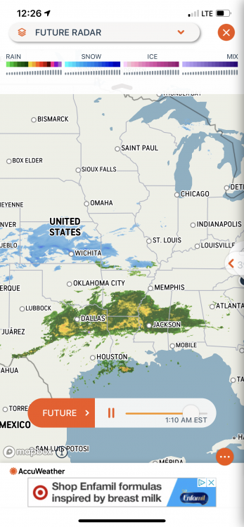
Just look at all that moisture.
CJ our local meteorologist said the newest model data had the moisture still coming down after midnight.
Earlier it ended by 7 or 8pm.
He said we have to keep an eye on this.

Mid to Long Range Discussion ~ 2022
in Southeastern States
Posted
Burger & Upstate T
Ur both right with the storms u mentioned.
2014 was the year u were thinking of Burger.
There is plenty of instances in my 51 years where their is arctic air in place.
The storms tend to be 4 inches or less.
Big dogs with arctic air in place tends to be once every 10 to 20 years.
Last one I remember was Jan/88
So u could say we are past due.
Ty all for the things u do.