

SouthCentralWakeCo
-
Posts
68 -
Joined
-
Last visited
Content Type
Profiles
Blogs
Forums
American Weather
Media Demo
Store
Gallery
Posts posted by SouthCentralWakeCo
-
-
4 minutes ago, BornAgain13 said:
GFS trying to get something going next weekend....
Wasn’t too impressive, but it’s a big improvement from its past runs.
-
3 minutes ago, BornAgain13 said:
CMC looks better than GFS I believe...
Correct
-
-
7 minutes ago, NCSNOW said:
Hope you guys realize just how close this weekend event is to doing more than possibly kissing the coastline. So so close at h5. Even though surface looks like we are 200 miles from moisture. The 2 pieces of energy we need to phase and caues a boom, are within a nose hair of making this happen. If only the southern one would just come off texas coast into Gom halfway between brownsville and houston, or heaven forbid houston area someone will get thumped. Right now its been brownsville. Northern stream is about to trend back sharp enough and come in behind ss energy. May just be a long fly ball at the warning track, but still has time to clear the left field fence.
You are talking about next weekend, correct?
-
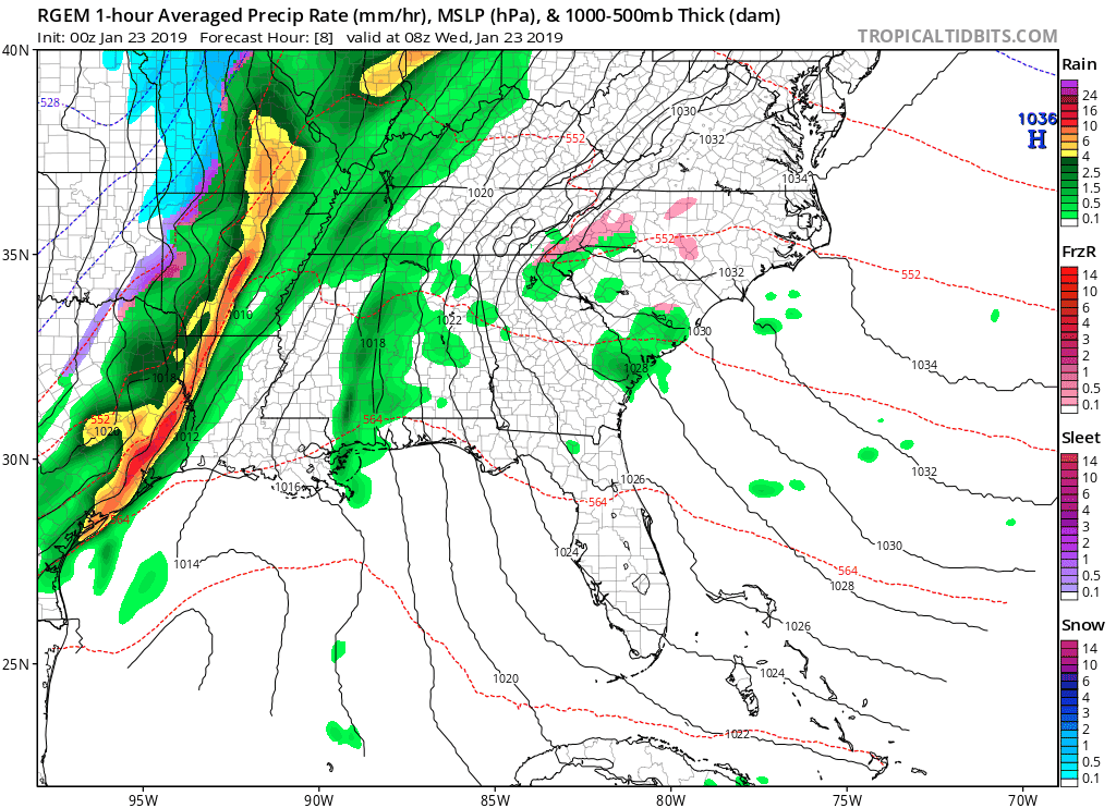
0z RGEM for tomorrow morning

-
-
1 minute ago, jjwxman said:
That's the 12z CMC.
It saved my old caption for one of my last posts. Idk why. Thanks
-
 1
1
-
-
-
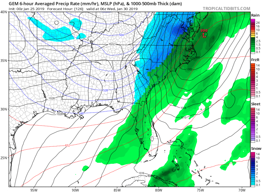
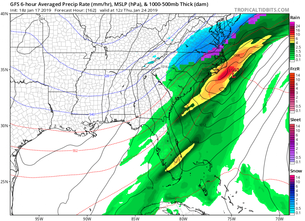
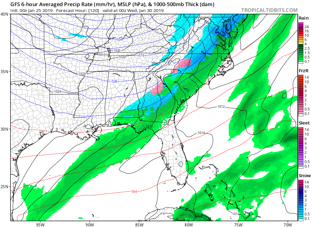
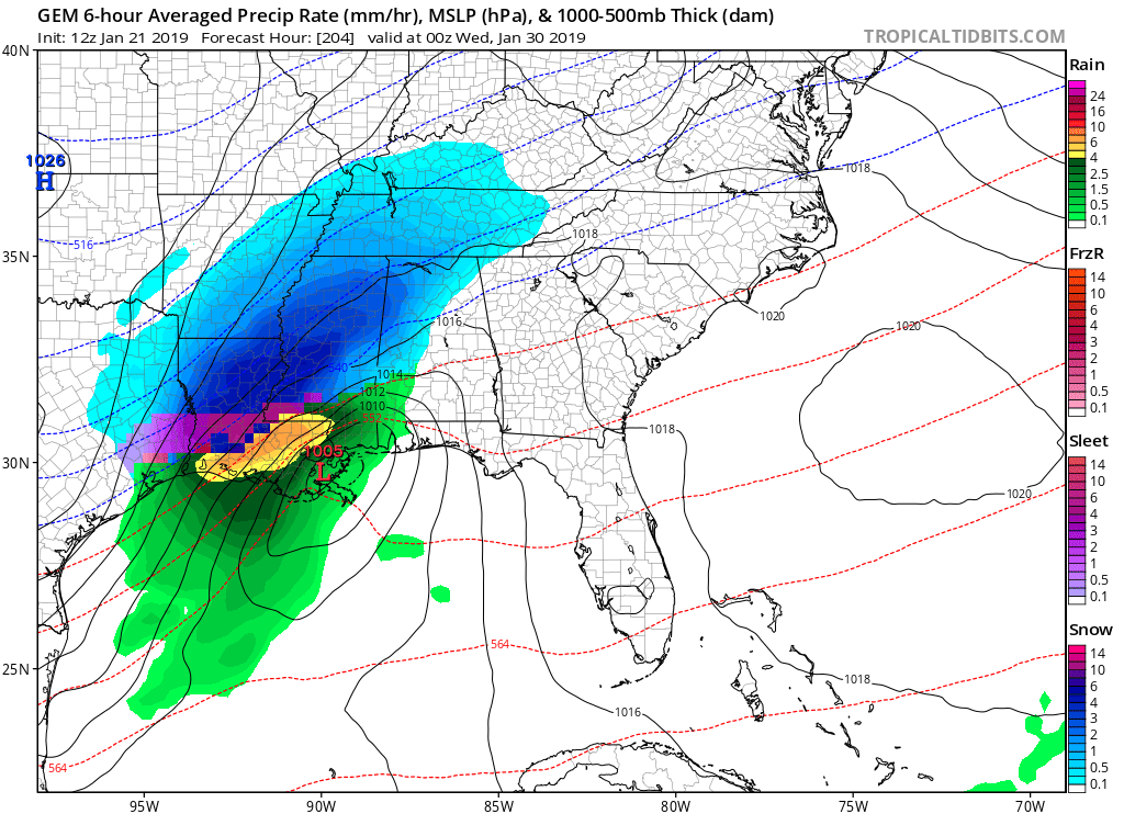
18z GFS for next Thursday
-
Sleeting here
-
3 minutes ago, NCSNOW said:
This is hour 48, as far as This Canadian Short Range model goes out.

if there is another shift SE, wake co could be back in the game.
-
-
33 minutes ago, BornAgain13 said:
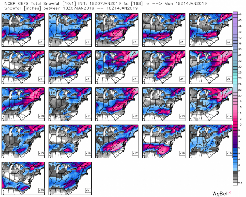
e18 please!
-
2
-
 1
1
-
-
Back to sleet now here
-
snowing so hard here. Road and sidewalks re-covered. Beautiful.
-
1
-
-
snow/sleet mix here
-
02z HRRR has it more of a sleet fest instead snow on the previous runs.
02z HRRR at hour 12:

01z HRRR at hour 13:

-
If this ULL overperforms, it is going to shock a lot of people. Not many local mets talking about it...
-
 1
1
-
-
1 minute ago, Jet Stream Rider said:
HRRR did better with placement of transition zone and timing for my area.
Good to know. Checking in on the HRRR for tomorrow, this is the 01z run.

-
1
-
-
Just now, Dunkman said:
There were some people on the edges of the transition zones in which the NAM seemed to give the most accurate forecast but as a whole it was pretty bad for this event compared to the other guidance.
Okay thanks for clarifying. Wasn't sure.
-
2 minutes ago, RTPGiants said:
Yeah, but no other real support
True, but it is interesting. Didn't the NAM verify the best for the last nights/today's band of snow/sleet/freezing rain? And didn't it nail the warm nose? Don't know for sure, but I think it did better than any other model.
-
Just now, RTPGiants said:
Go home NAM, you're drunk. Basically it keeps some sort of band over east central NC for hours...
It has been consistently showing this, though.
-
Would be awesome to end this event with some snow. Just watched the NWS briefing issued at 4:30 pm and he said that the models over the past 24 hours have trended toward more wintry precipitation throughout the day tomorrow. He said we need to watch it closely and to "not let your guard down."
-
HRRR looking interesting at hour 17


Mid to Long Term Discussion 2019
in Southeastern States
Posted