
luckyamaha
-
Posts
108 -
Joined
-
Last visited
Content Type
Profiles
Blogs
Forums
American Weather
Media Demo
Store
Gallery
Posts posted by luckyamaha
-
-
1 hour ago, psuhoffman said:
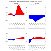
Those indexes often miss the picture. They are like poor man cheat sheets but cannot replace reading the actual longwave pattern.
I don’t know what the indexes say for 3-5 days from now but this looks mighty good to me.


Monster epo ridge. 50/50 vortex. West based NAO blocking. Severely fractured and displaced TPV. Trough east of Hawaii to help pump some ridging in the southwest. Way more hostile looks than that have led to snow in the past. Maybe it’s not the most ideal textbook perfect hecs look ever but it’s decent.
If you are referring to the indexes in 10 days as the threat happens then that is irrelevant. Big storms often happen once the blocking that set them up breaks down. Without that look day 3-5 we wouldn’t get the whole chain of events that leads to the day 10 threat. But that look is only 3 dats away now and across all guidance.
Could the gfs be right and storm one cuts then everything behind it gets suppressed, sure. Could it amp up too much and rain yea. Or maybe we get snow. It’s not a super high probability but no day 10 threat is but if you can’t see the reasons the next 13 days or so might yield snow in the mid Atlantic from that day 3-5 look then you don’t know how to actually analyze a pattern and are misusing indexes. Or you are trolling.
That Monster EPO your talking about is a major failure for the pattern. tilted the wrong way and a different direction in order to give us a trought in the east. Same pattern we have been stuck in since late Dec early Jan, So will end up with what another 2 days of cooler than average temps. No Significant Blocking going on either in the NAO so i dont see anything more than the same as cutters and sliders for the MA. My intention was not trolling by any means it was to just move on from this winter and look to spring past 1st weekend of March.
-
 2
2
-
-
We need to stop wish casting for a snow event. It's most likely over for this year. Teleconnections suck for the area and nothing lives up to 10+days as advertised so then it all goes to crap. Let's just stop it and move on. Everyone to the spring forum. Cya next season.
Sent from my SM-N960U using Tapatalk
-
4
-
 1
1
-
-
CWGs forecast always a boom or bust potential but they always get everyone's backyard right. Bunch of conservativesI'm just glad that CWGs forecast of 1-8" for mby was accurate.
Sent from my SM-N960U using Tapatalk
-
9am and very small dendrites but still picked up 3" so far in NW Stafford still no mixing
Sent from my SM-N960U using Tapatalk
-
Big flakes ripping in NW Stafford
Sent from my SM-N960U using Tapatalk -
Moderat to heavy snow falling with 2 inches on the ground in NW Stafford. Hope to hold off a bit longer the this before mixing. Nice band moving through now on the radar
Sent from my SM-N960U using Tapatalk

-
Yes it look good for SeattleOne would think this looks good
Sent from my SM-N960U using Tapatalk
-
1
-
-
Looking good for this Saturday down here in NW Stafford. Maybe a good 2-4" overall and into Fredericksburg. PUMMELED
-
1
-
-
Because this entire season has been Pacific Jet driven and it will most likely continue which will give way to more cutters and rain. All the cold is in the west and everything else points to early spring by March 1stWhy would we "roll" with that? If that is what is going to happen so be it, and we can't control it, but it sucks so why would we be like...yea lets roll with it?
Sent from my SM-N960U using Tapatalk
-
We roll with that. It's most likely of outcomes even if it's the cmc. Let's move on to next rain eventsCMC is 2 big ol cutter rainstorms. Not even close.
Sent from my SM-N960U using Tapatalk
-
1
-
-
If 2" is PUMMELED then we know this is not our winterSE MD PUMMELED!
Sent from my SM-N960U using Tapatalk
-
I will be in snowshoe wva so there it's that for the weekend. Should have some good PD skiing
Sent from my SM-N960U using Tapatalk -
5 minutes ago, Deer Whisperer said:
Yayyyyy
Apparently Prince William already closed for tomorrow
-
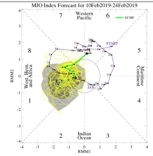
EURO MJO
-
 1
1
-
 1
1
-
-
Looks like everyone is wishcasting for the mid to long range for finding too happen as we all are standing on the ledge. Jump ship now
Sent from my SM-N960U using Tapatalk -
At least one groundhog will be right with early spring arrival,Punxsutawney Phil is correct and he has not looked at any model runs all winter. We are cooked I'm jumping ship
Sent from my SM-N960U using Tapatalk
-
What's that "V" symbol next to my poster name? I know it's off topic, sorry
Sent from my SM-N960U using Tapatalk -
Why does the GFS still get mentioned when it flip flops from every 6hr run? Now sure 24hrs ago it did not show 70s for all of va, now it does? Also it's just wretched and biased on temps. Toss and forget it. Look to the FV3 since the Gov has been open
Sent from my SM-N960U using Tapatalk
-
3°in NW Stafford as of right now.
Sent from my SM-N960U using Tapatalk -
I'm doneYep lol. How much longer before this thread is a dumpster fire?
Sent from my SM-N960U using Tapatalk
-
1
-
-
What happened to the cutlery content? We all know it's over. We're should go to the panic room and move on
Sent from my SM-N960U using Tapatalk -
All I saw was some garbage scrolling across the mid- states and cutting. Not sure you hit F5 key to refresh the runSometimes the weenie in our heads just overwhelms reality..it happens
Sent from my SM-N960U using Tapatalk
-
Wasn't that the news on November? Let's just jump ship now and look for dec march 2019/2020Yes it is good news. Seems we get into a better pattern and a more typical Nino like back ground state with blocking where we need it.
Sent from my SM-N960U using Tapatalk
-
We are back on for next week. Is only 7+ days away from being a legit hit.

Sent from my SM-N960U using Tapatalk


March Banter 2019
in Mid Atlantic
Posted
Lock it in for the FV3 GFS... Sun Angle has nothing on this storm at 17+ days out.