

Furrawn
-
Posts
53 -
Joined
-
Last visited
Content Type
Profiles
Blogs
Forums
American Weather
Media Demo
Store
Gallery
Posts posted by Furrawn
-
-
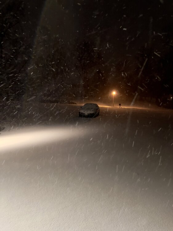
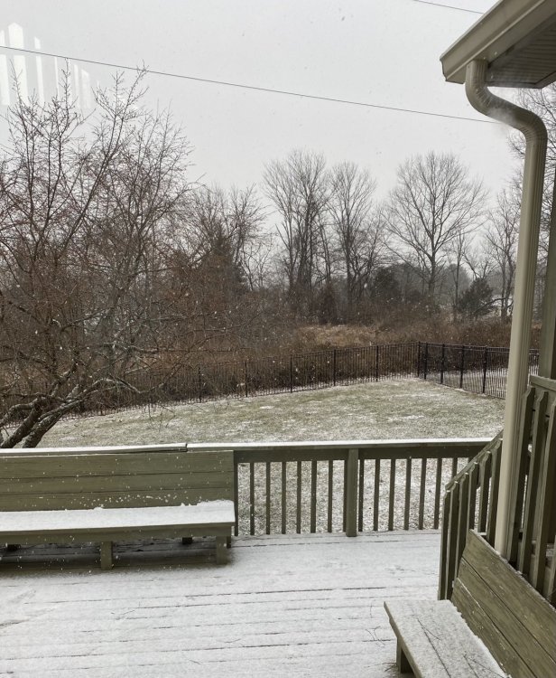
36 in Newtown. We’ve got half rain half snow at a decent clip.
-
Like others, the wind gusts make it impossible to reliably measure. Pixie dust here, too. Still, standing outside feels like falling into a poem…
 It’s a Robert Frost kind of snow.
-
 3
3
-
 1
1
-
-
3 minutes ago, Birds~69 said:
The more intense bands which were only in NJ making their way into lower Mont/Bucks counties. And right around Reading seems to be the cutoff line for the past several hours...
26/Steady snow

I was headed to sleep… Based on this, I’ll stay up:)
-
2
-
1
-
-
1 minute ago, CoolHandMike said:
Atmospheric turbulence bashes them to bits.
Thank you!
-
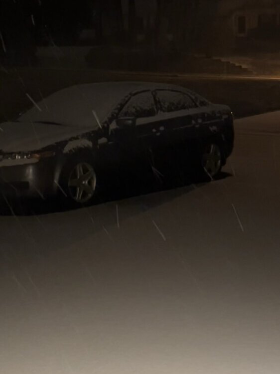
Light tiny snowflakes falling here. 32 degrees in Newtown.
If anyone feels like an ELI5, why would snowflakes be tiny when it’s 32 degrees?
I thought snowflakes tend to be larger because they tend to be stickier (and thus more likely to attach to other snowflakes) when falling through the air at warmer temps like 32 degrees.
-
1
-
-
58 minutes ago, Hurricane Agnes said:
I am just posting model images for the benefit of this subforum for people to look at since there are those who lurk here who are watching the play by plays and who have expressed a desire to "learn". I have given no weight or "analysis" of which one(s) I think is "correct". They all constitute "data points", nothing more, nothing less.
Your every post is very much appreciated. I am one of the lurking learners:)
Btw, 29 degrees and light snowfall here in Newtown.
-
57 minutes ago, BBasile said:
URGENT - WINTER WEATHER MESSAGE
National Weather Service Mount Holly NJ
313 AM EST Thu Jan 27 2022

DEZ001-002-MDZ012-015-019-020-NJZ012-015>019-021-PAZ070-071-104-
106-272200-
/O.NEW.KPHI.WS.A.0003.220129T0000Z-220130T0000Z/
New Castle-Kent-Kent MD-Queen Annes-Talbot-Caroline-Middlesex-
Mercer-Salem-Gloucester-Camden-Northwestern Burlington-Cumberland-
Delaware-Philadelphia-Eastern Montgomery-Lower Bucks-
Including the cities of Wilmington, Dover, Chestertown,
Centreville, Easton, Denton, New Brunswick, Trenton, Pennsville,
Glassboro, Camden, Cherry Hill, Moorestown, Mount Holly,
Millville, Media, Philadelphia, Norristown, Lansdale,
Morrisville, and Doylestown
313 AM EST Thu Jan 27 2022

...WINTER STORM WATCH IN EFFECT FROM FRIDAY EVENING THROUGH
SATURDAY EVENING...

* WHAT...Heavy snow possible. Total snow accumulations of 4 to 9
  inches possible. Winds could gust as high as 40 mph.

* WHERE...The eastern shore of Maryland, northern and central
  Delaware, far southeastern Pennsylvania, and much of central and
  southern New Jersey.

* WHEN...From Friday evening through Saturday evening.

* IMPACTS...Travel could be very difficult.

* ADDITIONAL DETAILS...Snow is expected to begin Friday evening in
  Delmarva and southern New Jersey, spreading northward overnight
  into Saturday morning. Snow may be heavy at times through early
  afternoon before diminishing late in the day. Winds may generate
  areas of blowing snow and low visibilities at times. The storm
  total snow forecast remains very uncertain, so stay tuned to the
  latest forecasts.

PRECAUTIONARY/PREPAREDNESS ACTIONS...

Monitor the latest forecasts for updates on this situation.
I came here to say this. I have to confess getting a notification on my phone saying WINTER STORM WATCH felt awesome. Just seeing that notification felt like progress in this desolate dry winter.
-
1
-
-
Bucks. We have snow falling at a decent clip.
Temp is 27. -
Light snow in Newtown. I’m just happy to have snow- any amount.
-
2
-
-
35 and cloudy in Newtown…
-
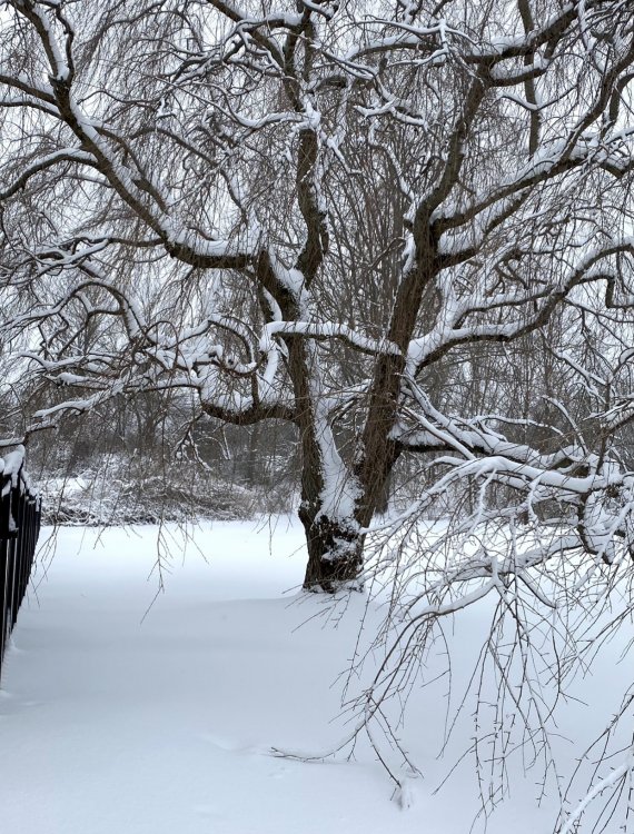
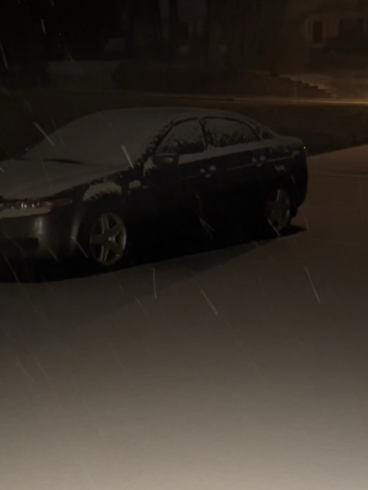
32 degrees, and snowing lightly. A little less than a foot of snow outside. I was thrilled to wake up to a snow-painted world this morning. We finally got some real snow. The sleet part was also awesome. I truly love weather in all its guises (other than extreme heat:).
This was a wonderful storm that gave many of us a true taste of winter...
-
2
-
-
16 minutes ago, CoolHandMike said:
I just noticed that we haven't seen a plow come by since around 3pm. Before that we had the big one come by several times and a smaller pickup once or twice. They're probably all being pressed into service on the major roads at the moment. Glad my jobsite cancelled work again tomorrow since I probably won't be able to get out without a lot of digging even after they plow.
Also in retrospect, I wish I had set up a camera on the back deck for time-lapse. I'll definitely do that next time.
Still snowing, lighter but still decent. Might break 2' before all is said and done. This is our first winter in Reading and the wife and I are loving this. (Her a little bit less so since she works from home lol.) One for the books, and the storm we'll use for comparison for many years to come.
I do feel bad that many of us weren't able to cash in on the snow totals this time around and I understand there's a bit of anger and disappointment to be had. It happens, and I've been in the same boat more times than I care to remember. And I'm sure at some point I'll get fringed again while others put up big numbers. But for now, this has turned into an instant winter classic that we'll be talking about for a long time.
Cheers and goodnight everyone.
I’m glad you and others got some amazing snow!! Here in Newtown, we certainly didn’t get the hoped for snow amounts. Still, reading this forum the week leading up to the storm and the anticipation was a tremendous amount of fun. Also, we did get a lot of sleet, and I had never seen such a prolonged sleet event with such high precipitation. I loved being part of this snow event. As for the snow, maybe next time the snow gods will smile on my area:)
-
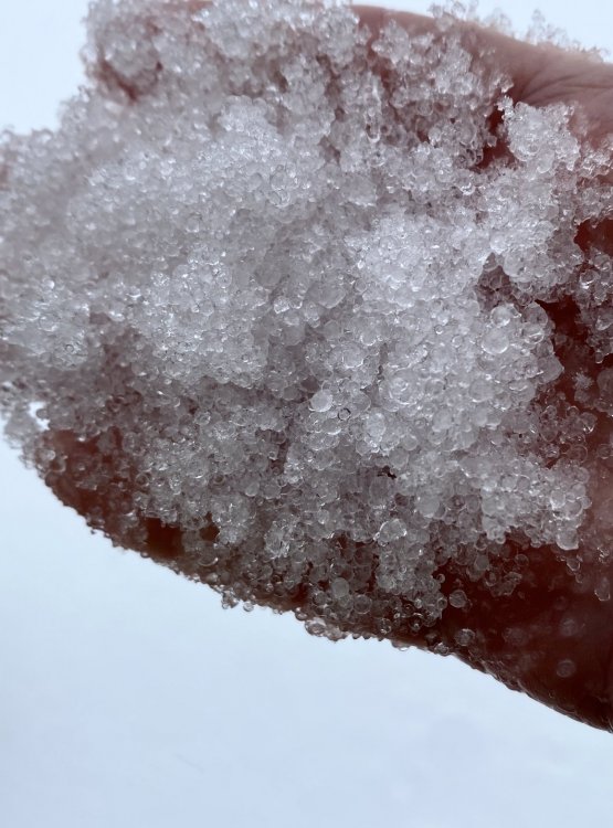
Newtown. 31 degrees. We’ve changed to half snow. Fast small flakes with sleet atm that won’t add up to much. I went for a walk and have to say that while I’d have loved Red Sky’s snow best, I’m enjoying the uniqueness of this storm. We have INCHES of sleet outside.
-
Newtown. 31 degrees. Still an onslaught of sleet pouring like a heavy rain, but there are finally a few snowflakes in the mix. Emphasis on FEW.
Is there any chance my area might get some snow on the backend of the storm? Or we’re SOL here?
-
1
-
-
3 minutes ago, MPotter_WX said:
Rates have diminished here in Hellertown. Only 1” per hour. Haha. Still have 9 hours of this good stuff
Sounds wonderful!!! I’d be happy with a few hours of good stuff here. I’m getting a bit worried that sleet is all we’re going to get in Newtown.
-
Newtown. 28 degrees. Sleet continues to pour down in an onslaught that looks like a heavy thunderstorm.
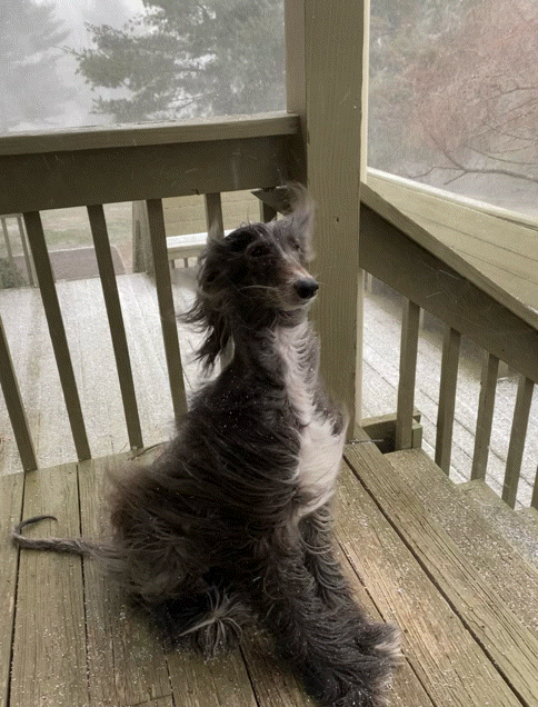
I let the dog out, and she was ON TOP of the snow the whole time because of that icy crust.
I hope snow is on the way, but I’ve enjoyed the sleet. It’s interesting and musical:) Time for snow soon I hope!!!
-
1
-
-
Newtown... steady light snow... it’s already laying... nice bonus pre-storm.
-
2
-
-
1 hour ago, RedSky said:
Weather World says meh 6-10" in SEPA in the forecast out 2 hours ago. A bit conservative.
IDK why but for me, your comment really highlights just how awesome this storm could be. It’s so wonderful that 6-10” is “conservative.” We've been having such rotten winters lately that this storm feels like a dream.
-
3
-
-
4 hours ago, The Iceman said:
I'm 20 years into this hobby and still learning! If you ever have questions about any posts here, definitely feel free to ask. I'll be glad to explain the best I can. It's always good to see new "weenies" in the making
")
Thank you!!! As I learn more, I’ll definitely have questions. Before, I didn’t even know where to begin. I always failed at learning on my own because I didn’t know the science. I still don’t, but I’m finally truly learning. In all honesty, if there’s a hint of snow in the forecast, I turn to this forum to find the real forecast. With this wave 3 hopeful storm, I’ve finally learned what a Miller B storm is... I hope this storm happens... It will be an entirely new experience to understand WHY it’s snowing.
-
2
-
-
38 minutes ago, The Iceman said:
Welcome to the board!
Here are the 2 free sites I use to model watch. I also have a subscription though for the euro and eps.
Tropical tidbits:
Pivotal weather:
Feel free to ask questions whenever! I know I'm a bit down on these threats but I still enjoy tracking them

Thank you! I’ll bookmark them! Somehow by staying in my literature & languages niche, I never learned the underpinnings of the science of weather. I did attempt to learn on my own but found it wasn’t easy like learning a language. I needed a teacher. I just discovered the class yesterday. A sad example of my lack of knowledge - I knew cold air is heavier than warm air, but I only learned yesterday it’s called buoyancy:D My goal is to be able to read the posts here and fully understand everything said.
-
Please post weather the weather model runs you’re loving if it isn’t too much trouble though I might well be the only one who isn’t good at finding them on my own. I’ve been excited since I read Ralph’s posts here last night. The possibility is wonderful fun regardless of whether we get some snow or a ton from the storm.
I’ve intended to learn for awhile now and am finally taking a Harvard (Free- using EdX) “Backyard Meteorology” online course. I learned about isobars yesterday:) I’m light-years behind all of you, but weather is one of my favorite things. I know weather (I was over the moon the first time I saw graupel), but I don’t know the science behind it.... or the science behind that:) I’m learning though:)
-
1
-
-
Light drizzle. 33 degrees in Newtown.
-
Lovely snow squall a little after 11 a.m. today. The dog and I went out to play.
-
9
-
-
Sleet is falling here like someone dumping sand from a bucket. Like @@Hurricane Agnes the sleet is audible over Taylor Swift and a fire playing loudly in the background. About five inches of snow with sleet starting to pile on top. 26 degrees according to Wunderground. Forecast has possible gusts up to 45 mph. Exciting storm!


December 22 - 25 possible historic wintery/mix/rain event obs
in Philadelphia Region
Posted
34 with a brisk-then-flurried wet large-flaked snow in Newtown. Feeling very happy:)