

GansettBay
-
Posts
94 -
Joined
-
Last visited
Content Type
Profiles
Blogs
Forums
American Weather
Media Demo
Store
Gallery
Posts posted by GansettBay
-
-
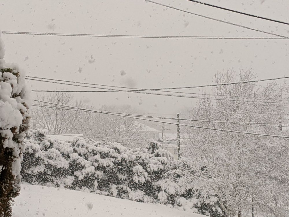
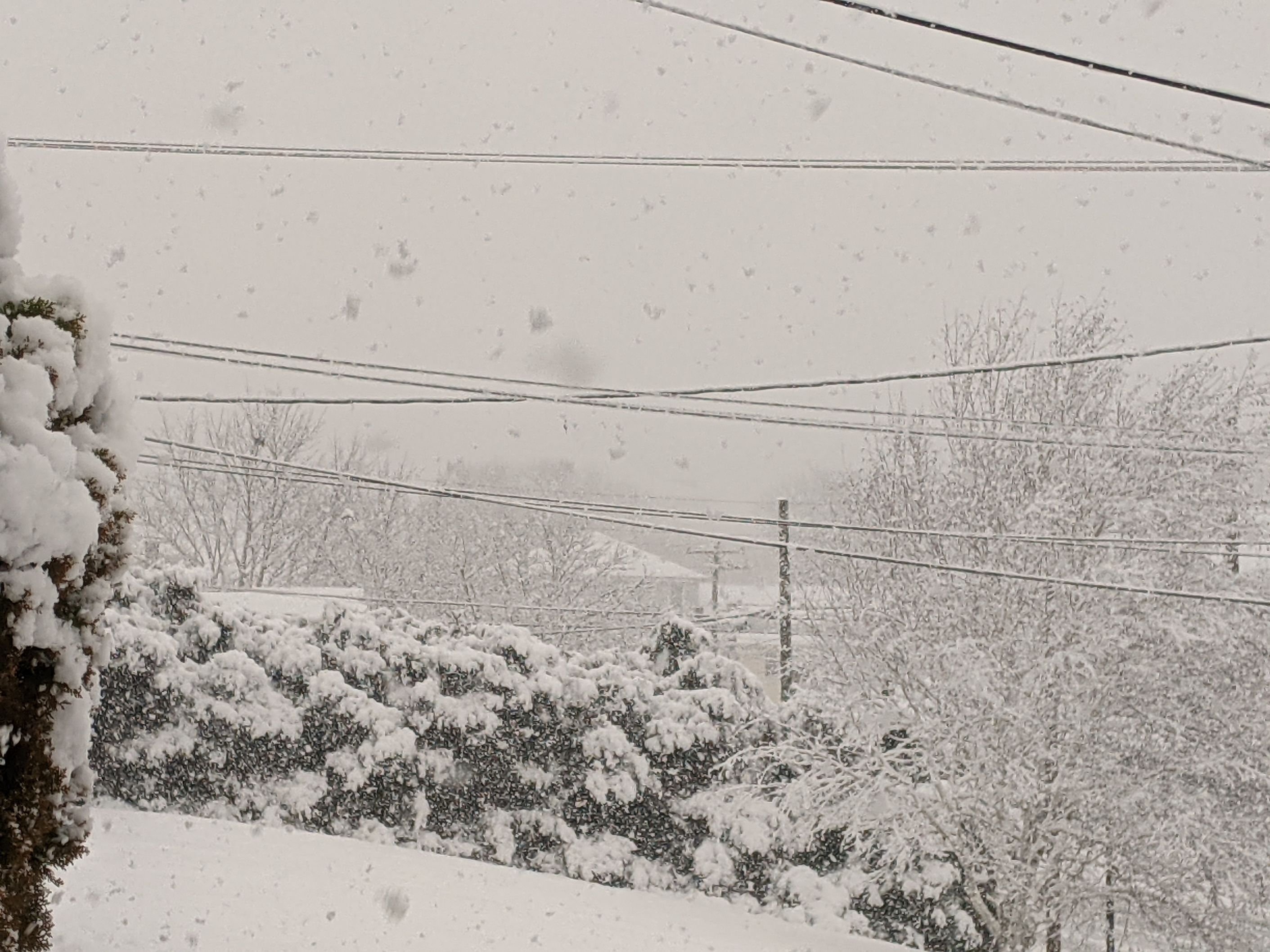
Best snow of the year atm. Pouring 1" flakes
-
 1
1
-
-
1 minute ago, WxWatcher007 said:

Mesoscale Discussion 0065
   NWS Storm Prediction Center Norman OK
   1040 AM CST Sun Feb 07 2021

   Areas affected...Long Island through southeastern New England

   Concerning...Heavy snow

   Valid 071640Z - 072045Z

   SUMMARY...Heavy snow is in the process of developing, with hourly
   snow rates expected to maximize around to 2-3+ inches per hour by
   2-4 PM EST across the Greater Providence and southern Greater Boston
   Metropolitan areas.

   DISCUSSION...Rapid deepening of a surface cyclone is now underway to
   the east-northeast of the southern Mid Atlantic coast, as a 100 kt
   cyclonic 500 mb jet streak, associated with a vigorous mid-level
   short wave impulse, noses across the North Carolina coast.  This
   system is forecast to accelerate northeastward through this
   afternoon, with continued rapid deepening of the cyclone, and
   intensifying deep-layer frontogenetic forcing to its
   north-northeast.

   Periods of heavy snow have already been observed within the
   developing frontal precipitation band across parts of southeastern
   Pennsylvania into the Greater New York City area, with increasing
   snow rates in the process of developing across Long Island and
   southern New England.  Latest model output suggests that forcing for
   ascent will increasingly be aided by strengthening frontogenesis in
   the 700-500 mb layer, across southeastern New England during the
   18-21Z time frame.

   Forecast soundings indicate that this will include the favorably
   cold mixed-phase layer supportive of large dendritic ice crystal
   growth, which may maximize across Rhode Island and southeastern
   Massachusetts.  This likely will include snow rates occasionally on
   the order of 2 inches per hour, and at least some guidance appears
   suggestive that an influx of lower/mid-level moisture may contribute
   to weak destabilization supportive of convective bursts around 3+
   inches per hour.

   ..Kerr.. 02/07/2021
Looking forward to that!
-
S+, vis around 1/4 mile. Temp dropped from 35 to 32 in less than 10 minutes. TWC took the rain out of the hourly. I'm hopeful for 4-5 inches but 6-7 seems within reach if this keeps up for a few hours
-
1
-
-
The nearby transformers surged a few times and then blew. Powers been out for about an hour now. Rain/ wet a$$ snow since.
-
20 minutes ago, Kbosch said:
I was complaining about OKX going too far with this storm, but I'll end up verifying in their range. Is anyone in SNE outside of the CT coast piling up what we are? It seems like the totals are going to be extremely spotty.
We have about 8 inches here in the SE corner of CT. Lots of QPF but it's very wet and compacted. Definitely not 10:1
-
1
-
-
3 minutes ago, IowaStorm05 said:
I think if a full changeover were to occur it would probably be mid to late in the storm. Even coastal CT is better spot than e mass for this one due to its relative “Westerly”, no pun intended, position.
I was thinking similarly. The temp hit 32 around 12pm and has held since. I think with some luck we might hit 10" here
-
1
-
-
Seems about 6". Not the easiest to measure though. Beer doesn't help. What are y'all thinking for timing changeover southern RI/CT boarder? Radar has the line pretty far south still
-
This band is bangin. Giant flakes. Definitely hitting 2"/ hr or more right now. Gonna go on a walk and enjoy this snow while it lasts!
-
Eyeballing a little over 3 inches here on the westerly/ pawcatuck line. The northern edge of the band is just approaching my home, although the meat of it seems to be a bit west. We haven't seen the winds I was expecting by now, but gusts appear to be around 30-40mph. Biting my nails over this rain snow line/ timing. Temp is up to 32 now
-
2
-
-
It looks like onset has been expedited to 7pm here in Westerly, but it doesn't seem to ramp up until early morning even though current radar seems solid. Is it expect to dry up a bit when it gets here?
-
Crushing. Looks about 6" so far. Lots of drifts over 12. The last of the grass disappeared as soon as this band came in. It's like a time lapse watch the drifts grow
-
Ripping. Looks like sleet may hit my doorstep by early morning
-
Getting whalloped by the band coming off the block island sound atm. Tough to say with the drifting, but it could be close to 2"/hr
-
Pretty good rates here in Pawcatuck CT. Snow is stacking on the roads despite a heavy salt layer.
-
Some half dollar sized flakes falling here. Just a dusting
-
6 minutes ago, NeonPeon said:
Is that what that was? I thought it was a power issue, mine was off for a second and the streetlamp blew, so I figured it was a transformer.
That’s possible. I saw two consecutive flashes and then a third about a minute or two later. Looked like it was coming from the south and I didn’t noticed power issues. But I haven’t seen anything since so I’m thinking you are right
-
lightning spotted in Newport ri.
-
21 minutes ago, NeonPeon said:
Don't do it to yourself. It's the hope that kills you.
Yeah, you right. You know how many winters I’ve spent wishing I lived in Smithfield?
-
 1
1
-
-
1 minute ago, CoastalWx said:
Probably after 2am, but ptype seems questionable.
Thanks
-
Anyone have a guess as to when I could see the best rates in Newport ri?
-
10 minutes ago, Baroclinic Zone said:
Solid thump there but I do think the BL warms towards the tail end.
Thanks!
-
Any chance Newport RI stays all snow for this?
-
Any chance my hood (Newport) goes all snow on this one?
-
12 minutes ago, S&P said:
Moderate occasionally heavy
Fun spot. I was just there last week! Looks better with snow
February 16th Disco
in New England
Posted
50 degrees with some of the densest fog I've ever seen. Vis less then 1000ft for all the wrong reasons