Beachin
-
Posts
337 -
Joined
-
Last visited
Content Type
Profiles
Blogs
Forums
American Weather
Media Demo
Store
Gallery
Everything posted by Beachin
-
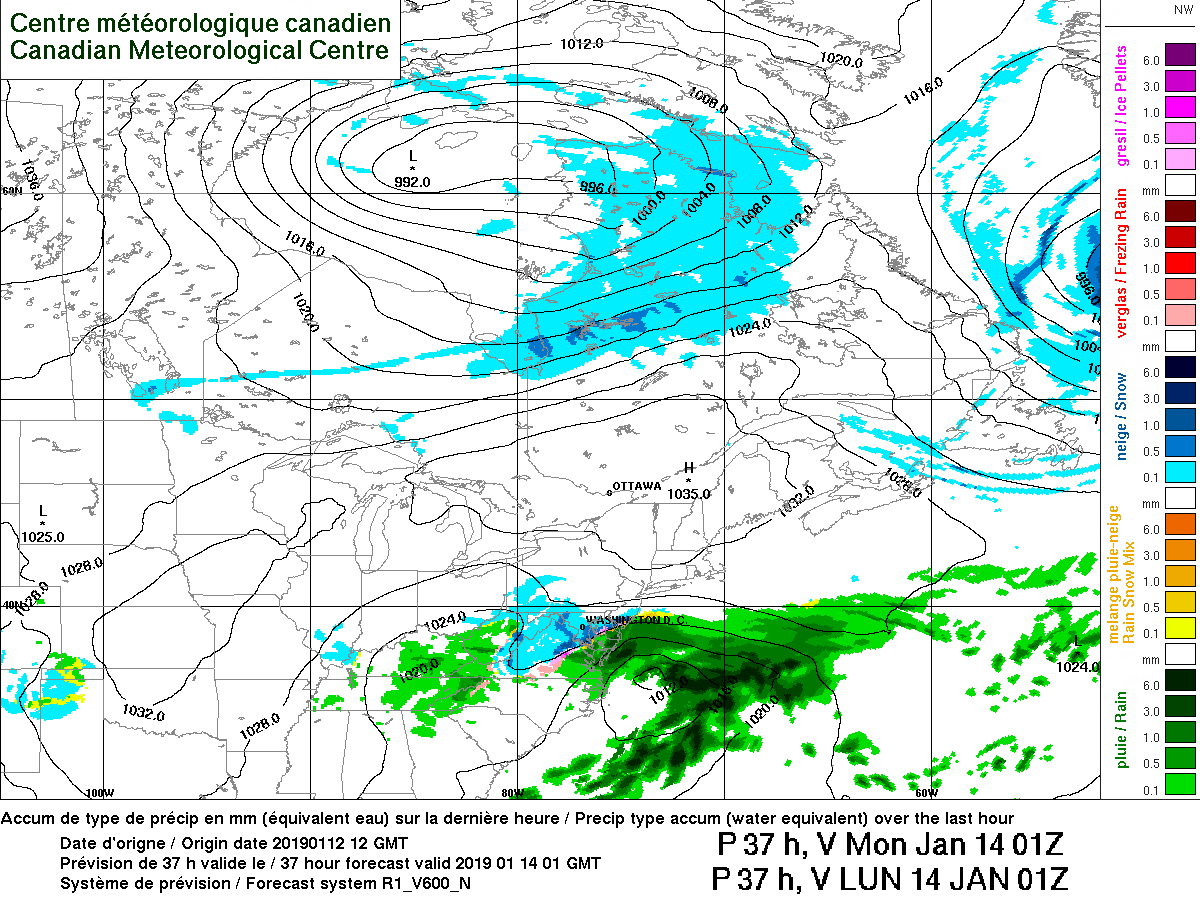
At this point the NAM is for sure dead on with where these models are headed. its so obvious aloft and at the surface
-
AT 30 area getting impacts from coastal! First time the GFS has shown it
-
GFS is amplifying more and more every single run
-
Big hit incoming on the GFS 0c 850s Approaching Fredericksburg hour 18. 850s flooding moist air north
-
GFS is about to make people have faith in the NAM haha. Looks very similar thus far Finally has the longer closed low
-
GFS immediately has higher heights at hour 6. Considering its only 6 hours id consider it a sizable amplification jump
-
Based off the GEFS 6z being north and the trend map GFS will be north and improved Running now
-
Icon trend map
-
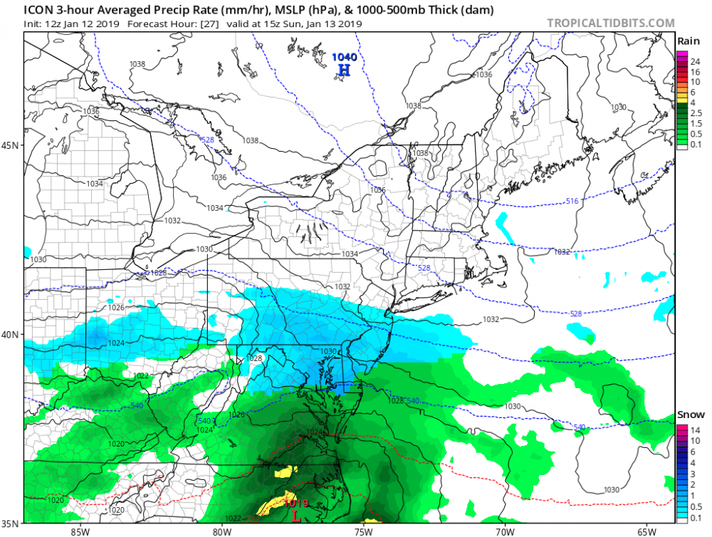
ICON has definite similarities to the NAM just lighter more realistic QPF haha looks great area wide 8-12
-
Icon has shifted north again R/S line is close to DC
-
FYIY HRRR is still shifting north run after run and the front end is looking healthier. This is exciting
-
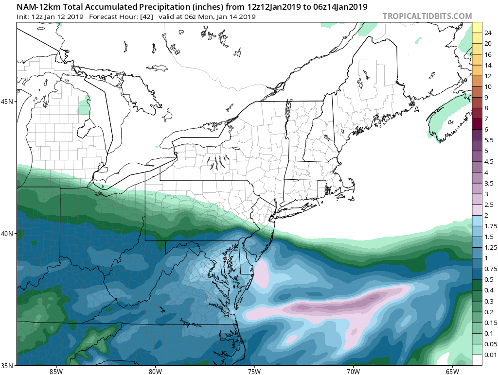
Yeah no doubt RGEM is going towards the NAM. SNJ to RIC Rain as the low get closer

-
Oh my RGEM is vastly improved from 6z too
-
On the trend map 3K is definitely trending towards a Regular 12km NAM solution. Its usually last to agree or get close
-
If the RGEM-GFS show anything remotely similar to the NAM as they should this place is gonna go crazy lol
-
You definitely cannot ignore the trend and Climo. All along Climo argued with what the models were showing. Good to see common sense is kicking in
-
DCA-BAL 20-22 inches
-
Kuchera is incredible haha
-
Caution this might cause joy. I had to skip 2 frames in between but jesus look at the energy aloft at 700mb. Definitely a signal for a smashing
-
Last 4 NAM runs. THIS HAS BEEN COMING !!!
-
GD crushjob

-
Look at the trend map. This has been coming. it was only a matter of time
-
Absolute destruction ahahahhahahah
-
Trend map dont lie ! ITS finnaly here and getting better!!!!!!!!!
-
Absolute crush job for everyone