

SnowLover22
-
Posts
1,287 -
Joined
-
Last visited
Content Type
Profiles
Blogs
Forums
American Weather
Media Demo
Store
Gallery
Posts posted by SnowLover22
-
-
7 minutes ago, dendrite said:
31.2° SN
10.5”
Stuck at 5.5 here. 30.5 degrees F
-
7 minutes ago, Chrisrotary12 said:
Radar looks like crap. Too be expected when the 700 mb low is to your north. On to golf season.
It isn’t? Or you are saying it is forecasted to be…
-
-SNRA here.
-
6 minutes ago, dendrite said:
Trash
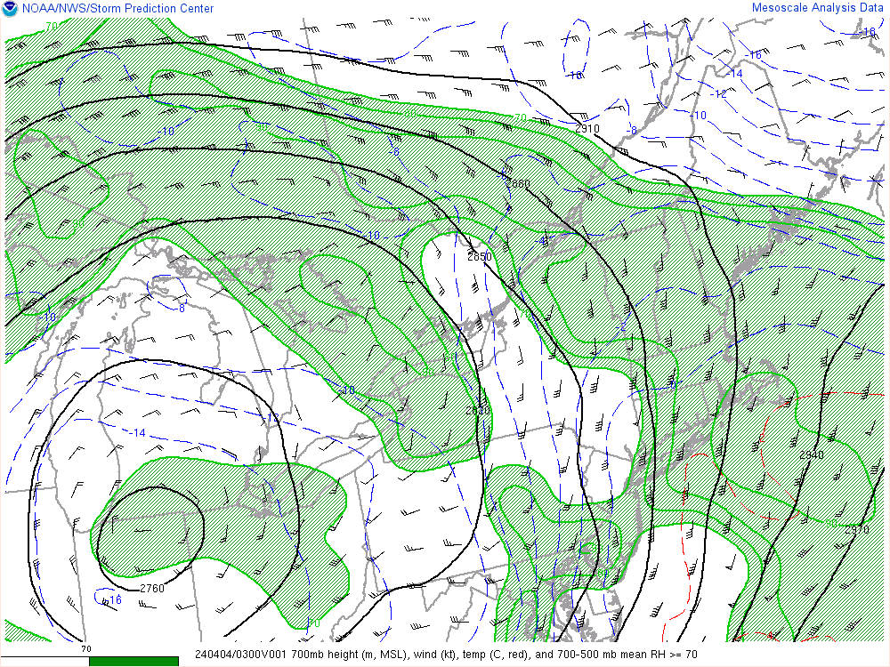
When is ever an appropriate time to use the PDC maps? I am pretty sure they only had 6-8 inches for our region for the last storm and we know how that turned out.
-
2 minutes ago, MarkO said:
North Conway area get's crushed with that track on the GFS. Break out the 3 footer bong reports.
Gfs is definitely smoking something, Plymouth with 30 inches and the white mountains with over 50 inches.
-
 1
1
-
-
29 minutes ago, 40/70 Benchmark said:
NAM is never, ever too warm in the mid levels. Not a good sign.
On 4/1/2024 at 9:47 PM, dendrite said:The NAM busts on the 850-925 warmth more often than 700. I wasn’t surprised it blew the last event.
Never say never but you are probably right.
-
7 minutes ago, HIPPYVALLEY said:
But with which parameters?
NAM is the go to for mid level warmth surge in these set ups.
I’ll second what someone else said. The NAM blew the mid level warmth surge forecast last storm. Had sleet/freezing rain up into the white mountains. In reality, only got as far north as knocking on the door of Plymouth. Was off by 25-50 miles up to game time.
-
1
-
-
54 minutes ago, jbenedet said:
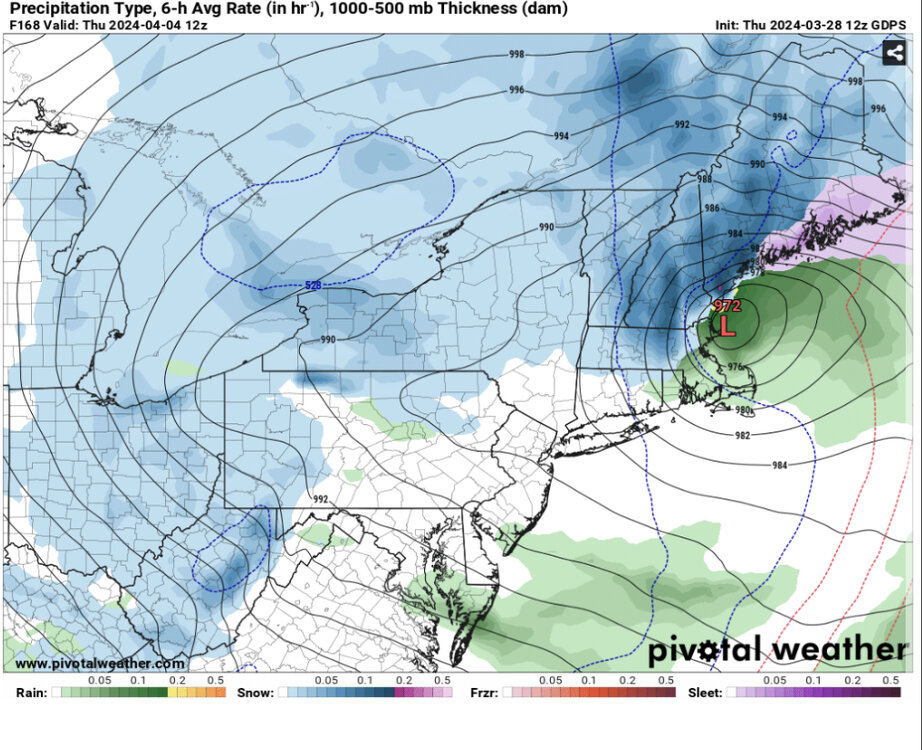
That’s a white rain goose egg in SE NH. PF has it right with the depth change maps. Much better baseline with that.
GFS gonna burn us on the coast up until go time with these looks.
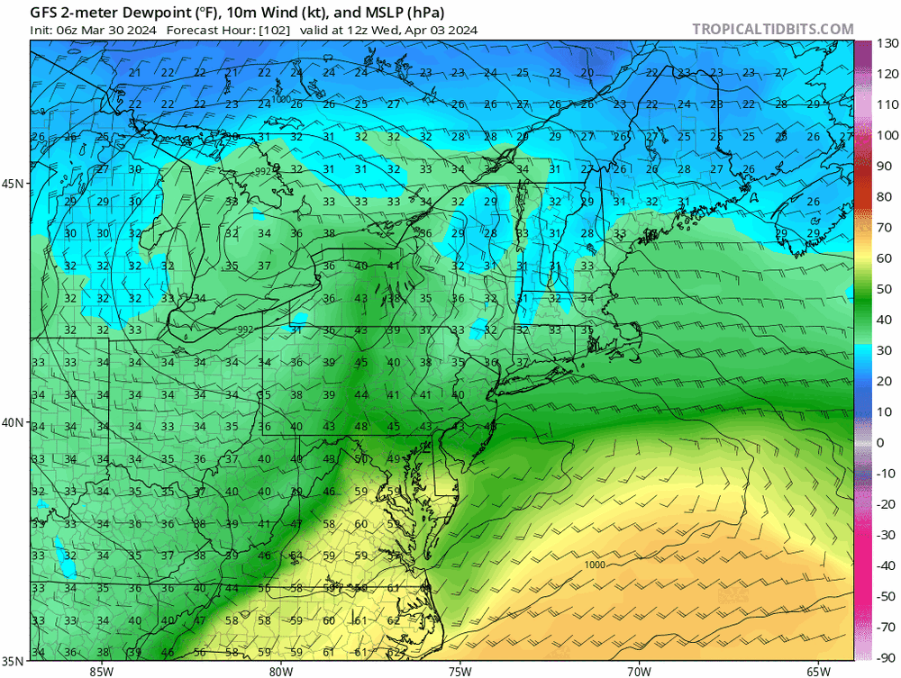
I mean, it’s outputting 32-34 DP throughout, with 34 surface temps over same time frame. Assuming that’s correct you’d have melting exceeding rates with the qpf output. And if it’s 3 degrees too cold (as the GFS has been all season at these leads) it’s wet surfaces except for the coldest with those transitory dustings that melt whenever rates lighten.
Seeing that 34 DP 18z Thurs on the backside of this <980 low is red flag we don’t have the cold conveyor hook up needed to positively offset “marginal”.
It does seem it will at least be cold enough to give ski areas some real accumulating snow. Looking forward to that.
-
5 minutes ago, 40/70 Benchmark said:
Like the AI.
Just check the ens mean.
NS will eventually start acting destructively with the set up if it gets too far behind.
The one time the AI model is right is to ruin SNE snow chances. All jokes aside, this storm will be a good test case to see how it does vs the other models.
-
4 minutes ago, 40/70 Benchmark said:
I knew there was a reason no one commented on the 00z GFS...

disjointed mess, less effective phasing, ss is more able to run ahead of ns
-
1
-
-
I am good missing out on this one…. 20 inches the other week was enough for me….
-
2
-
-
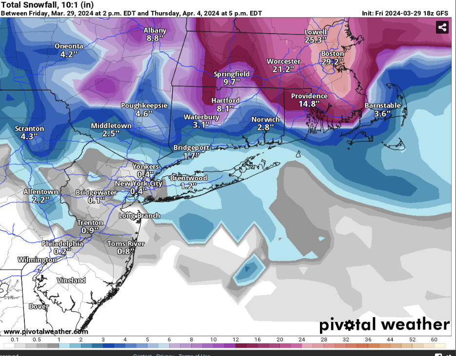
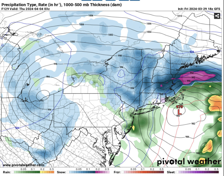
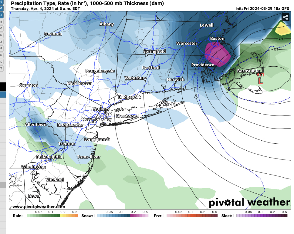
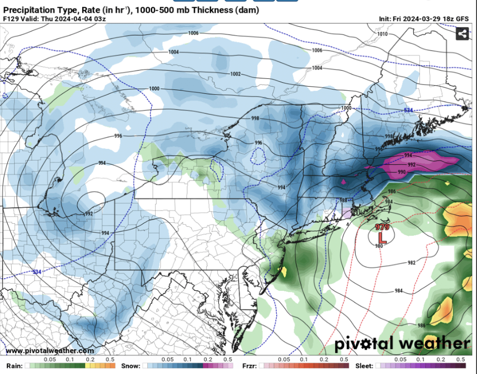
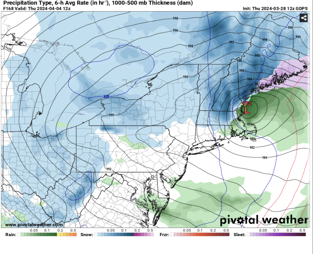
I know it’s a clown map but I’ll leave this here for the SNE peeps
-
1
-
 2
2
-
-
It’s over
-
2
-
-
Such a step back guys, storm cancel
-
4
-
-
2 minutes ago, dryslot said:
Want to be done with this winter.
I mean, this storm is probably the last hurrah so patience….
-
19 minutes ago, dryslot said:
You'll be shadowed, It will be a cold rain here 32.5°F
Hopefully, still far out enough to say we have no idea what will happen other then there will be a storm system somewhere along the east coast, location tbd.
-
1
-
-
14 minutes ago, dryslot said:
I'm sure he's already viewed your file........
This time next week you and me will be wishing away our 20 inch snow pack.
-
1
-
-
5 minutes ago, Typhoon Tip said:
That's like snowing really hard with nothing sticking ... not below 1200 or so...
I think though that the GGEM having a warm bl bias in this time range above, 'might' make that interesting with the perfunctory correction.
Snow will stick at 28-32 even in April and verbatim height of storm is at night.
-
6 minutes ago, dryslot said:
Yeah.
There definitely is tele support for something to happen
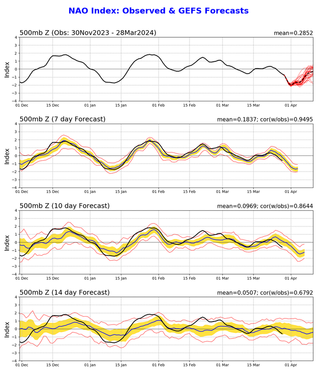

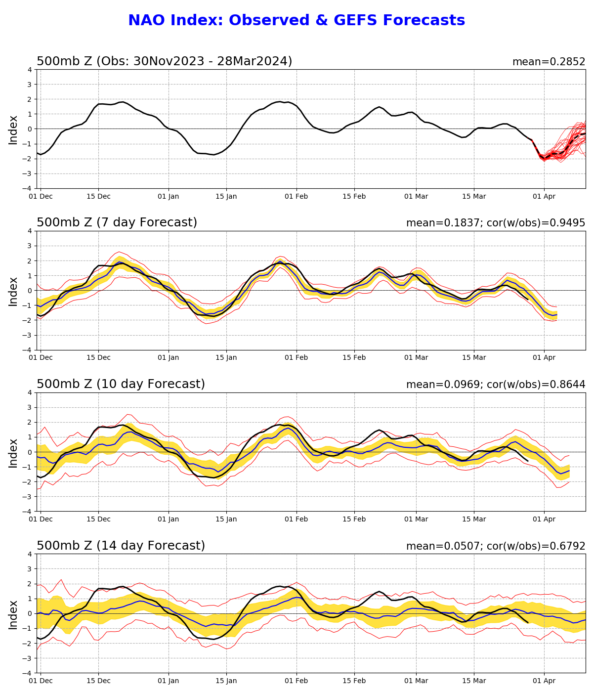
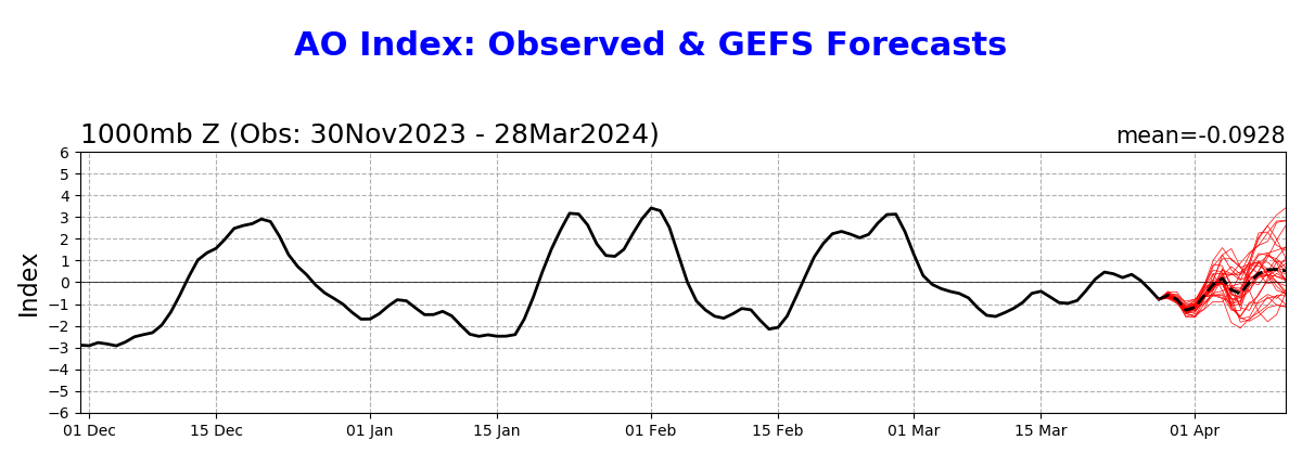
Rising NAO from negative to more neutral along with rising AO with the EPO being negative.
-
How much I pray this does not happen. I already moved on to spring.
-
2
-
1
-
-
Snow has just come to an end. Final total is 19.75”.
-
1
-
-
6 minutes ago, dendrite said:
I can tell the climate summaries are from the Davis software. I’ll save you from going up there in 20” new lol.
The door probably wouldn’t open unless the roof has been shoveled.
-
-
1 minute ago, dendrite said:
Is that a heated Davis or do they have something else up there now like an antifreeze weighing gauge? If that’s a heated tipper that’s pretty impressive.
I can go to the roof right now and get back to you lol
-
2
-
2
-

April 2024 Disco- SNE’s favorite month
in New England
Posted
Goddammit you jinxed it.