

RockabilyJunior
-
Posts
53 -
Joined
-
Last visited
Content Type
Profiles
Blogs
Forums
American Weather
Media Demo
Store
Gallery
Posts posted by RockabilyJunior
-
-
I wasn't following over the weekend and now I am very confused. Is it snowing tomorrow? It seems way too warm. Do we expect any accumulation?
-
What's the time frame exactly on snow. When do we expect the heaviest (is it now?) and when will it end. When Norlun band supposed to set up and when will we know if it looks like it is setting up where it is currently forecast to be?
-
Snowing in Baltimore. Roads caved immediately. I have a good feeling about this one ...
-
 1
1
-
-
Late Jan - March 2015 was for me the most wintry stretch of weather I have experienced in this area. There have been stretches with more total snowfall, and more frequent snowfall, but in that stretch we had fairly frequent snow, 1 or 2 fairly large snowfalls, and it was extremely cold. There was more or less snow covering the ground for 1-2 months.
I'm thrilled to see that this storm looks like it might over-perform, but I am skeptical with these norlun type events. The last two that were forecast for this region, I think one was in 2018-2019, gave me a little dusting and in-laws in the NJ suburbs of Philadelphia got 6 inches. I think this may have even happened twice that year. But I wouldn't be surprised if either Baltimore DC or both bust big on this one ... I hope I am wrong though.
-
1
-
-
I just measured 3.5 inches of snow on the deck here, just north of the Baltimore city line, south of Towson. We have 3.5 inches. The most I've had since I moved here was two 4 inch snowfalls 2 years ago so I would love if we beat that! It's already sticking on the roads more than anything I've seen since the 2016 blizzard which I care about more than total snowfall, so for me this has been awesome!!
-
2
-
-
I'm between Baltimore and Towson and it's currently 25.3 ºF in my front yard supposedly. The forecast low was for 29 ºF. My yard tends to run a little cool though not quite that much ... I would be happy if we had a surprise inch of snow even if it all melts away shortly after.
-
I posted this a few days ago. I tried to be positive in my outlook then, but for anyone who is new here, my sense from the experienced meteorologists here is that you should smooth, maybe even aggressively, whatever forecast models are showing with climatology averages.

-
 7
7
-
-
There is still plenty of time for things to change, but about 12-24 hours before a snowfall, if I see snow maps like the ones posted above, this is what they actually mean ....
We need a nice 50-100 mile shift for this to be of real interest, and there is still plenty of time for that.

-
 8
8
-
1
-
-
The smell at my house in Baltimore was worse than anything I smelled over the summer. The air looks pretty hazy too.
-
2
-
-
40.8 was the low this morning in my yard at the north border of Baltimore city. It felt like there could have been a frost but I guess we're not quite there yet.
-
5 hours ago, WxUSAF said:
Dang. Over 4” in Baltimore??! Not sure if this is radar indicated
I live right on the Baltimore city / county line on the north side of the city between the the purple blobs (4.6, and 3.3). I recently put in this Tempest weather station that claims it got 3.15 inches of rain, which I guess seems in line with this map.
It was pretty wild. I live on a hill and the entire road and sidewalk effectively turned into a river. I don't remember rain like that in a while.
I was also wondering if anyone else had experience with this home weather station and if I should trust the reading or not. I've been trying to calibrate the readings ... Even the during the heat wave last week, the reported temperature where I was never exceeded 94ºF, despite having a forecast high temperature of 97-100 most days which made me a little skeptical of the temperature readings as well as others that it might be reporting. Maybe I just live in a cool spot ...
-
1
-
-
1 hour ago, gopper said:
4.5 in Towson.
Woke up a few times to see the progression from NO to WOAH to oh watch it go away.
North Balti Zen might have done better at his old place with this one?
Can confirm. Just barely south of Towson and I had 4 inches exactly just before I went to bed at 3:25am as the death band was starting to wind down. It looks like we got another 30 min-1h of fairly good rates after that so 4.5 is what I think we have outside here.
-
Northern Edge of Baltimore City here. I just measured around 3.5-3.75 inches as the death band arrived.
-
2
-
-
Just now, Kleimax said:
In the last hour here in Owings Mills we’ve picked up over an inch. We’ve been in this secondary little band for a while now and it’s ripping
It's been crazy. I saw the first flakes at 1 am and I just measured almost 2 inches outside. At this rate we might be pushing 4-5 around here.
-
2
-
-
Finally just started seeing a few flakes between Baltimore and Towson 5 min ago. I was worried it would never happen.
-
1
-
-
Just now, gopper said:
Thanks! Someone on this forum posted this once and I had lost the link. This is exactly what I was looking for. Best of luck everyone!
-
1
-
-
Is there a site that has nice radar, including the dual pol products, other than nws? Since they updated their radar a few years ago it loads so slowly as to be unusable.
4:06 am On the northern edge of the Baltimore city / county line, south of Towson
34º with moderate snow / sleet mix.
Grass is mostly covered and It looks like it might start sticking to the paved surfaces soon.
-
1
-
-
Just predict climo. Once you already know there is going to be snowfall it's a pretty hard baseline to beat. For Baltimore, that means 2.7 inches (average of all snowfalls occurring in February in last 30 years). I'll take it.
-
13 minutes ago, ge0 said:
have we ever busted high? I can't remember the last time. 2009 maybe?
Also February 2015. Snow was supposed to change over to sleet/rain, but it never really did. We got 10 inches in Baltimore instead of 3 or 4 forecast before hitting a dry slot with just some freezing drizzle after the changeover finally did happen.
-
1
-
-
I think the problem with our area is that there is a very heavy tail of probabilities with snowfall accumulations, so that the expected accumulation is way greater than the most likely accumulation. Maybe models and forecasters are trying to hedge their bets so that on average they aren't too wrong? But most snowfalls are either boom or bust here, often just due to temps.
For instance, in February in Baltimore it has snowed (> 0.1 inches) on average on 2.8 days in the month in the last 30 years. Of these on average 1.3 days had 0.1-1 inches, 0.6 days had 1-3 inches, 0.5 days had 3-5 inches, 0.3 days had 5-10 inches, and 0.1 days had 10+ inches (I'll call this category 12 inches)
46% chance 0.1 - 1 inch (0.6)
22% chance 1-3 inches (2)
18% chance 3-5 inches (4)
11% chance 5-10 inches (7.5)
3% chance 10+ inches (12)
___________
Expected Snowfall --> 2.7 inches
Most Likely Snowfall --> 0.6 inches
So this is an honest question, which number actually would get used in a forecast? And for any given event, this distribution might have an even heavier tail and the expected snowfall and most likely snowfall would diverge even more. Is there a point where forecasters opt for one number over the other, or are these also blended? I feel like a forecast that just said 2.7 inches for every snowfall in February (aka climo) would have verified more accurately than most forecasts we've seen this winter. How wrong would our forecasts be if we should just use models to give us an idea if it's even possible for it to snow and then just predict amounts with climo afterwards?
-
3 minutes ago, Chase said:
Heavy freezing rain has a harder time accreting than light rain, just throwing that into the discussion.
I think this is actually a very good point to consider. It can accrete on elevated surfaces, but not really on roads when it's too heavy. I lived in Montreal for a while and we used to get some epic freezing rain there since it was in a valley, but it rarely caused much trouble unless it was very light. One notable exception was around Christmas in 2011. We had heavy rain at 23 degrees and I can confirm that if it's cold enough, even the heavy stuff accretes well.
-
1
-
-
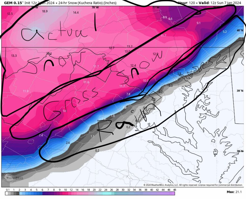
Also, the GEM model is almost always one of the coldest solutions. If the GEM isn't showing snow, then it's probably not happening, but it often over does the cold. It doesn't mean it's always wrong, but as other people have mentioned, you can generally rely on a move NW, or at least a slightly warmer solution to ultimately verify.
-
I mentioned this before, but it seems to me like while the CMC is very snow happy, it is also a high recall snowstorm model. By that I mean if the CMC says no snow, then there is no snow. When there is snow, the CMC showed snow (and probably over did the totals). On the other hand, most of the time the CMC shows snow it doesn't pan out. So if the CMC is showing snow, that is a good start. I know the pattern is a bad when when it isn't showing anything. Hopefully we can get some other models showing the same storm.
-
5 minutes ago, Maestrobjwa said:
Wow...how are you guys getting all of this? I've only measured 0.5" inches so far...still trying to crack double digits (hopefully next week can develop and we can all cash in...the screw zones are a little frustrating)
But then again...you guys can get skunked half the time so I guess you're due too!
That's what I keep thinking, and then I remember that I'm just happy we even got any snow. This winter has so far been a nice change from the previous two where I think all the snow basically came in March, and didn't really stick or stay around long. It's been snowing pretty consistently the whole time here too! It just doesn't want to snow enough to accumulate.

2024 Valentines Day Who the Hell Knows - Comeback Thread
in Mid Atlantic
Posted
I've seen this movie before. It's too warm and the flip won't happen. If it does happen nothing will stick. If it does stick it will only be on grassy surfaces. If by some miracle it even sticks a little on the roads, we aren't getting more than a very slushy inch anywhere. I hope I'm wrong ...