

bargainmusic
-
Posts
115 -
Joined
-
Last visited
Content Type
Profiles
Blogs
Forums
American Weather
Media Demo
Store
Gallery
Posts posted by bargainmusic
-
-
1 minute ago, eyewall said:
The hard truth from RAH:

A few showers may develop across the
western Piedmont Saturday evening, then widespread precipitation
will spread across the region Saturday night through early Sunday
night. Models are coming into better agreement with the details, and
confidence is increasing that this will be less of a snow event and
more of a freezing rain/rain event. All areas will be below zero
when precipitation begins to fall Saturday night, and most areas
north of the Sandhills and southern Piedmont will likely see snow
where it develops, while southern areas have a rain/snow mix. Then
by early Sunday morning, a warm nose develops as the the possibility
of freezing rain/sleet spreads north to just south of the Triangle
by noon. By late Sunday afternoon, areas away from the Triad will
likely have rain, while freezing rain becomes the dominant
precipitation type across the northwest. This warm nose will lower
snowfall amounts across most areas, even the Triad. Accumulating ice
will become the greater hazard in the afternoon, and with wind gusts
around 25 mph, could easily break weak icy tree branches. A dry slot
will likely cut off moisture and end precipitation quickly late
Sunday evening into early Sunday night. A Winter Storm Watch may be
issued for portions of central NC either tonight or Friday morning.
Highs Sunday will range from near 30 far NW to near 50 far SE.
Well the snow potential from this storm certainly died a quick death.
-
What a mess

-
 1
1
-
-
1 minute ago, Wow said:
ice is terrible. Don't wish ice for anyone.
Think they meant "could be" not "good be"
-
1
-
-
-
GFS looking solid
(14).thumb.png.d1cc19246354c1a23feb9712f995d5da.png)
Hoping we get more than an inch in Forsyth County
.-
1
-
-
Just now, DC2Winston said:
I would call it a moderate flurry right now with little sleet mixed in. Breezy.
I don't see Winston getting any more than this to be honest.
-
Moisture is back in Winston Salem on Stratford road. Looks to be a mix right now.
. -
Mostly Sleet at Stratford/Ardmore Winston-Salem
We live right by each other! Can confirm the snow has transitioned to sleet.
. -
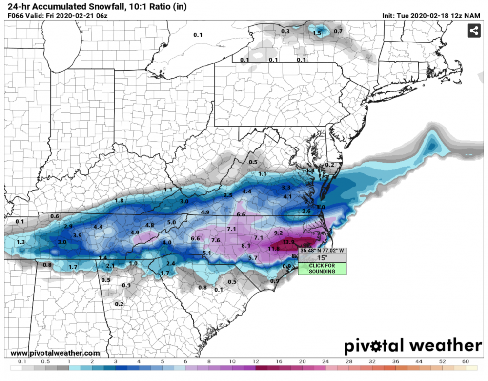
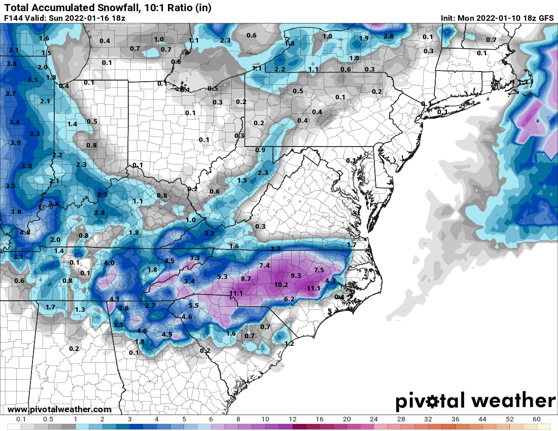
The GFSv16 is dropping a bomb on WNC and the Piedmont this run.
-
No reason to run any more models. Let's just stick with this one and call it a day.

-
4
-
 3
3
-
-
Appears the cold arrived in Winston just in time to push the moisture out.
. -
Snowing in Winston-Salem right now. Little tiny pellets.

.-
1
-
-
Snowing buckets in Winston but nothing piling up. 34 degrees.
-
2
-
 1
1
-
-
Minor (and I mean minor) precipitation fell briefly in Winston-Salem on Stratford Road. Looked like snow mixed with sleet. Nothing more at the moment.
Dew point has risen from 44% to now 73%
-
I’m one of maybe half a dozen people who use mPING in the entire Triad.

I submitted my report this morning
.-
1
-
-
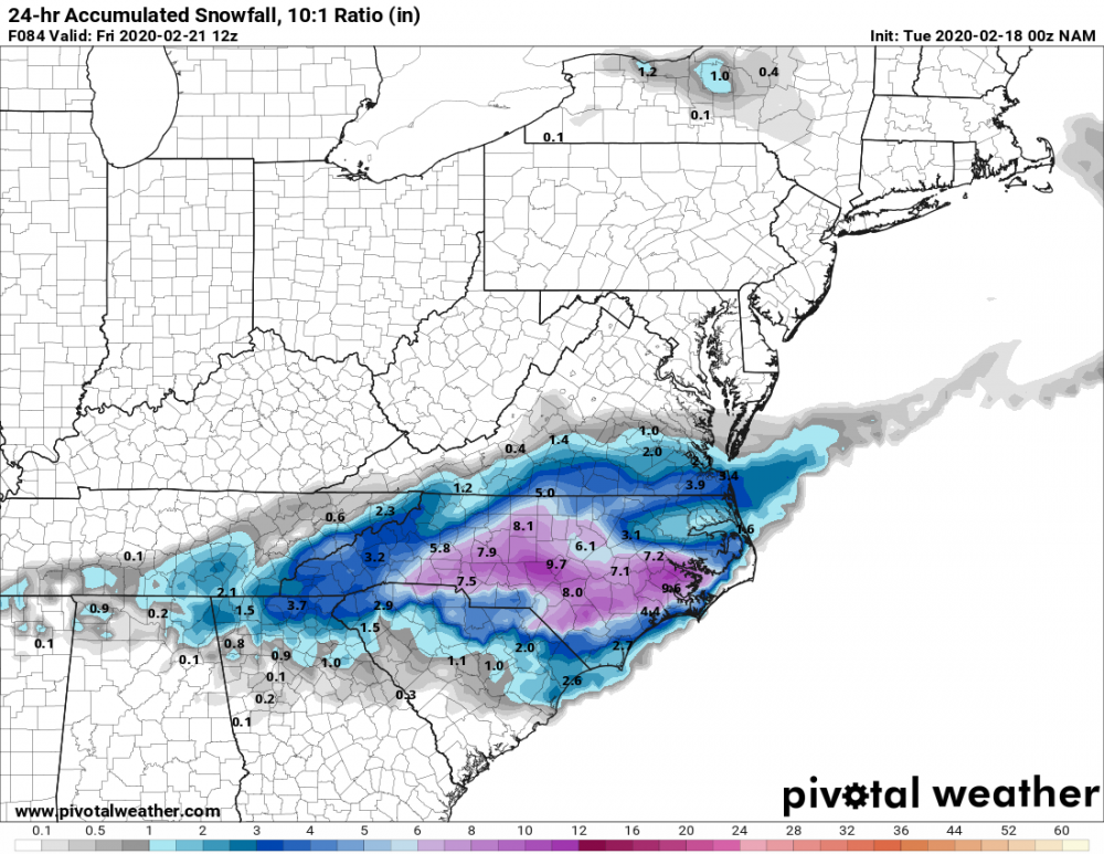
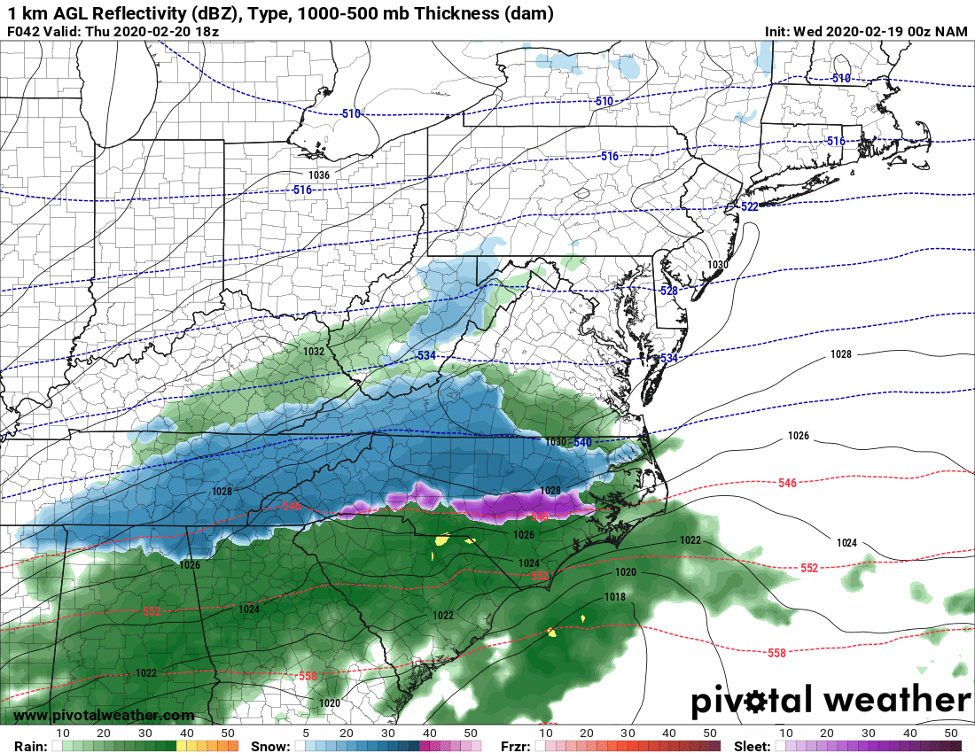
The more I I read the storm thread, the more it hurts. And since I'm a masochist I decided to come here. For what it's worth, at least the storm looked beautiful on the NAM two days ago!
-
 1
1
-
-
6 minutes ago, eyewall said:
There have been a few sleet reports north of Raleigh already today as an FYI.
My brother lives in Apex and says it is sleeting right now.
-
Honestly, how much stock should we put into the Euro when this time yesterday the model showed almost nothing for the majority of the state? I am glad to see it's coming around to the NAM, though.
-
1
-
-
North Carolina gets absolutely demolished this run.
-
2
-
-
Still snowing.
-
Just now, TARHEELPROGRAMMER88 said:
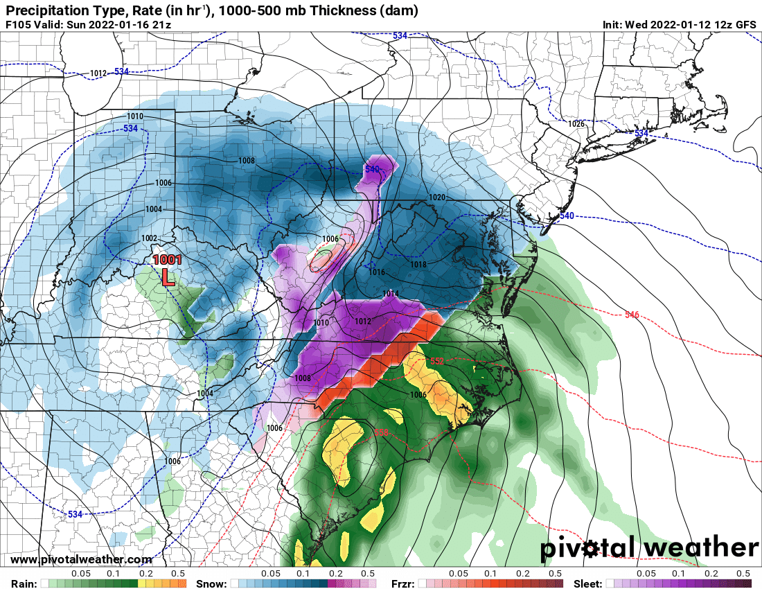
Warmer run from the NAM is incoming. It has slowly been trending warmer each run. Maybe trending toward all rain?
 Doubtful.
-
3 minutes ago, BornAgain13 said:
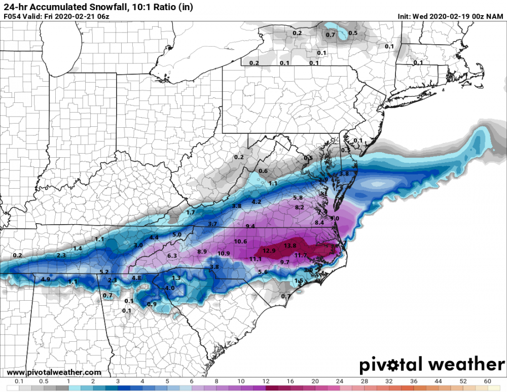
Someone will probably get close to a foot on this NAM run...
15" and still snowing
-
3 minutes ago, mackerel_sky said:
The high NAM totals in previous maps, probably include tomorrow and We’d too
This is the 24-hr accumulated snowfall map.
-
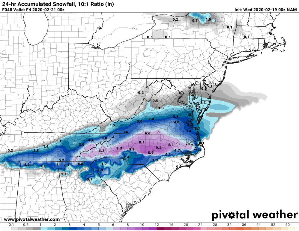
ICON is slow in bringing the freezing temperatures in, but is much more in line with the current NAM run.

(14).png.4a6468deb7779b4ee5981f2edfe4bc68.png)


Winter Storm Izzy Obs Thread
in Southeastern States
Posted
Basically all sleet now. I'm surprised it's switched over so quickly. The snow was coming down really hard a few minutes ago!
.