
Tealsnowball
-
Posts
36 -
Joined
-
Last visited
Content Type
Profiles
Blogs
Forums
American Weather
Media Demo
Store
Gallery
Posts posted by Tealsnowball
-
-
1 hour ago, Buddy1987 said:
Man! Come back in to reset my mind from present to future after today’s event and the Euro just plants a weenies dream. Anyone with Euro maps access think this scenario is beyond plausible and if so what it is keying on vs the gfs? Is there enough spacing with the cutter and then the possible storm day 7?
That Euro run was a thing of beauty. February 8th's temperatures though? Downright frigid.

-
24 minutes ago, BornAgain13 said:
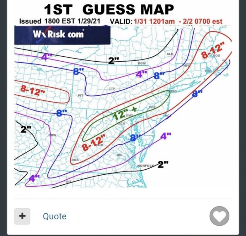
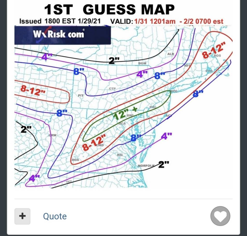
DT's 1st guess Map... got me in 4-8" , would love that but I don't think we get that high , maybe 2-4" before the change to ICE
Sent from my SM-N981U using Tapatalk
I think DT's map is too bullish for Southside, Roanoke and the NRV. I think his numbers are more accurate around lexington and points northward. I'd take DT's totals for southwest Virginia and cut them in half. That said, I wouldn't be complaining in the slightest if we achieved those totals. I've lived in Roanoke most of my life and I know when that warm nose gets close, a sleetfest ensues. I think 3-5 inches of "crunch" is reasonable to expect at this point. I think your estimates for Dry Fork are spot-on. But hey, here's to hoping that cold air aloft remains stubborn throughout this event.

-
 1
1
-
-
Roanoke seems to be on the cusp of all sorts of p-types. It's either going to be a snowfall approaching double digits or a 3-5 inch "crunchy" snow with lots of sleet mixed in. It should be fun to watch.
-
2
-
-
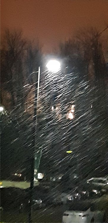
Full-on snow now. It didn't take long to change over completely. Picture provided (the quality is a bit poor at night).
-
1
-
-
Rain is transitioning into a rain/snow mix here in Radford, VA.
-
2
-
-
2 hours ago, George BM said:
There is something magical about December 5th snow indeed. The December 5th, 2002 event was the first real snow event I have vivid memory of. I just remember opening my window blinds in my apartment in Falls Church as a six-year old looking at this mysterious, bright, radiant, white landscape. It was surreal... almost like I'd been teleported to a foreign planet. Thus further sparking my interest in the wintery aspects of weather. Of course, after that we would see 4 more "first snow on December 5th events" within the following seven years.
I have to agree about the December 5th snow, which also happens to be my birthday. In the early 2000's whilst at elementary school/middle school, it always would seem to snow around that time. That got me interested and hooked into winter weather. I distinctly remember that those snows were more on the wintry mix side. A lot of 4-5 inch crunchy/icy snows. After those years, I always anticipated more of those early December snows, but it rarely if ever occurred. Of course as a child the added bonus was a day off of school
 .
.
-
1
-

2/6/-2/7 Snow Threat
in Southeastern States
Posted
What gives me pause at the moment is the HRRR. My question is, what is it seeing or not seeing in comparison to the NAM? Why does there appear to be so little moisture with the HRRR?