
swva
-
Posts
464 -
Joined
-
Last visited
Content Type
Profiles
Blogs
Forums
American Weather
Media Demo
Store
Gallery
Posts posted by swva
-
-
3.5” in South Redfield. Not much going on at the moment.
-
 2
2
-
-
I’m stationed in Redfield for the next 7-10 days so come on Euro. Nice rainstorm and 38 right now.
-
1
-
-
West or slight WNW
")
-
1
-
-
18z GFS still ends up being a weenie run haha
-
 1
1
-
-
Euro and GFS both looked good for LES. Then clippers setting up the week after. Only 4 more days to go.
I will be hanging in Redfield starting next Tuesday for 7-10 days. Will keep you posted from there.
-
3
-
-
-
6 minutes ago, BuffaloWeather said:
The next system on GFS is perfect track, but a rainstorm. We're really using up all our good tracks on 35 degrees and rain aren't we. Need a better airmass.
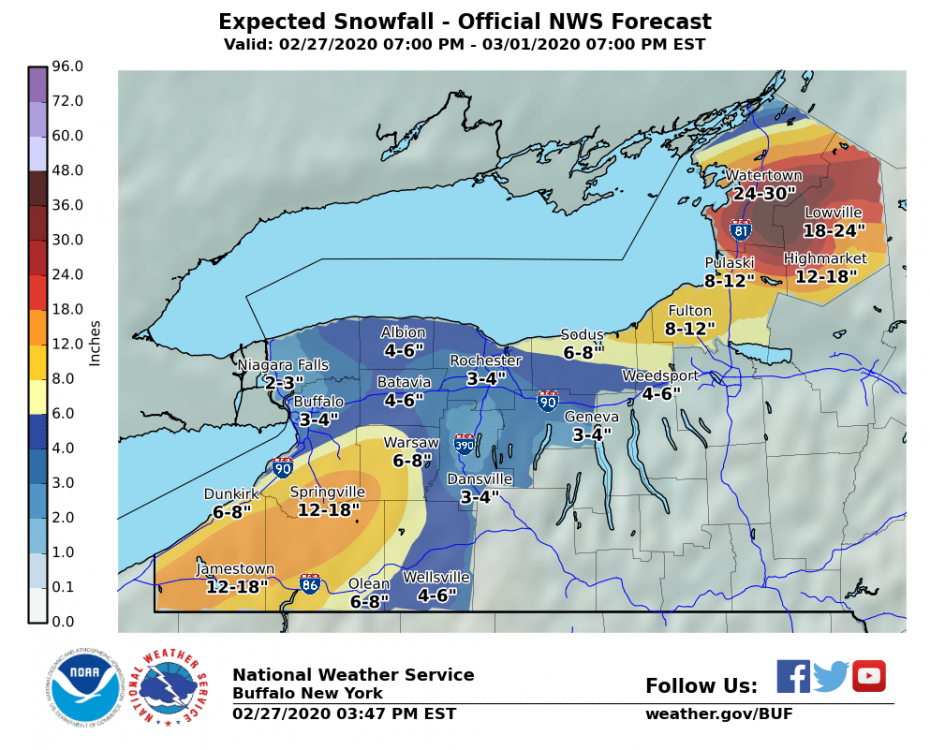
Looks like it flips to heavy wet snow especially Rochester north. This would be measured in feet if it were mid January
-
1 hour ago, wolfie09 said:
30+ hours of a westerly-wsw flow on the gfs, now the tough part, getting it to materialize lol

GFS is pretty aggressive with LES east of Ontario. Pretty much snows all day Wednesday and Thursday. Would likely be much wetter than typical LES
-
1
-
-
Hey guys, excited about another winter. The next weekend storm has bigger implications in my opinion. Maybe some synoptic.. but sets up possible longer duration LES. Of course it’s a long ways off.
-
2
-
-
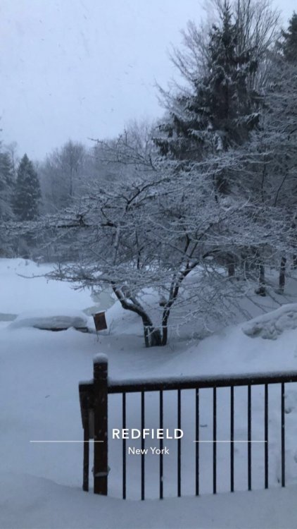
Well one more day here in Redfield. We had 10” yesterday. May ride north a bit today and see what’s happening. Hoping things drop south to give us another 6” at least. Heading out early tomorrow.
-
1
-
-
 From 7pm tonight. Huge shift north and I don’t see me getting another 12-18”
-
1
-
 1
1
-
-
Snow has really picked up again here. Seems like the wind is picking up too. Hope we can hang on to it for awhile. The snow that is.. I could do without the wind.
-
1
-
-
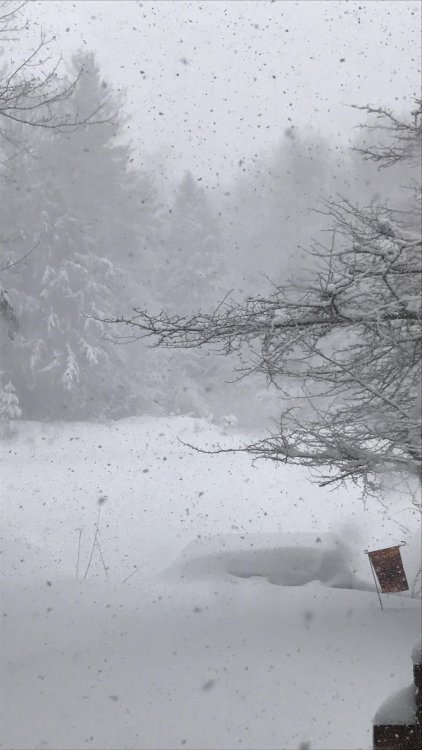
8" so far but snow is light and blowing around at the moment. Someone help me out... what is the best radar to use for up here?
-
Just now, wolfie09 said:
Now it is ripping out..

Yep! 7” and near whiteout here. Wolfie, this band going to camp out here a little while?
Going out to enjoy a bit!
-
3
-
-
1 minute ago, wolfie09 said:
Yup, same here, nice pic!!!
Just had a 36 mph wind gust so starting to see blizzard like conditions..
Just need that wind to hang on for awhile.
-
 Cranking for the moment!
-
8
-
-
Just now, wolfie09 said:
Looks like a single band is starting to fire up .

4” so far in 5 hours. Keep me posted on the wind direction. 12z RGEM was WAY north but still spreads enough around for 12-18”. Come on GFS haha
-
7 minutes ago, wolfie09 said:
Honestly don't think your gonna need a Yard stick lol
It's hard to ignore what guidance is showing..
If they are correct the band stays north of us the entire time until tomorrow afternoon when it quickly sweeps by lol
The best part of this event will probably be till this afternoon with lake Enhancement..
The northern
portion of the Tug Hill on Friday morning looks likely as earlier
model guidance trended a bit north with the band and that scenario
still seems to be favored
Your prediction of Watertown looks legit if models keep trending north. Sad! May not even snow most of the day tomorrow.
-
A little over 2.5” here since the flip. Need that wind direction Wolfie for later!
-
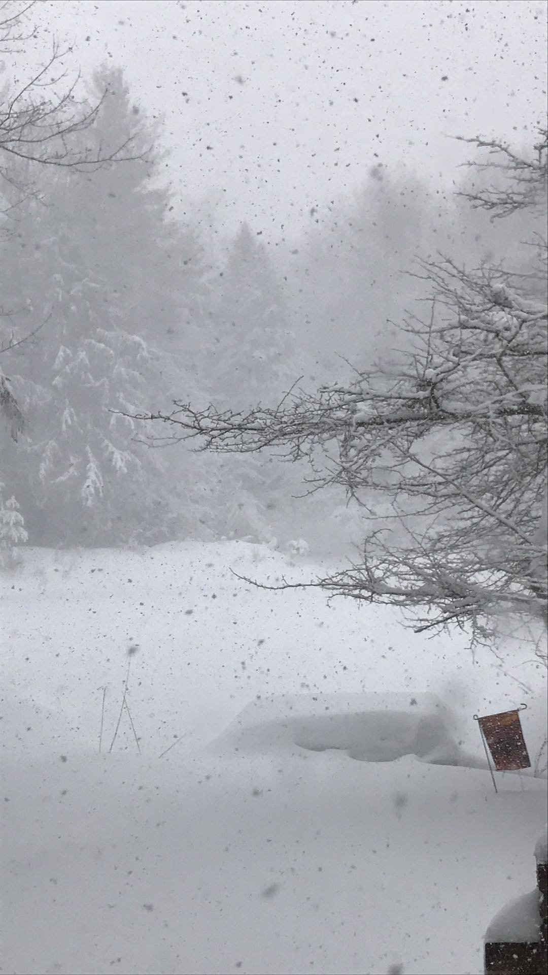
I don’t know about you guys but whether I get 3” or 3’, I could wake up to this every morning. I’m going to enjoy every flake before spring!
-
8
-
-
Here and in place for whatever this thing has in store. Better snowpack than I thought there would be.
-
2
-
-
3.5 hours and I’ll be setting up shop. Just stopped for some dinner. Super foggy in PA!
-
3
-
-
Wolfie - almost every model still gives us 24”+. A lot of the short range models stop at 12z Friday. Best snows for us may still be yet to come Friday. I’m staying optimistic for now haha
-
1
-
-
22 minutes ago, wolfie09 said:
Arw with it's big time southern bias looks good..Push everything north by about 20 miles lol No way the Fulton area has 2 feet by Friday morning lol

I could see this stay north. I’ve been up many times and Carol gets 3’ and I get 6”. Really hope that’s not the case, but always on the table.


Upstate/Eastern New York
in Upstate New York/Pennsylvania
Posted
18z Euro came back west FWIW. Trend?
I wouldn’t give up just yet.