
Diggiebot
-
Posts
160 -
Joined
-
Last visited
Content Type
Profiles
Blogs
Forums
American Weather
Media Demo
Store
Gallery
Posts posted by Diggiebot
-
-
I’m in Dennis on the Cape. We lost power at noon. It’s starting to ramp back up now but it’s been a ground blizzard the entire lull. No idea on totals it’s bare ground or drifts. Wind is gusting the highest of the storm in the hour.
-
 1
1
-
-
Nantucket airport ASOS just had a gust to 64 knots
-
1 minute ago, OceanStWx said:
Zonked is always a NAM worry. But it has some support from the Euro, which makes it more believable.
We saw this with Juno. Zonked to the west near game time then it tickled east. I think we see this end the west shift evening out tonight then it tickles sightly east during game time.
-
1 minute ago, CCHurricane said:
Lost in all of this chaos is Cape Cod no longer being a solid position...gradient between 2 feet and not much looks to be ~25 miles.
We’ve seen lots of shifts with it still being mostly snow excluding the latest NAM but it’s the NAM. I think wait and see the rest of the model runs. Even the furthest west Euro which was very close to the cape kept us all snow. I think If it does go west anymore it’ll be all snow but if we see anymore shift westward it will change over.
-
2 minutes ago, JC-CT said:
Seems like we are somewhere between "Hey wow that's really, really west again," "Okay seriously it can stop now" and "it will tick back east, it always does" depending on the exact location of each poster.
long way to go folks.
Especially with people taking one run as gospel. Haven’t we learned anything this week? It won’t happen exactly as the model shows. It’s about the whole picture.
-
 1
1
-
 1
1
-
-
1 minute ago, moneypitmike said:
Can we name this storm "James"?
This storm is going to hit the Gulf Stream and just explode RIP James
-
2
-
1
-
-
I can’t remember a yo-yo like this before. I’ve seen storms go away and then comeback a day or two later but never this much roller coaster run to run. Hedge east and see what develops? I’m guessing Thursday cycles should give an answer.
-
1 minute ago, Cold Miser said:
Just toss the runs that show solutions that people don't like.
If the NAM were showing a snowy solution people would be all over it.
But it’s not really a solution that makes a lot of sense and it is all over the place run to run so it’s not throwing it out for a unwanted solution. We are tossing because of inconsistency.
-
1
-
-
1 minute ago, DavisStraight said:
Thought he was with NECN?
Sister stations he is with both
-
2
-
-
2 minutes ago, weatherwiz said:
Obviously going to have to factor wind into this somehow (which I will admit I don't have much knowledge on) but 12z NAM bufkit is spitting out some pretty impressive ratios. I wonder have to think under the CCB ratios probably approach 18:1 with snowfall rates 3-4'' per hour...maybe upwards of 5''.
I think you could see some locations pull a foot in only a few hours with this. It happened with Jan 23 2005 with the strongest bands.
-
1
-
-
Just now, Damage In Tolland said:
Except it will be Saturday and the storm will be forecasted much better than 1978 so probably not this scene…….
-
6 minutes ago, Cyclone-68 said:
2-3 feet of snow with hurricane force wind gusts would knock out a lot of power though
No leaves on the trees and the wind prevents sticking if it’s true blizzard. 2005 and 2015 on the cape we had minimal outages. The snow and completely impassable roads would be way more of a problem.
-
2
-
-
7 minutes ago, HIPPYVALLEY said:
It’s a Chiefs - Rams SB.
Chiefs will win. Stafford is soft. He does great in the first half but in crunch time he’s terrible.
-
1
-
-
21 minutes ago, wxsniss said:
What's not to like? Game is still on

Most of the deeper solutions are BM to Ack as well. This is a pretty good place to be this far out!
-
1
-
-
1 hour ago, Heisy said:
This is about as close as it gets without being a direct hit. Still, just more support for event.
.thumb.png.8537abd7018868ce62242d3afd09fd36.png)
Absolute sidewinder. This is Jimmy’s dream storm.
-
If you want a good cup of local coffee that actually tastes good go to snowy owl in Brewster & sandwich. It’s a little expensive but not anymore so than Starbucks and it’s actually good.
-
1
-
-
17 minutes ago, ice1972 said:
The ocean ****s everything up…..
Does North Dakota get 40” in one storm? Ocean giveth and ocean taketh . I’d take the big boy storms over the nickel and dimes any day.
-
2
-
-
Definitely the James Gale. Gulf Stream was cooking right out of the James cook book!
-
1
-
-
4 minutes ago, Hoth said:
Tucky tucky.
Pretty good cluster…..I’d call that a consensus
-
1
-
-
2 minutes ago, MJO812 said:
18z eps

This looks south with the northern Antilles more in the mix
-
-
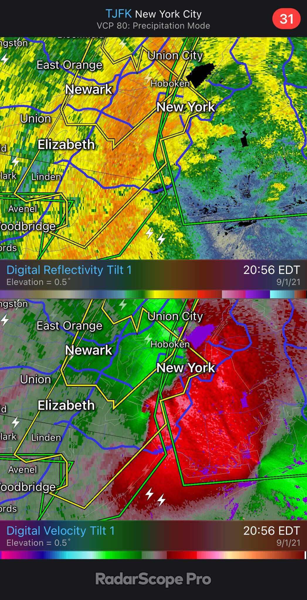
1 minute ago, wxeyeNH said:
Very light rain up here the past 2 hours. Seems like the northern edge (me) might have been overdone. New Euro says 2" for me but I don't see it
18Z Euro precip amounts came down slightly in SNE but still 3 to 4.25" for everyone
Radar is way more important to look at now. I’d guess globals are mostly useless now. Mesos models if anything.
-
1 minute ago, TauntonBlizzard2013 said:
any guesses on strength? Strong EF1 of EF2
Ef3 homes torn apart
-
2 minutes ago, wxeyeNH said:
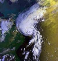
As of 545pm east time I still have not seen any storm chaser video that is showing true high end Cat 3 conditions. I am just comparing some of the Youtube videos of past major storms. Maybe no ones position if directly under the worst of the eyewall. Reed Timmers video in Houma definitely has not shown true near white out conditions as we saw many times with Michael. Ida's radar and satellite presentation is so impressive so chasers must be just missing the inner eyewall.
Have you been watching the web cam and chaser vids? They are all showing cat 4 conditions easily. Not sure what you are looking at. Also I’m sure the worst of this wasn’t even caught on video. Storms this bad make it hard to capture. Video cuts out and communication is lost.
-
7
-

.png.2fd710dc66fe45e2b31ba5b498cad129.png)
OBS/DISCO - The Historic James Blizzard of 2022
in New England
Posted
It’s def picked up here in Dennis. Between the wind and steadier snow it’s complete whiteout here. I think the radar is finally back building some so I think we get a last hurrah here the next few hours.