
Diggiebot
-
Posts
154 -
Joined
-
Last visited
Content Type
Profiles
Blogs
Forums
American Weather
Media Demo
Store
Gallery
Posts posted by Diggiebot
-
-
Lots of power outages on the Cape. The snow has finally stopped. I lost power in Dennis. The wind is still pretty gusty and we have 7-8 inches of paste on all the trees.
-
 4
4
-
-
3 minutes ago, Patrick-02540 said:
Yarmouthport/Dennis at 5-6" so far.
I’m in Dennis too. The power has been flickering for the last hour. It feels like we will lose power soon. The trees are pasted.
-
1
-
-
4 minutes ago, ORH_wxman said:
Cape is getting destroyed. Down to 32F and heavy snow at HYA. Radar looks great for them
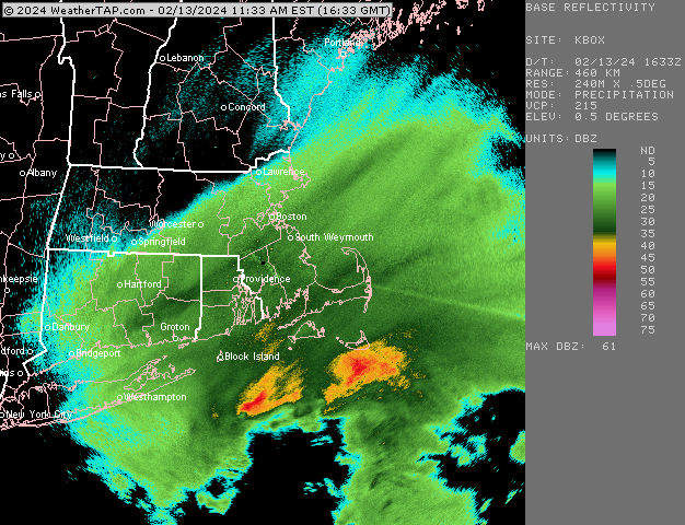
Looks like a mid cape pivot point?
-
13 minutes ago, LibertyBell said:
We can hope for either a 1995-96 or 2010-11 (or combo lol)
Was 1966-67 cold neutral? That would be a nice analog since 1965-66 is getting compared to this winter.
Don’t bet against the streak.
-
31 minutes ago, SouthCoastMA said:
I wish I measured correctly for 1/22/05 though it was pretty difficult. Had between 26-28" depth the next day
Hardest storm measure I’ve experienced 12+ foot drifts mixed with bare ground. Basically a guess in the end on the Cape. I’d say 30-35 was a good bet though.
-
2 minutes ago, WinterWolf said:
None of that is gonna happen here lol..too funny. OKX is a barrier island..last time I looked, none of us in interior SNE live on a barrier island.
Cape cod is a barrier island technically
-
1
-
-
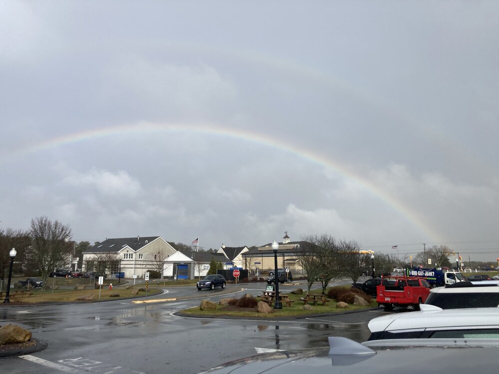
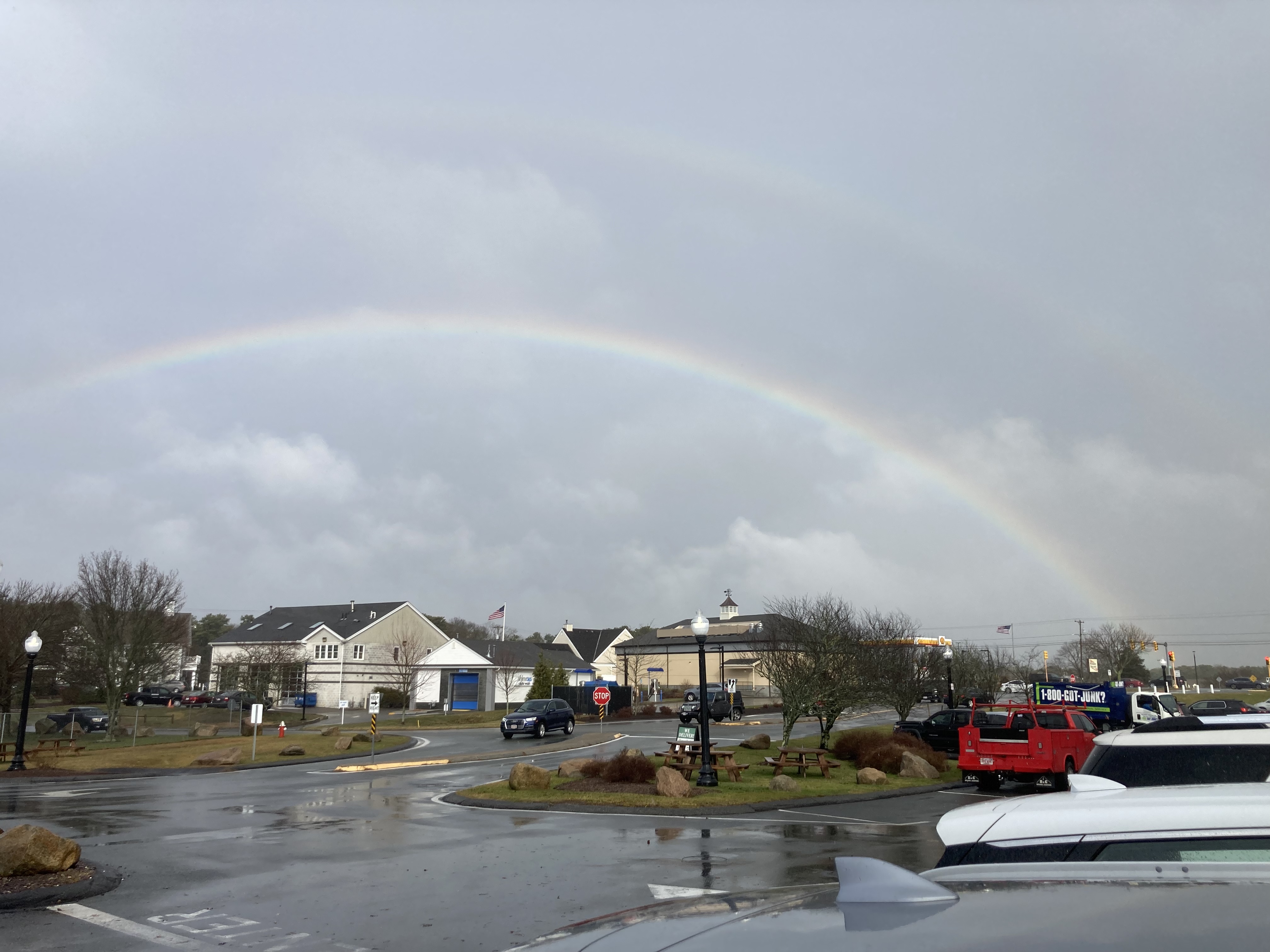
Rainbow in Dennis
-
2
-
-
5 minutes ago, dryslot said:
That would be one hell of a surge too.
Cape cod bay would fill up and magnify that surge sandwich to Brewster wrecked
-
1
-
-
12 minutes ago, Torch Tiger said:
Did it? it's still 200? miles east of Cape Cod

Keep those goal posts moving left!
-
1 hour ago, Childude645 said:
Any one seeing similarities to Bob 91 Track?
.Closer to Edouard in 1996
-
2
-
-
17 minutes ago, dryslot said:
Have at it.
What storm in the last 20 years has looked statistically better at hitting NE than this? It’s still relatively low but I’ll take tracking this. The cards are there but we need a turn and a river to seal it.
-
7 minutes ago, dryslot said:
I'm not talking about Atlantic Canada, They have had there share of tropical and post tropical systems, My money would be on them again for this one right now or the flemish cap, Very few on here was around pre 1960, The obvious answer is post, I'm strictly talking New England.
I just think that it’s pegged too low and that we are basing this on recent history. Not enough sample size. The pieces to a NE hurricane won’t fully reveal themselves until 2-5 before the hurricane passes us. The small pieces and timing are so crucial.
instead of the endless regurgitation of the probability of hurricanes hitting NE is so low how about we actually analyze what is in front of us.
-
12 minutes ago, dryslot said:
10% chance at day 10 is a reach if you follow history in New England.
Which history? Pre 1960’s or post? I think we have been programmed to write off every threat because they keep missing. Just because almost everything minus bob and Gloria has missed over the last 60 years and we haven’t had a major has everyone dismissing any threat. We are 10+ days out with things far from determined.
1 minute ago, dryslot said:I didn't give it a 0% chance, But i will maintain a low bar, That then is where we differ, I may have different thoughts in 2-3 days from now, But overall modeled synoptic patterns are not a lock at this lead even in winter, Subtle changes will have big implications on TS outcomes up here and i will lean on the side off past history until proven otherwise on a LF major hurricane into New England.
Why do you maintain a low bar? Because of the history of storms not hitting here over the last 65 years? What about 1850-1960 when majors had a much shorter return range? How about Atlantic Canada getting multiple hurricanes in the last 20 years what is their return rate over the long term?
-
I remember Matt noyes doing an analysis of all the points a NE hurricane passed through and this storm is hitting them all.
-
7 hours ago, FXWX said:
There's a lot of work to be done before I would be mildly interested in this setup producing any New English issue. Believe it or not, our significant hits actually have a pretty solid footprint for trouble in place by day 10. This one, in my opinion, does not. Still time to change but I'm not a fan of the large-scale layout at this time.
I think this setup looks better than most but it’s still a reach. Most likely a recurve.
-
8 minutes ago, FXWX said:
There's a lot of work to be done before I would be mildly interested in this setup producing any New English issue. Believe it or not, our significant hits actually have a pretty solid footprint for trouble in place by day 10. This one, in my opinion, does not. Still time to change but I'm not a fan of the large-scale layout at this time.
I think any New England hurricane will be sneaky. The large scale setup never looks good for a NE hurricane let’s be real. If we get one it will just happen and shock everyone not on this forum.
-
11 minutes ago, STILL N OF PIKE said:
What is a MH
Major hurricane
-
1 hour ago, Torch Tiger said:
Taake me down to recurve city where the tracks are shit, but the storms are pretty. Oh won't you pleeaasaseeee take me hoommmmeee
At this range please show a miss allllllll day. If it’s hitting on the models at this range it’s always a rug pull.
-
 1
1
-
-
17 minutes ago, WxWatcher007 said:
Doesn't really matter at range because there's a lot to sort out, but the 12z Euro continued the overall trend of a more westward 90L. 00z had it basically around Bermuda. We'll see what the ensembles do.

And on that euro run to add to the uncertainties another TC forming by the keys and heading north! Wow
-
Just got the tornado warning for cape cod on my phone!
-
1
-
-
15 storms 7 hurricanes 3 majors
-
1 minute ago, MJO812 said:
Wow ukie
Do tell or show please and thank you
-
8 minutes ago, weathafella said:
12/9/05
Yeah but that had epic winds that overshadowed the snow especially on the cape
-
Close the shades this is brutal. We had seasons of SNE specials now it’s time to pay the pieper. I just wish the models wouldn’t tease so much then pull the rug.
Severe Weather 4-25 through 4-28-24
in Central/Western States
Posted
How do you survey multiple tornadoes through the same location? Wild stuff!
edit: Large tornadoes through the same place. Def a case study for the future