

mckinnonwg
-
Posts
150 -
Joined
-
Last visited
Content Type
Profiles
Blogs
Forums
American Weather
Media Demo
Store
Gallery
Posts posted by mckinnonwg
-
-
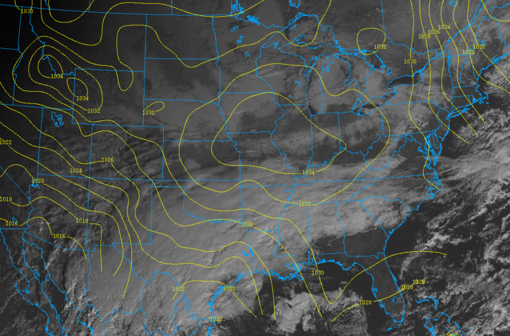
Soil temps tonight:

That’s a good map-mind asking where you found?
.-
 1
1
-
-
NAM decided to back off for the west georgia region on the 18z.
. -
Praying for some shifting for west Georgia chances LOL
-
Just now, BornAgain13 said:
So the GFS/ICON/CMC seem to be more Amped. While the UK/EURO are less amped, with just light amounts.
Sounds about right considering how many days away we are from the event.
-
5 minutes ago, Orangeburgwx said:
My current DP is dead freezing... Right at 32
This was the 10z analysis so I definitely expect slight variations but that is solid.
-
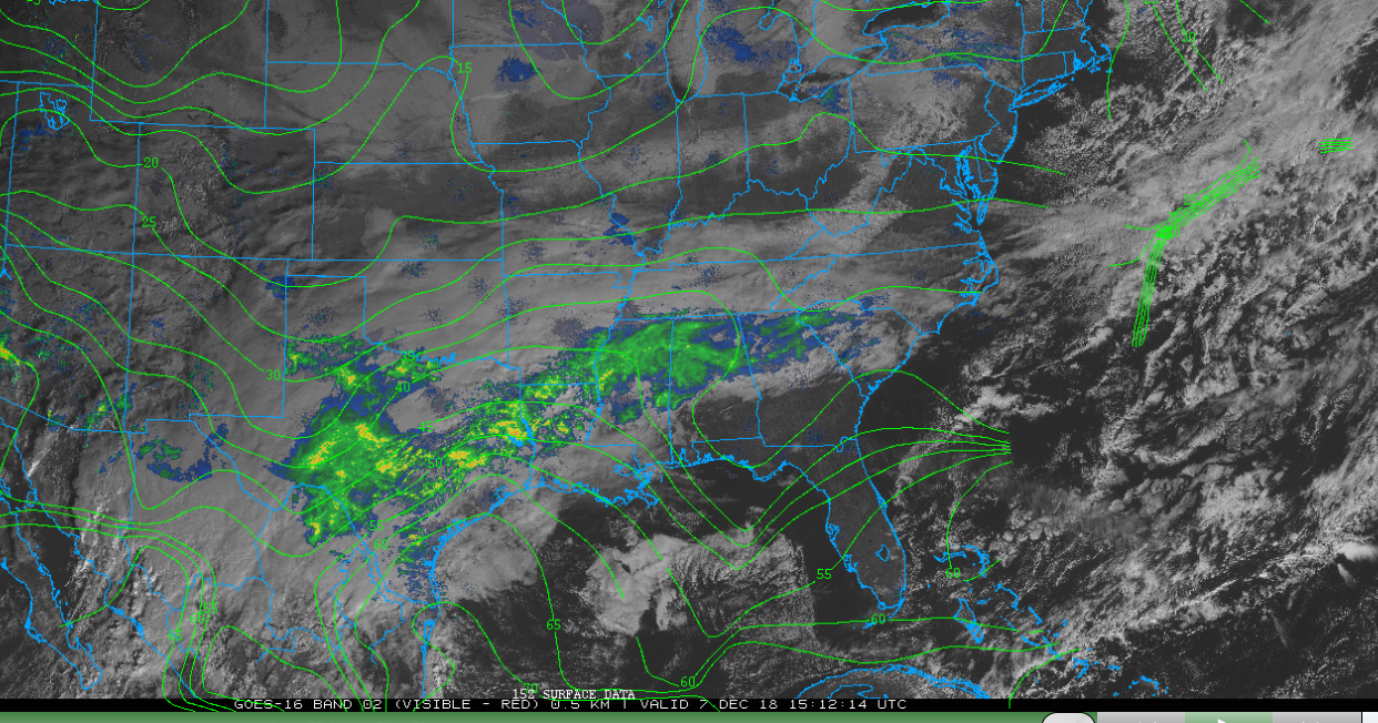
The dew point analysis map is digging much deeper than the HRRR model is showing. The HRRR model showed the 35 line a bit further back into Georgia but the analysis shows it stretched all the way down into the panhandle. That is strong wedge IMO.

-
1 minute ago, Hammer said:
Most have been quiet here in Cherokee County GA about this - indicating just rain. But the FV3 seems to show accumulations in the area. And I just saw a forecast map from a poster (AshvilleWX) here with up to 2”
What am I missing? Am I just being hopeful?
. Pro
I think they are expecting more of the 850 temps to cancel out. We are still a good bit away from the actual event so the model observations occurring can still play a major role. We just need to be mindful we are on the borderline and certain placements ahead of time to the north or south can shift something greatly in the longterm.
-
 1
1
-
-
4 minutes ago, Orangeburgwx said:
That good for us?
Not 100% sure honestly...but the forward lean might lead to more cold getting out in front of the main rain. Which is why folks are already reporting certain conditions. The high is going to pull it down into the moisture. Also, vorticity has increased in the 500 level where the cold is coming from more than what was forecasted. The low will continue to push in...its' the cold air we all need.
-
Looking at analysis data, it looks like the current HP is not as stretched out and has a forward lean (east) than what the 12z NAM forecasted.
.png.1bae1230ed0478ce9e17b67713e6135e.png)
-
4 minutes ago, eyewall said:
The storm has busted so far in the Southern Plains.
Busted as in not as much precip totals....more south, more north...etc.
-
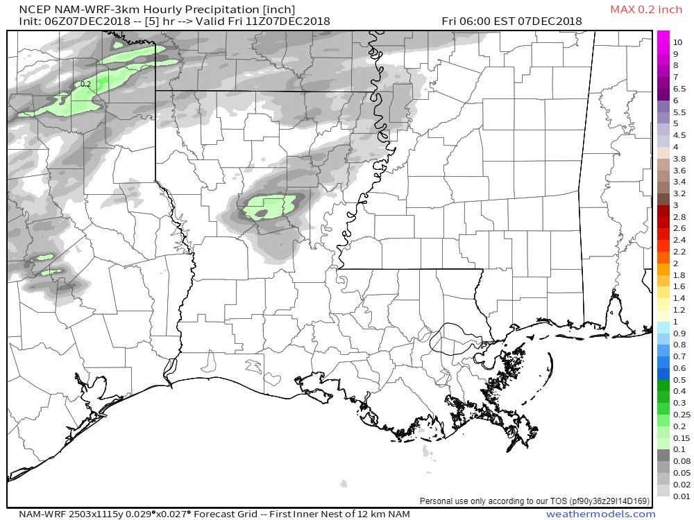
Also, long range HRRR is coming into play and showing A LOT OF RAIN. How is the performance of this outside the 18 hour window?
-
Is it my eyes or is the 12z NAM exiting the low a bit quicker? Not as much suppression and time for heavy accumulation?
-
11 minutes ago, CADEffect said:
Another quick question at this point in the game do you start looking at the precipitation field more in short term models are continue to watch the op models?
personally, I focus on the short term at this point.
-
 1
1
-
-
1 minute ago, CADEffect said:
No sir, I have not. Would it be different then what the overall model predicts?
It's possible based on the algorithms used to define the contours. The soundings will give you the exact dew temp at climbing levels and may show you something different. But maybe not. Just one method of verification.
-
1 minute ago, CADEffect said:
Guys, perhaps you all could help me out. I’m trying to understand I’m in the upstate S.C. area. Pivotal has a crippling freezing rain event on its NAM ICE accumulation algorithm. When I checked the NAM 850 across most if not all the area it’s above freezing. I even checked the 2m temps and it was above freezing. It still had a ice storm. I didn’t bother checking the upper levels after seeing both levels above freezing. Please help me understand what am I missing?
Have you viewed the soundings?
-
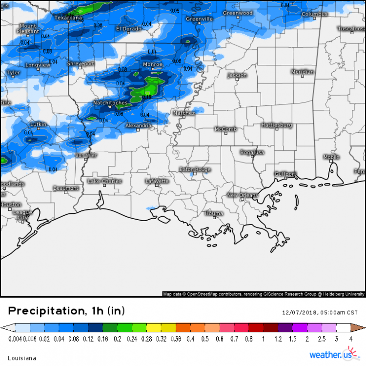
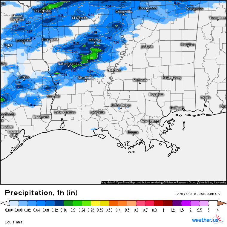
NAM6z did pretty well with Precip Totals thus far
NAM
Verified
-
Just now, Nraleigh said:
I agree. However, the proof is how it compares to reality. It is either going to look great and rival the Euro for future storms or be viewed as a joke that was nothing more than a consistent joke.
This storm is a major test for that exact reason. Personally, hope it verifies. Maybe some of the extra money we spend on the EURO can be back in our pocket.
-
1 minute ago, Brick Tamland said:
The model runs continue to look fantastic. Great to see them stay consistent or get even better the closer we get.
I have been very impressed with the FV3. I know it has had data issues, but the consistency and the range were impressive. If it continues with this streak and does end up verifying, well-spent govt money IMO.
-
1
-
-
1 minute ago, Poimen said:
All the snow maps at www.weathernerds.org are supposed to use the Kuchera method. It's a cool site that I didn't know about until earlier this week.
Here is the 6Z FV 3 and the 0Z Canadian.


I found out about the site last week as well. Not as user-friendly as some of the larger sites but for a stand-alone site, it does pretty dang well. Love how you can plot specific points and I prefer some of their contour maps over others.
-
1
-
-
5 minutes ago, beanskip said:
Would love to see the Kuchera map. Also — is there a public site for those?

-
1
-
-
16 minutes ago, Rankin5150 said:
With this being so close to the start of the Winter Storm tomorrow, I feel we need to remember to not lose sight of looking at Radar Trends. They can tell a lot. For example, look at the expansiveness of the moisture. WOW! Someone is MOST DEFINITELY GOING TO GET CLOCKED!
http://www.intellicast.com/National/Radar/Current.aspx?animate=true
i KNOW this is Intellicast Radar, but I am posting this for the ease of viewing, to help any newbies, etc.
Here is base reflectivity as well
-
1
-
-
3 minutes ago, Nick Esasky said:
Haven't seen much discussion of N GA based on the overnight runs. Is ATL pretty much out of the woods as far as significant ice? I'm guessing maybe a dusting on Monday on the back end might happen, but nothing more?
I think we are going to see mostly rain and maybe a slight possibility like you are saying on the back end of the event. Models have been very consistent regarding the wedge from the NE. The 850 tropical temps are going to keep it an all rain event for ATL. The NE portion of GA is where the action will occur and that is even being discussed as minimal impacts. The area we need to monitor will be early monday morning to monday night. That time frame is still uncertain with the short range models just now bringing it into frame.
-
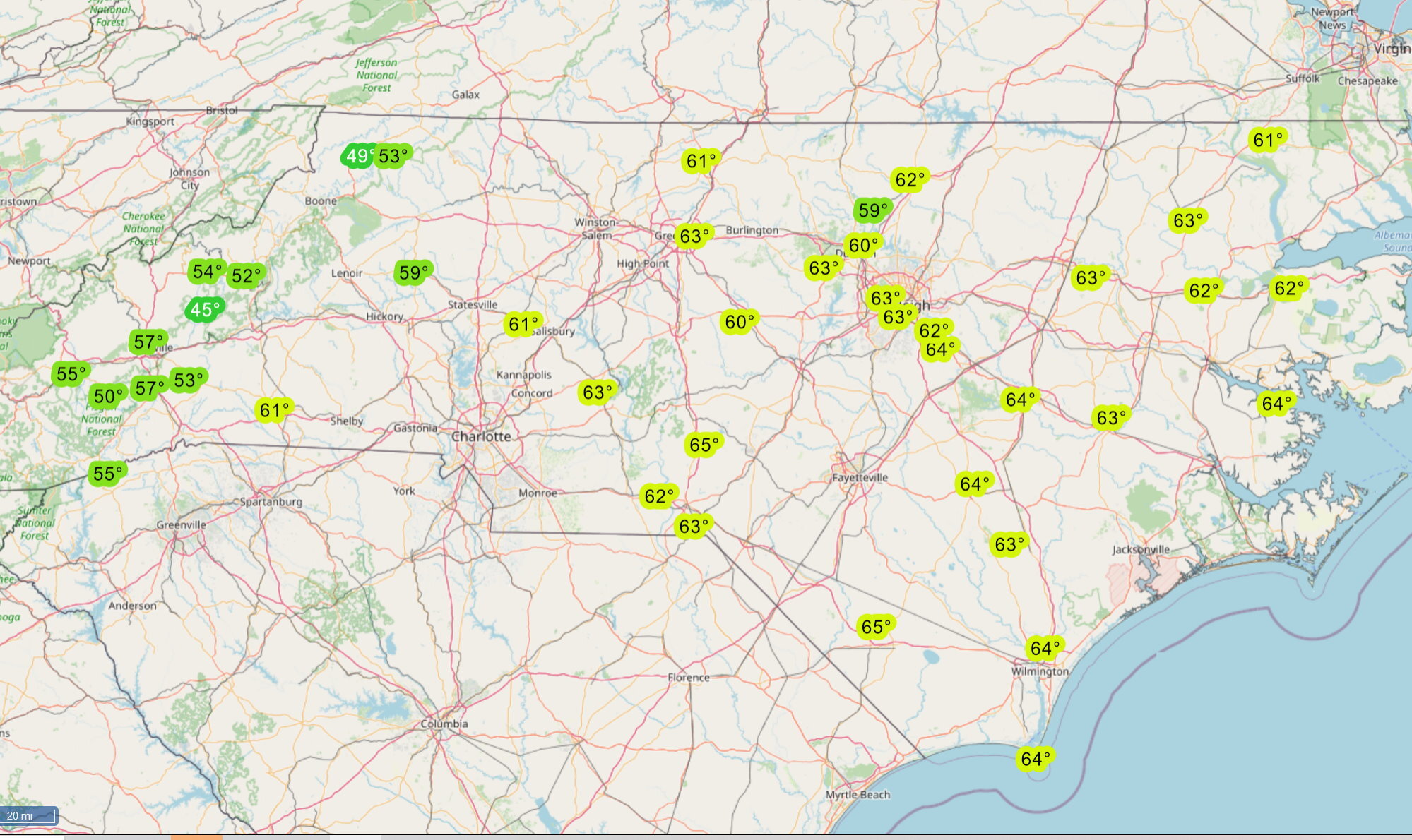
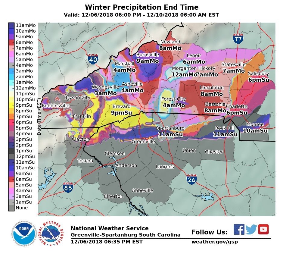
NWS really outdid themselves with this map:
what in the actual H***

-
2
-
-


January 3rd wet snow potential
in Southeastern States
Posted
Thanks, can’t seem to find one decent for georgia
.