

CTWeatherFreak
-
Posts
1,105 -
Joined
-
Last visited
Content Type
Profiles
Blogs
Forums
American Weather
Media Demo
Store
Gallery
Posts posted by CTWeatherFreak
-
-
It's a little unsettling that Uncle hasnt budged.
-
 1
1
-
-
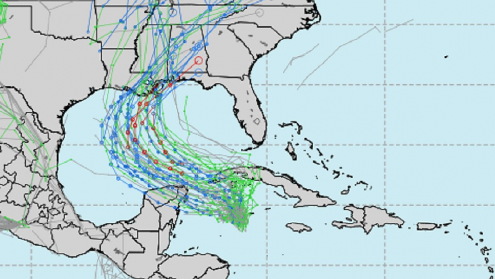
Madison, Fl getting crushed right now in northern eye wall
-
TWC has a live camera in Perry. Looks like the end of days there
-
Still cat 2 at 11pm . 958
-
15 minutes ago, Damage In Tolland said:
Yeah a bit less nipple . Nod towards others . Gives even more confidence now
Needs a bit more cowbell
-
 1
1
-
-
1 minute ago, CoastalWx said:
I think there is a shadow (in terms of lighter snowfall amounts due to boundary layer), but the key is to avoid the inv trough look and get this to consolidate into more of a classic nor'easter. Some guidance has tried to do that, but not sure we will ever get there.
Does this mechanism have to do with that meso low which had been shown earlier but less prominent or not at all with 12z runs?
-
30 minutes ago, CoastalWx said:
I'll take Canadian look.
What happened to that giant FU valley shadow in Ct the canadian models (and others) had been prominently showing? What feature of the forecast storm development changed to basically wipe it away on the 12z run(s)?
-
28 minutes ago, EastonSN+ said:

UGH. Rain for almost everybody east of the CT river. Could it be focusing on the wrong low in that couplet?
-
 2
2
-
-
2 minutes ago, RUNNAWAYICEBERG said:
Fear the east ticks.
More snow, Less rain
-
23 minutes ago, weathafella said:
One thing is clear...this winter turned on a dime over the past week.
Who says SSWEs don't work
-
22 minutes ago, PhineasC said:
Is being bad at depicting likely outcomes considered a bug? LOL
No, its a feature.
-
12 minutes ago, JC-CT said:
Stage left is our right
From the actors' perspective
-
9 minutes ago, DTWXRISK said:
doesnt suck dick
Weekend Rule?
-
2 minutes ago, WinterWolf said:
More like an I84 jack right through the heart of CT.
That's how we know it's not happening
-
22 minutes ago, The 4 Seasons said:
Kuchera crackhead fix


Connecticut valley Jack? Yeah, right
-
1
-
-
5 hours ago, NavarreDon said:
Hello!
Central Gulf yet again?? I left noreaster territory in the hopes of nabbing a cane or two. This is definitely not my year.
-
1
-
-
14 minutes ago, Ginx snewx said:
75 mph in Eastham Ma
Wow Truro
...Barnstable County...
   Truro                   80   350 PM  2/07  CWOP
-
1
-
-
-
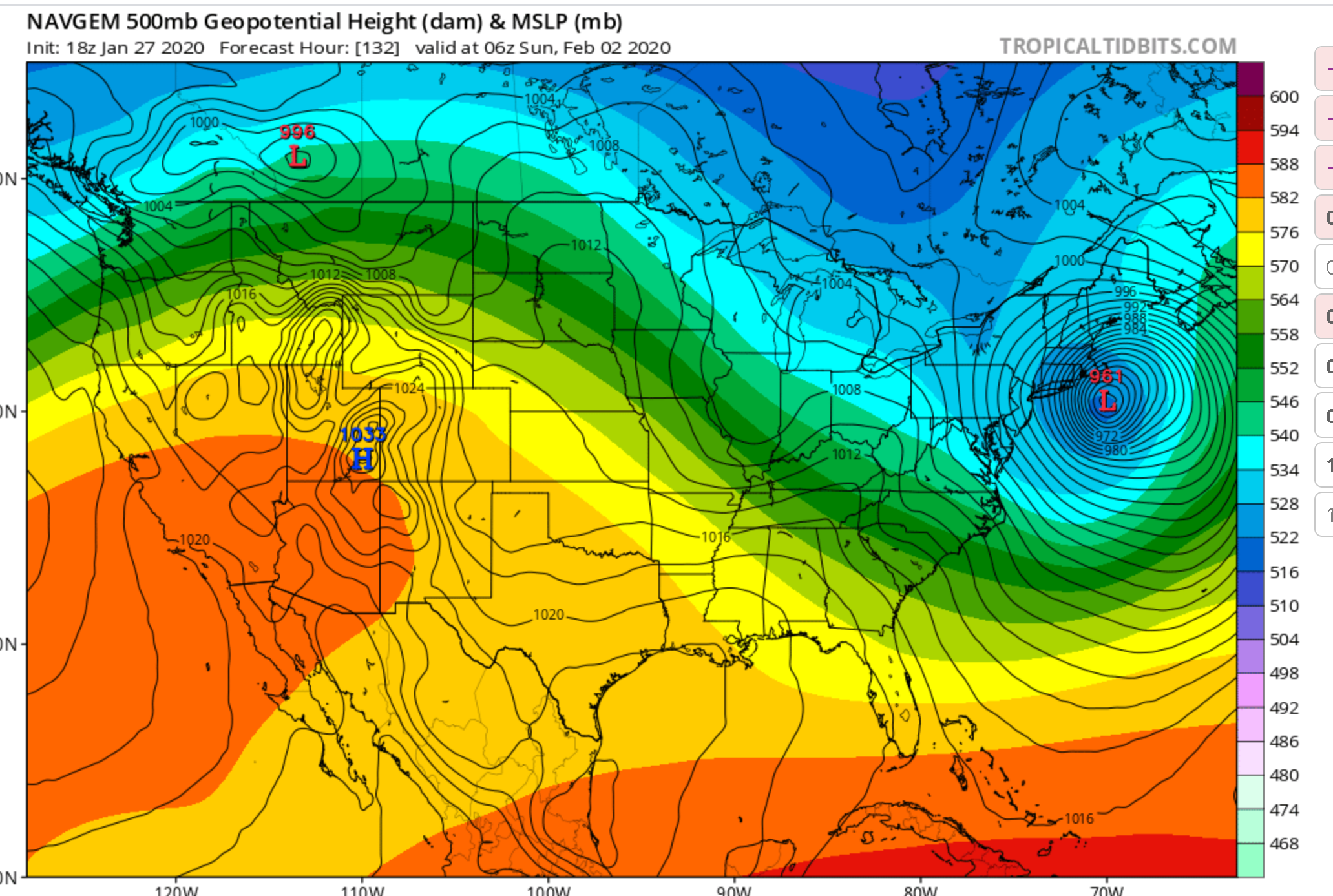
1 minute ago, The 4 Seasons said:
I'm actually surprised its not 40mb weaker and supressed and shunted to the SE..
Not like the NAVGEM
YUP. Big red flag for a progressive model to be so amped.
-
1
-
-
Holy Monkey Balls.. Southern New England special. 954 on the benchmark.. If Only..

-
1
-
 1
1
-
-
Icon a Major hit.
-
1
-
-
Box's bullish afternoon AFD is belied by the 18z GFS which followed it.
-
Transitioned over to predominantly snow now. 33/32
-
about 2.5" here


Following a Miller A/B hybrid type coastal potential, Feb 13th ... As yet untapped potential and a higher ceiling with this one
in New England
Posted
Any chance of blizzard warnings for the Cape?