
HO1088
-
Posts
106 -
Joined
-
Last visited
Content Type
Profiles
Blogs
Forums
American Weather
Media Demo
Store
Gallery
Posts posted by HO1088
-
-
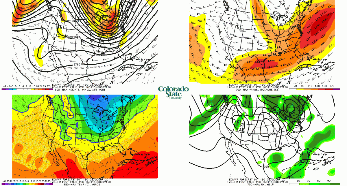
The most recent ECMWF (these panels are for Tuesday at 7 p.m.) show a pretty good setup for decent lake effect in the eastern Cleveland suburbs.
-
There must be a good chance for decent lake effect next week? 850 temps get down to about -20 C for a few days while the polar vortex dips down and gets stuck in Quebec. Surely the wind has to be NW at least some of the time with that synoptic setup?
-
The medium range models show a potential lake effect setup after the New Year with a NW flow and 850 hPa temperatures colder than -10 C for couple days. An upper-level ridge builds along the West Coast which is a change.
-
Global warming 'hiatus' puts climate change scientists on the spotTheories as to why Earth's average surface temperature hasn't risen in recent years include an idea that the Pacific Ocean goes through decades-long cycles of absorbing heat.
http://www.latimes.com/science/sciencenow/la-sci-sn-global-warming-hiatus-20150226-story.html
-
02/23/15

-
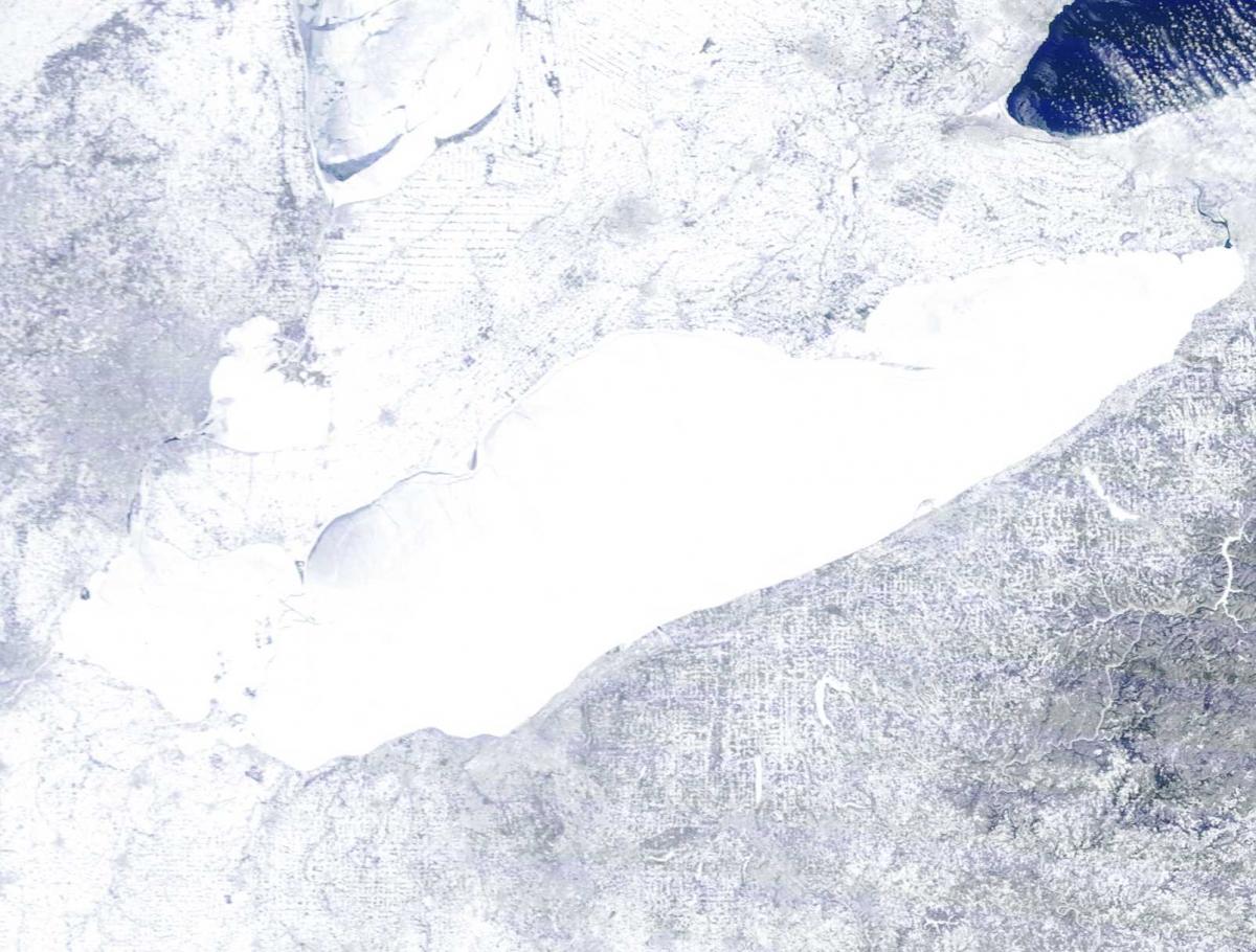
Nice pictures from a Coast Guard Ice Breaker on Lake Erie courtesy of The Plain Dealer:
http://www.cleveland.com/metro/index.ssf/2015/02/coast_guard_cutter_neah_bay_br.html#incart_river
-
Holy crap. A PNS in Ashtabula County is reporting -39, which would tie the all-time state record. Obviously, I can't vouch for its precision but still... The two closest PNS's are reporting -29 and -30, so it's definitely in the ballpark.
I got in touch with the owner of this station. He says he has two stations although only one is setup on the internet. During windy conditions the overnight temperatures are the same, during calm conditions the lower station reads 1-3°F lower. That sounds reasonable. The stations are located at the Grand River Jersey Farm in Rome.
Perhaps the reading can be certificated as "official" at some point?
-
Holy crap. A PNS in Ashtabula County is reporting -39, which would tie the all-time state record. Obviously, I can't vouch for its precision but still... The two closest PNS's are reporting -29 and -30, so it's definitely in the ballpark.
The weather station you pointed out had a low of -38.7°F reported on Weather Underground. It's in Rome, OH and it's a Davis Vantage Pro.
http://www.findu.com/cgi-bin/wxpage.cgi?call=DW3607&last=72
The temperature readings seem accurate, although the barometer is not.
-
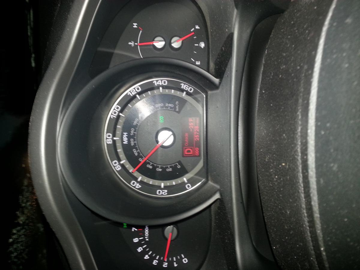
-19 F at home this morning. I took a drive across Geauga to Chardon around 6:30 a.m. to see if the Weather Underground temps were reasonable. Temperature was a function of elevation, -13 F at the highest spot east of Alpine ski area on Rt 322 in Munson to -25 F in Russell on Rt 87 just west of the West Woods (the lowest part of my journey). My car thermometer has always been very accurate and I went fast to keep the sensor aspirated.
-
The 850 mB temperatures for CLE tonight are -28 C for the GFS and -29 C for the NAM. That's a bit colder than a few nights ago. Will it be even colder tonight?
-
CLE's total is absurd. You would have to think they will revise their total. Right around 7"' here. That band on the southwest side has been parked for a long time. Probably approaching double digits there. ice cover is hurting the east side right now.... Not sure the Huron band will connect to Erie.
Is the wind blowing the snow at CLE causing the low totals?

Northern Ohio Obs/Discussion Part 2
in Lakes/Ohio Valley
Posted
Today's 12 Z GFS shows the 850 mB winds Tuesday night and Wednesday 280-290 degrees. Southern Lake and northern Geauga (Chesterland and north) would do good with that.