

Maxwell03
-
Posts
234 -
Joined
-
Last visited
Content Type
Profiles
Blogs
Forums
American Weather
Media Demo
Store
Gallery
Posts posted by Maxwell03
-
-
Yeah so, am I truly the only one noticing/weirded out by this persistent sky glow/inversion/trapped light pollution pattern of recent weeks? Can anyone else back me up here? I keep consulting people in knowledgeable circles and people just ask me to get my health checked out. I’m not crazy and I do think I’m noticing an anomaly. In fact I think it had a big role in amplifying our fog today.
-
 1
1
-
-
9 in S Jers...cuts you up like a knife
-
 1
1
-
-
37 minutes ago, BBasile said:
Sleet and cloud to ground lightning. Wasn't expecting this.
No bolts but several loud bangs with mixed hail* and rain at my house. Great stuff
0.72” in the gauge this morning.
-
Am I crazy or has the late night sky registered as a brighter, bluer color recently? Almost an early twilight color? Maybe there's a simple explanation like an inversion or maybe it's a natural hue of the night sky but my brain keeps interpreting it as unfamiliar.
-
Not unusual for a cold season warm-up preceding a frontal passage. It is unusual to throw a tropical system into the mix.
-
1
-
-
56 minutes ago, Normandy said:
Not gonna lie looks much better than I thought it would this early. Curiously watching today to see how it unfolds, these WSW moving storms can have interesting results intensity wise.
Yeah agreed, it doesn’t look half bad for a TC in November.
-
0.44" from last night's storms, un-sarcastically a ton of fun driving in them. Now here comes the cold.
-
I'm convinced this storm doesn't run out of moisture
-
1
-
-
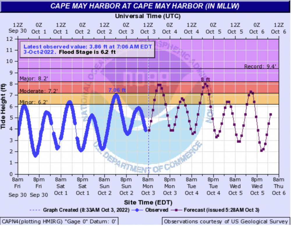
More heavy rain headed for Ocean County -- just in time for the 2:30 high tide.
-
2
-
-
Persistent onshore flow is no joke. I think water may approach our house in Wildwood on Tuesday, which to my knowledge has only flooded in big events.
-
This storm delivered some of the most jarring footage in years. Reporters and lay persons always come off prone to hyperbole in these situations but there is no embellishing what we saw today. This was the real deal.
-
1
-
-
15 minutes ago, WishingForWarmWeather said:
This gif on Twitter was too incredible not to share in here with you all.
The way it just seamlessly passes over Cuba as if it's not even there
-
23 minutes ago, NorthHillsWx said:
Couldn’t agree more. A sharp angle of approach, a major city, uncertain intensity at Landfall, and a major hurricane sitting a stones throw off the beach. The destructive potential is extremely high but the bust potential especially in the public eye is as high as it gets. Glad I’m not making those decisions
Yeah it is very delicate given the night and day difference from small deviations in tracks. A mildly aggressive approach seems the most prudent? Post evacuation orders for the most vulnerable? Always better safe than sorry.
-
It does look very Sandy-esque on satellite
-
Just now, Sandstorm94 said:
You think that is a good thing? Who here is gonna tell him

Sent from my SM-S102DL using Tapatalk
The I storm curse, yeah I know. I just really disliked the name Hermine.
-
2 minutes ago, MattPetrulli said:
TD10 has been given the name Hermine. TD 9 will be Ian.
Phew
-
5
-
 2
2
-
-
37 minutes ago, dan11295 said:
Back 15-20 years ago, Canada never issued Hurricane or Tropical Storm warnings, just general rain/wind warnings. I assume because most storms affecting Canada were either close to or already post-tropical at the time of impact. After Hurricane Juan in 2003 (which was clearly tropical at landfall) they starting issuing Hurricane/TS warnings. When the NHC overhauled their warning system for transitioning systems in the U.S. following the Sandy debacle, Canada has starting following the NHC lead to also issue warnings for similar transitioning systems.
Yes, I knew that. I don’t know if they’ve used the watches/warnings for Labrador yet though.
-
I knew operationally there were watch/warning breakpoints on the Labrador coast, but I never expected to see them actually used.
-
This rotten spinner in the subtropical Atlantic is going to steal the name Gaston and we're gonna have to deal with a land bound storm named .... Hermine

-
1
-
-
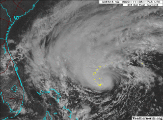
Yeah it emerged practically unscathed and ready to blow. I thought there would be a bigger hiccup in intensity. An ominous look to it this afternoon.
-
34 minutes ago, Normandy said:
Its an interesting question..."Do I want to see people's lives ruined". If you ask me that on its face, then the answer is no. But I do want to see a hurricane hit land so I can see videos like:
https://www.youtube.com/watch?v=Ar8Usv-Kwvs
on a fundamental level, that is a video of people's lives getting ruined.....and I enjoy watching it. If you say you don't.....I would say you are being disingenuous. So I posit the question back to you: Do you want to see people's lives ruined?
Bro get help
-
1.29" for the event
-
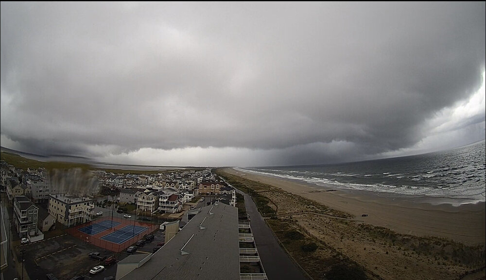
Can’t find any pictures online yet but did get this nifty little capture from the live cam atop the Spinnaker in Sea Isle
-
3
-
-
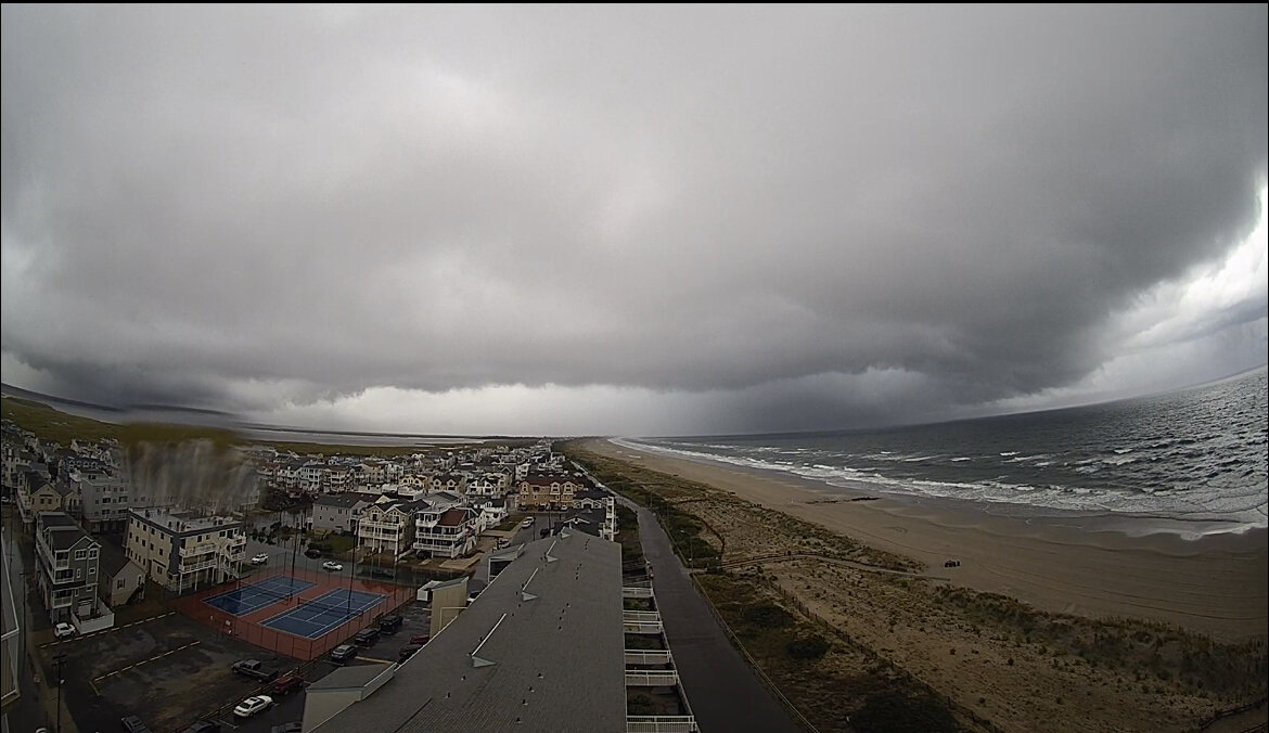
Tornado warned cell near Sea Isle City
-
1
-
1
-

Philly Area Banter
in Philadelphia Region
Posted
Spent the weekend in Quebec, thought you guys might enjoy a refresher of what winter looks like: