

Tullioz
-
Posts
2,367 -
Joined
-
Last visited
Content Type
Profiles
Blogs
Forums
American Weather
Media Demo
Store
Gallery
Posts posted by Tullioz
-
-
Rain snow mix
36.1/35.8-
 1
1
-
-
14.0 degrees this morning at my location, which was the coldest temperature I have recorded in 2023. The coldest temperature prior to this morning was 19.8 on February 4th.
-
BWI: 28.6"
DCA: 24.4"
IAD: 27.6"
RIC: 14.7"
Tiebreaker: SBY: 11.9"
-
1
-
-
Had a morning low of 20.8 in my backyard just NW of Eden. Shiloh Airport (KSIF) in Rockingham County also recorded a low of 21.
-
Sleet snow mix at my location just west of Eden with a nice coating so far. The temperature is a bit colder than I expected it to be this morning. Currently 31.1/ 30.3
-
1
-
 1
1
-
-
5 hours ago, landof2rivers said:
The temp at my home hasn’t moved from 51 all day but I see online temps for here are 48.
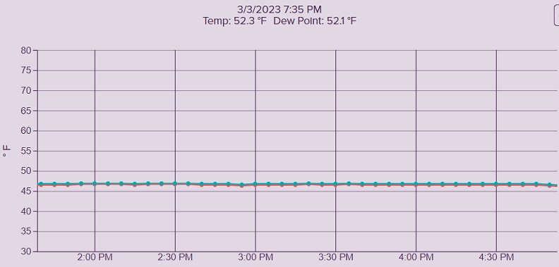
The temperature at my location just west of Eden hovered around 46.5 all afternoon and only started to rise around 6pm. Currently I'm at 52.3.
-
Light sleet just west of Eden. 46.7/29.6
-
18Z Euro was an improvement over recent runs for the northern piedmont of NC.
-
5
-
-
I've had a steady light snow for a little over two hours now. Within the past 15 minutes or so the intensity has increased quite a bit, but so far there has been no accumulation, not even in the grassy areas due to the temperature being well above freezing. Currently I'm at 36.9/27.6.
-
2
-
-
Light snow in Eden. 38.1/28.8
-
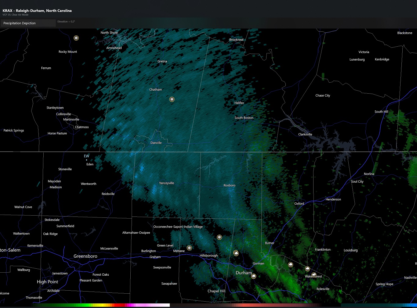
Starting to see some mPing reports of snow in central NC.
-
On 12/16/2022 at 3:59 PM, Carvers Gap said:
The one I am thinking of is a line graph w/ time as the x-axis and model verification as the y-axis. One model is represented w/ triangle points, another squares, and so on.....I am heading out the door or would dig a bit more.
If you haven't found it already, I think this might be what you're looking for:
https://www.emc.ncep.noaa.gov/users/verification/global/gfs/ops/grid2grid_all_models/acc/
-
1
-
2
-
-
31 minutes ago, GaWx said:
For a wx history lover like me, the highest Montana/N Wyoming SLP next Thursday will be fun to track.
This is something I have been watching as closely as the possibility of Wintry precipitation late next week. December 24/25, 1983 is an experience I would love to repeat as it's a top 5 weather event for me despite the lack of any precipitation.
At 12:00am Dec. 24th the temperature at my location in Eden, NC was 34; at 8am it was 23; by Noon 15; and by 5pm the temperature had fallen to +4. At 11:45pm I recorded a low of -1 for the day. Along with the falling temperatures were winds of 25 to 35mph with higher gusts at times. In my journal I recorded that we had wind chill temperatures of -25 to -35 during the day, but that was using the old scale.
Christmas Day I recorded a high of 14 and a low of -4 with sunny skies.
In my entry for Dec. 26th I recorded a high of 22 after a low of +2. I mentioned sleet and freezing rain on the evening of the 27th with a high of 29 after a morning low of 18. After a "mild" high of 34 on the 28th, the 29th saw repeat of falling temperatures during the day going from 34 at midnight, to 19 by 5pm. December 30th saw a high of 23 after a morning low of +6.
-
3
-
1
-
-
BWI: 22.5
DCA: 18.3
IAD: 21.5
RIC: 13.8
SBY: 8.8
-
1
-
-
Recorded a wind gust of 47mph at 5:05pm. Haven't had power since around the same time.
-
15 hours ago, landof2rivers said:
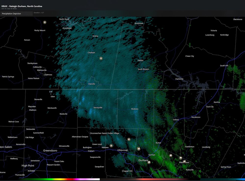
Tullioz, Did you ever get any rain? Like you, I was under warnings for awhile and had dark clouds and lightning, but absolutely no rain. It’s crazy to watch radar to see storms heading this way from mainly the N/NW and they split just north of Eden and then regroup south of Eden.
Just .03". Watching radar I thought for sure we would see some decent rain, but like you I watched the storms split only to reform to the south and east.
-
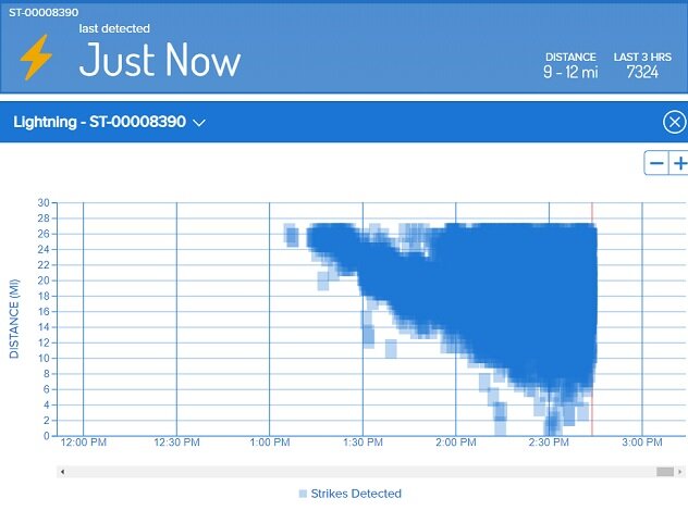
Crazy amount of lightning with the storms to my north and west.
-
There was enough hail (mostly pea to penny size) to cover the ground in some spots today in Eden . After multiple thunderstorms and showers moved through the area beginning in the late afternoon, I've measured 1.33" of rain through 10pm.
-
3
-
-
Moderate snow with gusty winds just northwest of Eden. 32.2/19.6
-
1
-
-
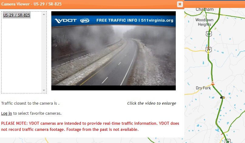
26 minutes ago, BornAgain13 said:
Absolutely puking snow here. Temp 33
Checking a nearby traffic cam it looks like a light dusting along Hwy 29 up that way.
-
1
-
-
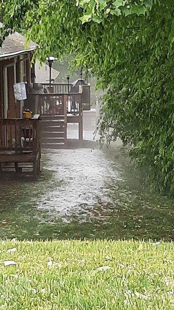
35.2/33.5 with a rain snow mix just NW of Eden.
-
1 hour ago, Sandstorm94 said:
In case anyone is wondering....

Sent from my SM-S115DL using Tapatalk
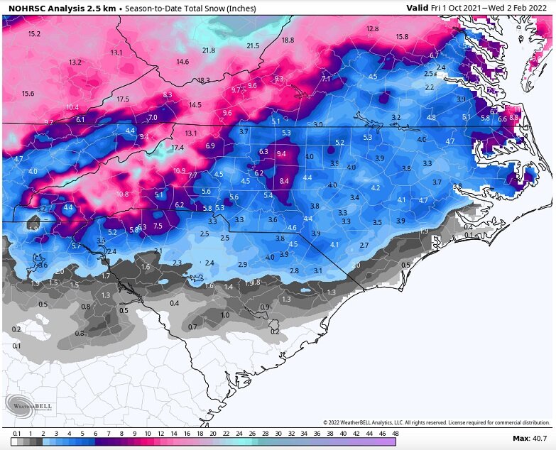
21 minutes ago, WinstonSalemArlington said:Must not count sleet. GSO is reporting 8.2” for the season
That map is off for sure. For some reason the season to date totals are higher when you use February 2nd as the end date.
-
26 minutes ago, BornAgain13 said:
Fact is, here, we have already exceeded our average snow for an entire winter. We have between 9-10" total so far. The average is somewhere around 6-7". I hope we get more and I believe we will, but if we didn't, it wouldn't be a bad winter here.
Deleted comment. I was looking at the wrong chart.
-
22 minutes ago, landof2rivers said:
Lol nothing here but rain next to the Dan off of 14 as you come into Eden from the south. My unscientific thermometer says 37.
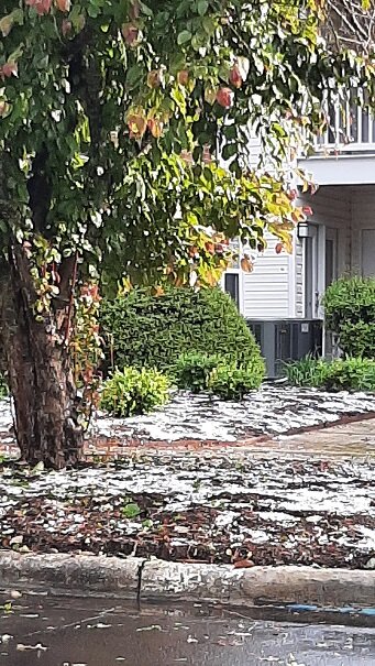
I'm right at 700ft above sea level compared to 500ft along the river, so maybe the extra elevation helps at my location. Starting to see some slushy accumulation in the grass and on top of elevated surfaces now. Temp has dropped to 32.3.
December 2023 Obs
in Southeastern States
Posted
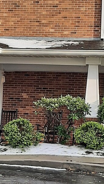
Precipitation never went over to all snow, but there was enough mixed in to leave a little slush on my trash can lid.