

mryanwilkes
-
Posts
53 -
Joined
-
Last visited
Content Type
Profiles
Blogs
Forums
American Weather
Media Demo
Store
Gallery
Posts posted by mryanwilkes
-
-
3 minutes ago, Akeem the African Dream said:
the 1938 SNE storm wasn't even tropical at landfall
It was a Cat 3 hurricane at LF. Was previously a Cat 5.
https://web.archive.org/web/20140925140913/http://www2.sunysuffolk.edu/mandias/38hurricane/
-
 1
1
-
-
EWRC does not seem to be complete from what i'm seeing. Any verification? (I think the radar loop i'm looking at is maybe 10 minutes behind...)
-
I relented any cold weather related frustrations this weekend. Ice fishing in the Adirondacks…awful travel, but a good time there.
-
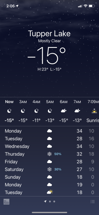
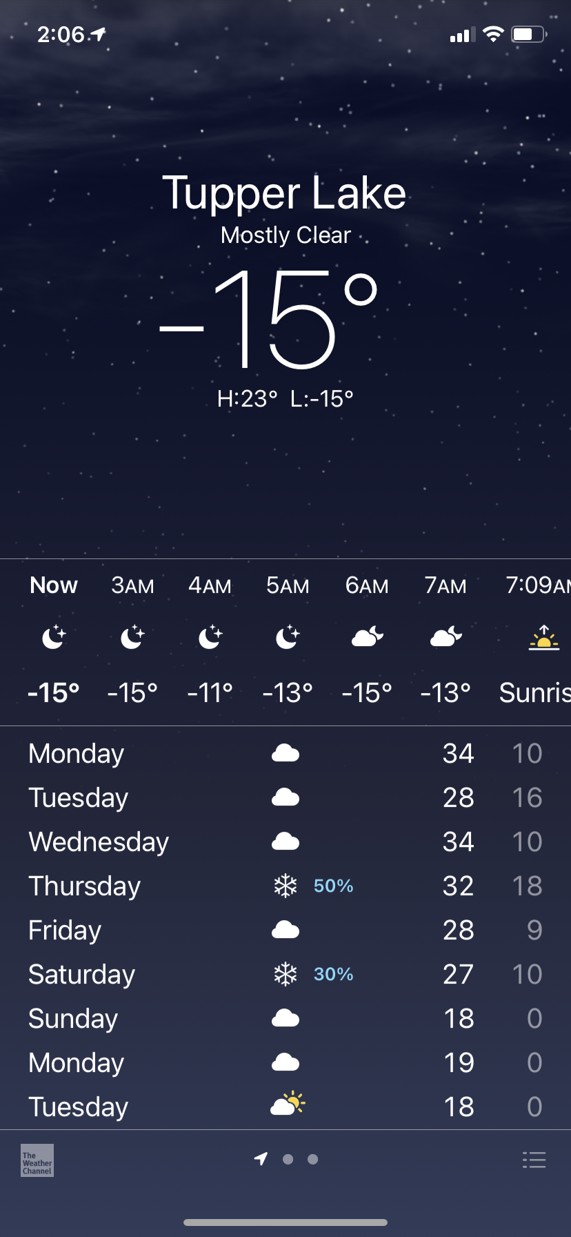
I’m driving (with a neighbor) to visit his old buddies at Tupper Lake this weekend for ice fishing and snowmobiling. Leaving South Carolina on Thursday. I hope the interstates are OK… still, I’ve made better decisions.
-
 1
1
-
-
From Chris Jackson (South Carolina)
”Post coming by 10pm. Looking at the latest guidance coming in and the upper air balloon soundings from this evening.
For the Pee Dee my thoughts remain unchanged for the most part, but I’m currently leaning towards more impacts in the Midlands than I thought would occur yesterday.
Give me a bit to look over this pretty thoroughly and I should have something out by 10.
- Chris”
-
 1
1
-
-
Back down again at hour 54.
-
4 minutes ago, canderson said:
Comment says it is a cellphone with a 50k mah backup in a pelican case mounted 8’’ off the ground to a steel pole
You mean 8 feet, right?
-
2
-
-
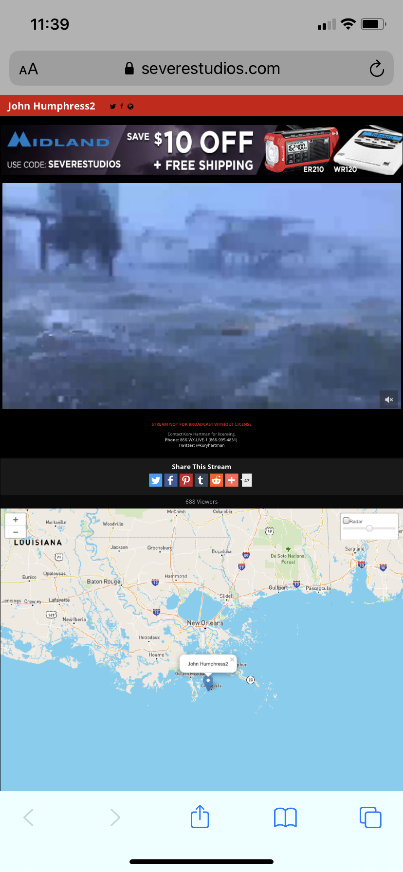
I’m starting to see some larger items floating by on that Grand Isle camera. Pixilated, but visible.

-
4
-
-
Can someone define what GSHDDs is/are? Google is failing me. TIA!
-
15 hours ago, Stormpc said:
Oh no...that looks like a
Willie?! Willie Nelson, can I have your autograph??
-
I am taking the family up to Sugar Mtn. this weekend for the kids' first snow/tubing trip. I'm sure that the slope itself has a slightly different climate than Boone, but those several days this week of staying above freezing (even at night) are a little worrisome. Anyone in that area that can speak to snowmelt in mid 40's temps?
Thanks!
-
That looks almost like hurricane coverage.
-
1
-
-
I'm on Lake Murray in Chapin, SC (just NE of Columbia.) Not much wind to speak of with this front line. Lots of rain.
-
Someone answered me. Thanks. I tried to do the like button, but I didn’t download tapatalk, and I have no idea what to do with my photosynthesis.
-
56 minutes ago, Cheeznado said:
This big switch by the Euro is not believable IMO. Had no ensemble support last night and little if any from the 12Z GEFS. When any model jumps around like that it is usually wrong.
Get outta here with your fancy logic and reasonable opinions.
-
1
-
1
-
-
Which potential threat is this one? 4 days out?
-
34 minutes ago, jburns said:
I'll tell you what. You go and find the post or posts of any moderator that was talking about Jim Cantore's height and I will discipline them severely. I'll wait.
Yeah, that was me that originally asked the question. Constant lurker. Infrequent commenter. Was bouncing around between threads and didn’t realize I was on the Obs thread. A couple pics of our members with him piqued my interest.
-
4 hours ago, AsheCounty48 said:
18 inches of snow and one Jim Cantore pic later. Was rather windy early this morning, figured power outages would be a bit more of a concern than they were here.

Sent from my SM-N950U using Tapatalk
How tall is Cantore? Looks pretty short...but you might be tall.
-
10 minutes ago, Queencitywx said:
Why can’t we ban Wilkes?
Me?!
-
CAE is saying that there's not even a chance for ice. Wouldn't have expected that for Winnsboro and the north midlands.
-
1 minute ago, pbrown85 said:
Does anyone have any theories as to why the GFS FV3 gives so much more with it's winter output than the other models so far?
It's still in beta stage and likely being tweaked.
-
1 hour ago, FLO said:
Is suppressed a good thing for ppl in say Columbia? What do you mean by suppressed?
Basically, it means "further south." In terms of latitude, the high pressure system to the north keeps the low pressure system (the moisture) from going further north.
-
4 minutes ago, Wow said:
Quite a few wild snow maps out of the 18z GEFS

E4 is drunk.
-
1
-
2
-
 1
1
-
-
It's strange to me to see these northern midlands (SC) totals modeled, when the 3-hour loop of the model does not show a snow/sleet line reaching down this far.

Hurricane Ian
in Tropical Headquarters
Posted
You keep saying this, but it's not correct. That storm was tropical. It became extratropical after moving inland.