
From: Pattern Change and Severe Weather Opportunities

Entry posted by OKpowdah ·
7,567 views
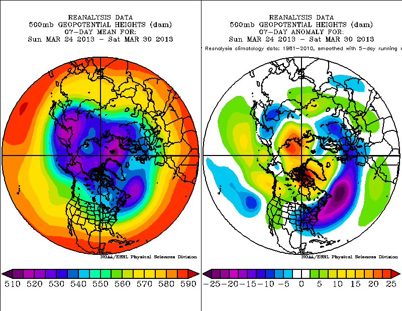
The persistent low index blocking pattern that has lent itself to a frigid end to winter and start of spring is finally nearing an end.
An oldie but a goodie reference: Namias, J., 1950: the index cycle and its role in the general circulation. J. Meteor., 7, 130-139.
Likely culprits to our extreme blocking ... the prolonged easterly QBO and a final "warming" that resulted in a strong wave-1 response in the stratosphere.
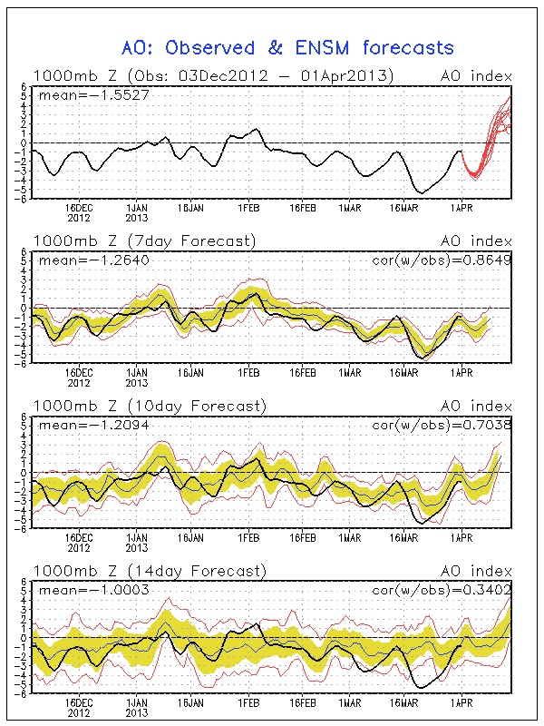
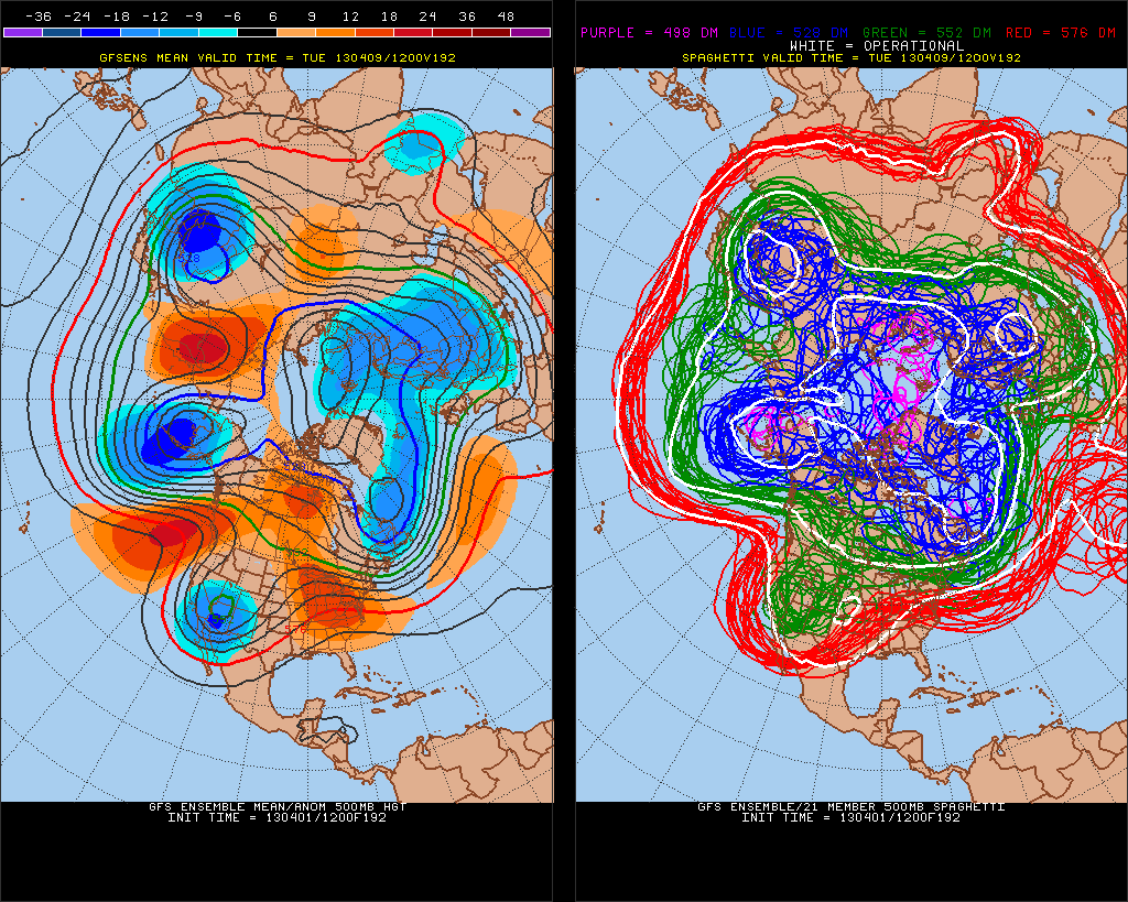
The AO has been down in the deepest darkest depths of the basement for a while now. There is unanimous agreement in the GEFS for a world-class reversal in the NH annular mode ... i.e. a rise of over 6SD in 10 days!!! That's pretty amazing.
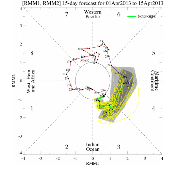
Tropical forcing has been persistent near the dateline over the last month, but a new MJO wave is forecast to cycle through phases 3-4-5 over the next two weeks, triggering a wave response that will have significant implications in the mid latitude pattern.
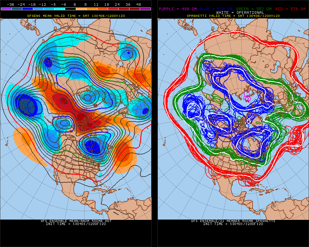
All the energy trapped in the Pacific jet gets ejected eastward and dumps into the western US. The GEFS and ECMWF are in fairly good agreement on this pattern development with just differences in the timing. Notice on the spaghetti plot, there are just some minor phase shift differences from the Pacific across the CONUS. Pretty impressive agreement actually for day 8.
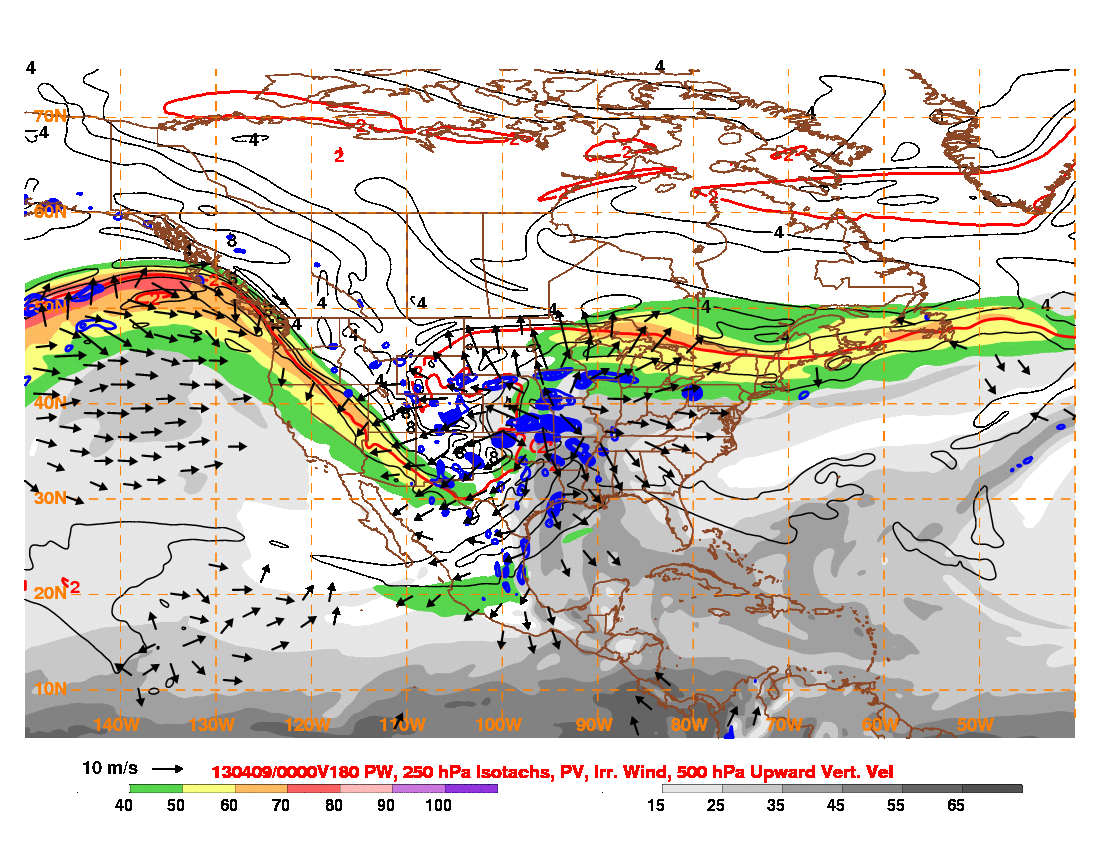
Really impressive jet structure. Notice dual jet support over the Plains with the strong Pacific jet diving into the backside of the trough over the western US and the polar jet across the Great Lakes and Northeast intensified by the tightened temperature gradient in the high index pattern.
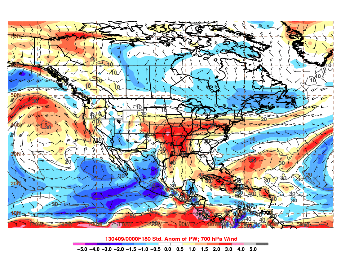
In terms of severe weather potential, the rain storm this week also doesn't hurt ... adding moisture to the boundary layer.
By the weekend, looking at large scale moisture convergence from the Gulf to the polar front across the Midwest and Northeast.
A lot of good stuff coming together to support a rapid increase in Springtime severe weather activity over the Plains by early next week!
0 Comments
Recommended Comments
There are no comments to display.
Create an account or sign in to comment
You need to be a member in order to leave a comment
Create an account
Sign up for a new account in our community. It's easy!
Register a new accountSign in
Already have an account? Sign in here.
Sign In Now