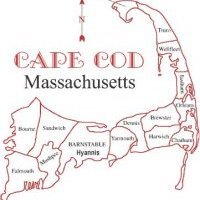
First Cape Cod Snow Threat Emerging first week of December 2020
Models are beginning to show an area of focused vorticity rounding the base of neutral to negatively tilted northern branch of the jet stream trough. Now, energy is over the central North Pacific south of the Aleutian Islands which means the energy is not being sampled properly at this time. However, multi model consensus is beginning to show prudent signs that this trough will be energizing as it moves through which far more productive than a trough that is weakening instead. We have the right trends going as the system ignites over the extremely warm waters relative to average norms for November 30th. While the warm waters are a concern at times, this system will not be driving southeast winds, so the area should remain in a cold environment, enough for snow, I have no idea. Right now, the threat has begun to emerge for Friday December 5th!


0 Comments
Recommended Comments
There are no comments to display.
Create an account or sign in to comment
You need to be a member in order to leave a comment
Create an account
Sign up for a new account in our community. It's easy!
Register a new accountSign in
Already have an account? Sign in here.
Sign In Now