
Succession of Clippers bring us a White Christmas!

Entry posted by USCAPEWEATHERAF ·
1,032 views
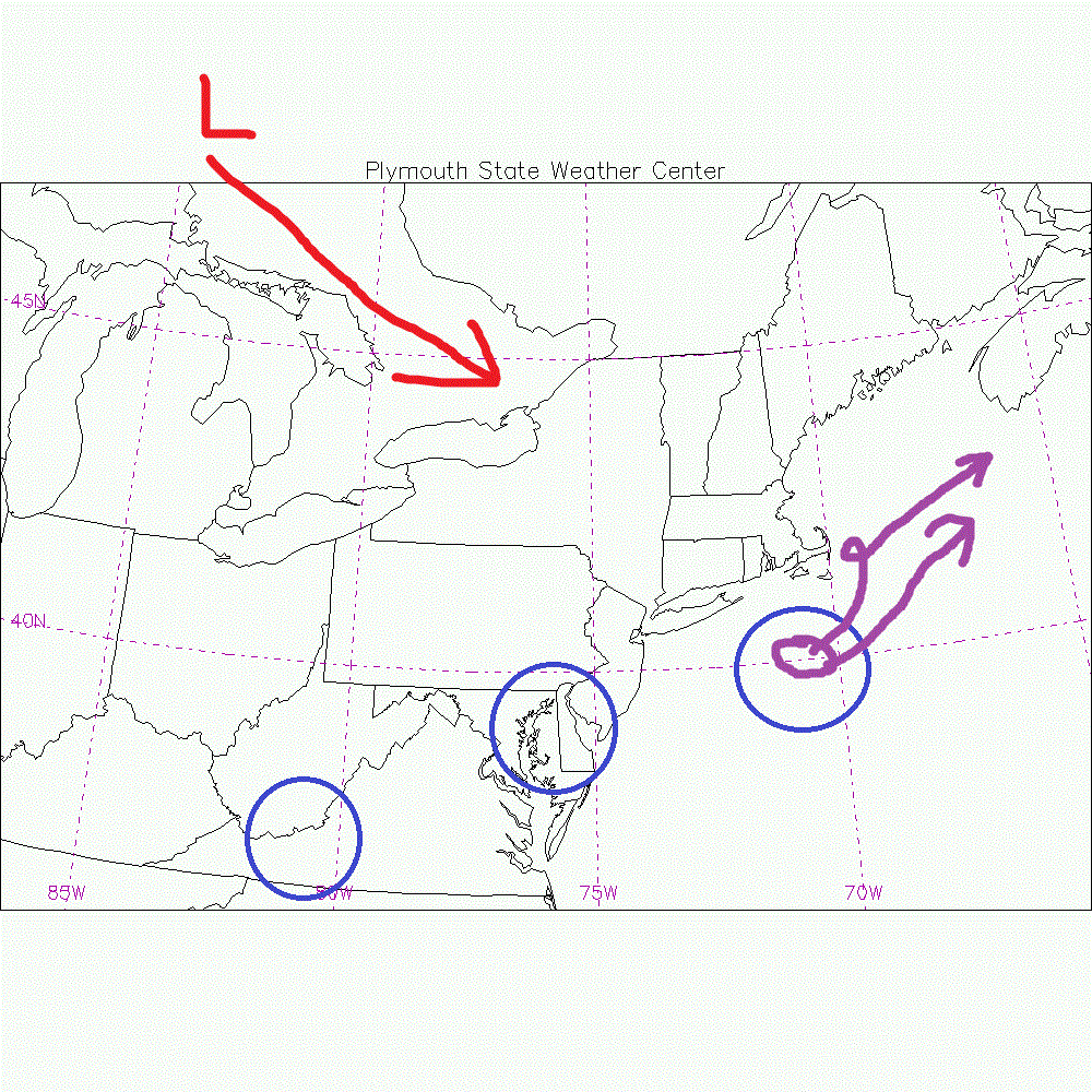
Right now the storm for Sunday and Monday looks rather warm for SNE with a later phased stream bringing mainly rain to eastern SNE, especially the coastline. However, I believe the models are having a problem identifying the +PNA and it is rather stout, +1 standard of deviation in the positive realm, leading to high ridging into Arctic Circle bringing cold air southeastward out of the reaches of central Canada. The northern stream becomes quite amped up but too late on most of the guidance. I will quickly check the short range guidance, the 00z RGEM, WRF ARW, and WRF NMM models. The graphic I have below shows the two main players involved in the weather making this weekend. First, the southern stream disturbance and upper-level low moving over the Mid-Atlantic States tomorrow through Sunday and of the NJ coastline by Sunday afternoon and south of ACK by Sunday night, does this tuck into the elbow of Cape Cod and make a stall or does it head out to the east of Nova Scotia? Right now I would favor the HIRES models and show a path just east of Cape Cod occurring and pummeling Eastern SNE with heavy precipitation mainly snow northwest of Boston to Providence and a mix of snow and rain for the coastal plain. I will have a snow accumulations map out tomorrow morning.
0 Comments
Recommended Comments
There are no comments to display.
Create an account or sign in to comment
You need to be a member in order to leave a comment
Create an account
Sign up for a new account in our community. It's easy!
Register a new accountSign in
Already have an account? Sign in here.
Sign In Now