

Entry posted by Ellinwood ·
2,571 views
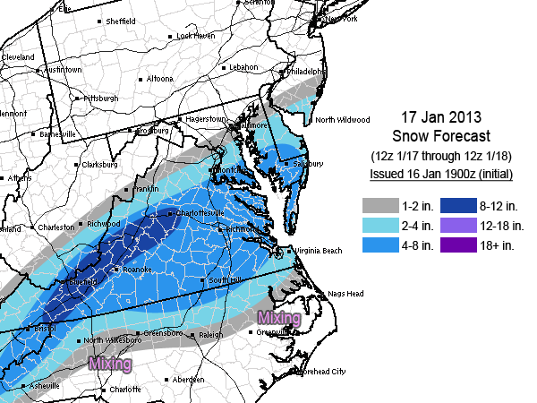
Here comes the first notable snow event for the southern Mid-Atlantic this winter! A powerful upper-level vort. max will push through the region tomorrow, bringing strong dynamics with it that will help create a period of moderate to heavy snowfall. The snow will start in the morning hours in the higher elevations and will work east through the afternoon and evening. The I-95 corridor will probably start off as rain in the morning. Some sleet could accompany the transition in the late morning and early afternoon, with the changeover to snow occurring around mid-afternoon on I-95 between DC and Richmond. This could lead to large traffic headaches during the afternoon rush hour.
Just in case some people might be thinking it, the current forecast is not favorable for thundersnow/thundersleet.
1 Comment
Recommended Comments
Create an account or sign in to comment
You need to be a member in order to leave a comment
Create an account
Sign up for a new account in our community. It's easy!
Register a new accountSign in
Already have an account? Sign in here.
Sign In Now