
Explanation of December 5th Snowstorm Potential

Entry posted by USCAPEWEATHERAF ·
831 views
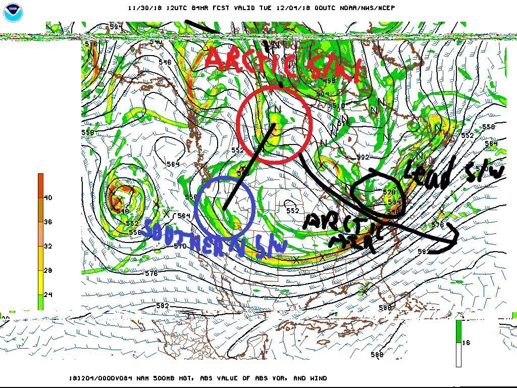
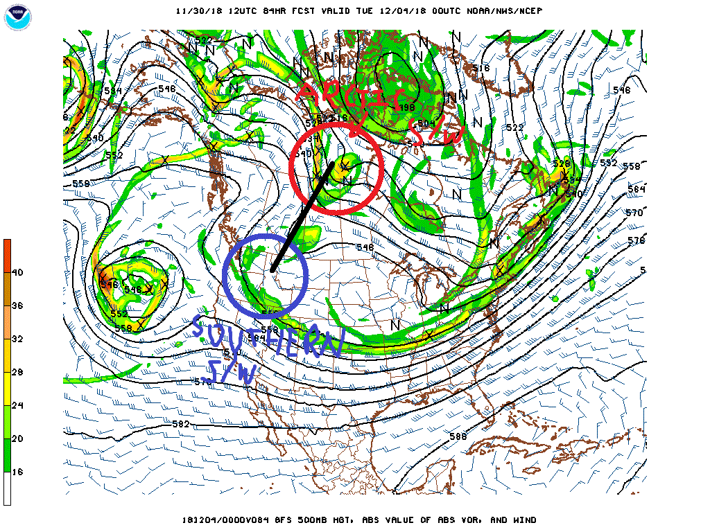
Right now all options are on the table. In the next 84 hours, the solutions will vary greatly in detail and overall vigor. The reasoning for why so many options remain open for a blizzard to sunny days remains the unknowns. The unknowns are the strength, wavelength, positioning of the factors at play. One is the Arctic Shortwave, this is either the kicker s/w or the phasing backside s/w that determines if the storm gets whisked out to sea or comes to the benchmark location. IF the phase happens like we all hope it does if you love snow, then the arctic shortwave in question is not fully sampled yet and therefore the models have no idea on the details of this shortwave. Two is the southern stream shortwave, our energetic system for coastal development. This should be sampled shortly within the next 12-20 hours of time on the west coast of the US. Its strength and position have a lot to do with where the storm exists off the East Coast. Right now, models, have it exiting around NC without phasing, this goes east and never hits the Northeast US. If the phasing occurs, we get the storm to hit the benchmark. Those are the questions that need to be answered in the next 84 hours.
0 Comments
Recommended Comments
There are no comments to display.
Create an account or sign in to comment
You need to be a member in order to leave a comment
Create an account
Sign up for a new account in our community. It's easy!
Register a new accountSign in
Already have an account? Sign in here.
Sign In Now