
Pattern favors cold and snow in the 6-10 day forecast

Entry posted by USCAPEWEATHERAF ·
881 views
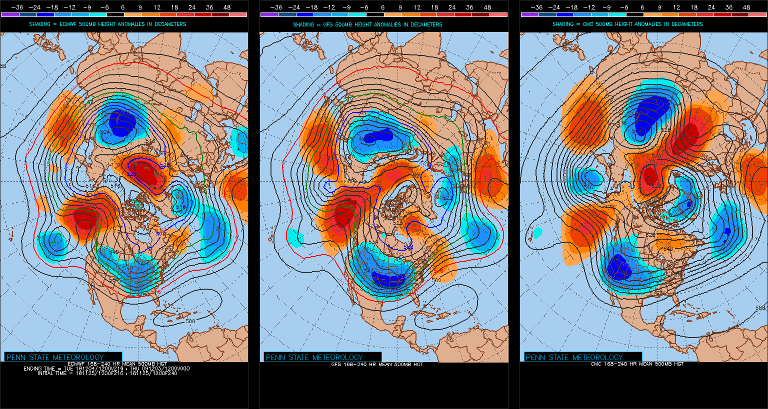
Could we see snow in the next 6-10 days, I believe so, do not pay attention to individual runs of the operational models, they will have flaws in them run to run, but look at the ensembles and their means and they will show you the way. I found this map on PSU EWALL website, the models are 12z runs of the EURO, GFS and CMC from left to right. They pretty much agree on ridging in Alaska, our -EPO/+PNA feature, along with a ridge in northern Greenland and some ridging in northeastern Canada west of New Foundland. Stay tuned, we could be tackling a major east coast snowstorm in this time frame.
0 Comments
Recommended Comments
There are no comments to display.
Create an account or sign in to comment
You need to be a member in order to leave a comment
Create an account
Sign up for a new account in our community. It's easy!
Register a new accountSign in
Already have an account? Sign in here.
Sign In Now