
First New England Snowstorm this upcoming week, TUE into WED

Entry posted by USCAPEWEATHERAF ·
1,077 views
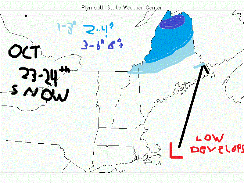
The first moderate snowstorm of the fall season and winter season comes for Tuesday into Wednesday, October 23-24th, 2018 from Caribou, ME CWA northwestward into the mountains of NW Maine, where up to 8" is possible, and forecasted by the models. I have my first snowfall map this year posted in the NNE fall thread and I will post below. An arctic jet will come southeastward during the late weekend into the early weekdays of the next few days. As it hits the SE New England coastline a surface low will develop and rapidly deepen moving NNEward towards eastern ME causing a blossoming area of precip and snow to the northwest of the track of the surface low as it taps the arctic jet which closes off at H5 over eastern ME causing extreme deepening of the surface low as it moves NNEward. This low will bring rain to eastern New England with an area of blossoming heavy precip as it tracks northward. This could be a sign of an active New England snowfall this winter season, especially favoring eastern MA, NH and ME.
0 Comments
Recommended Comments
There are no comments to display.
Create an account or sign in to comment
You need to be a member in order to leave a comment
Create an account
Sign up for a new account in our community. It's easy!
Register a new accountSign in
Already have an account? Sign in here.
Sign In Now