
March 7-8th 2018 Nor'easter potential Blizzard Map

Entry posted by USCAPEWEATHERAF ·
1,066 views
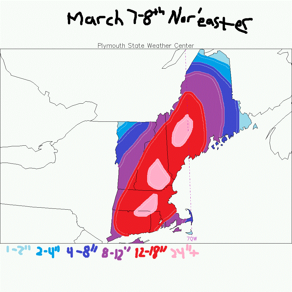
This is my only snowfall map for the Noreaster of March 7-8th 2018. Thundersnow is apparent in NJ and NYC and especially in the warm conveyor belt south of SNE where lightning is immense underneath very cold cloud tops where convection is. these heavier snow rates will bring down the cold air from the 850mb layer of the atmosphere and lead to potential snowfall over the Cape and Islands tonight the R/S line will crash southeast as the surface low is forecasted to move southeast of Nantucket and Chatham and is being reported as east of the 20z analysis of the 12z/18z NAM runs and 12z RGEM run, this should bode well for the Cape and Islands as this will keep the 925mb 0C line southeast of the area and should promote dynamic cooling to the surface, we shall see, otherwise there is another nor'easter on the models for Monday of next week that looks a little more dangerous than this storm tonight. We shall see! Current observations: Harwich, MA 38F temp, ENE wind gusty, and raining
0 Comments
Recommended Comments
There are no comments to display.
Create an account or sign in to comment
You need to be a member in order to leave a comment
Create an account
Sign up for a new account in our community. It's easy!
Register a new accountSign in
Already have an account? Sign in here.
Sign In Now