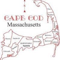
February to bring cold and snow to the New England coastline
Right now the pattern supports a cold and snowy regime with the PNA staying positive throughout the month, while the NAO stays positive, which means a rather progressive regime stays in place and we will likely see an oscillating AO pattern which produces some polar vortex lobes of energy to phase into the southern stream disturbances and that is how we get our nor'easters. I am still suspect thinking on the Monday storm, right now models have a second piece of energy phasing into the eastern US troughing just as the cold front tries to clear the New England coastline. NAM is west with the frontal zone and therefore the track of the surface low, while the GFS/CMC are further offshore with the secondary low. EURO somewhere offshore as well, but this model has done absolutely nothing but kill itself in this range, which is 48 hours out. Stay tuned, I think Monday event could trend better for South Coast of New England including the Cape and Islands.


0 Comments
Recommended Comments
There are no comments to display.
Create an account or sign in to comment
You need to be a member in order to leave a comment
Create an account
Sign up for a new account in our community. It's easy!
Register a new accountSign in
Already have an account? Sign in here.
Sign In Now