
December 13-14th Clipper Snowfall Map and Discussion

Entry posted by USCAPEWEATHERAF ·
941 views
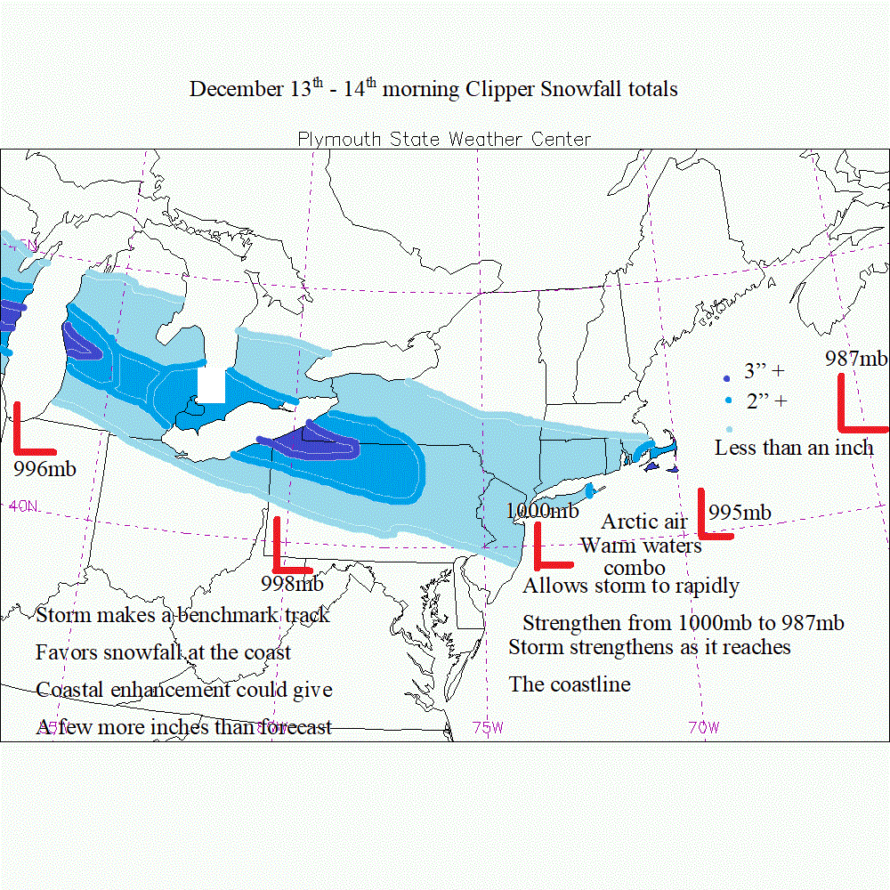
Thursday morning could bring our first snow fall accumulation of the season for Cape Cod and the Islands, a shortwave rounding the base of the H5 trough this evening will bring a shot of arctic air to the region where highs tomorrow and the rest of the work week will remain below freezing. We now have a very potent vorticity max disturbance in the northern jet stream flow that will amplify some as it rounds the base of the somewhat negatively tilted trough over the Northeastern US. Snow will be falling across central MI tomorrow morning and then will quickly move towards western PA and Pittsburgh area by the evening and then redevelop off the NJ coastline by Thursday early morning hours, and then be around the benchmark 40/70 location by midday Thursday. Depending upon the jet dynamics and the oceanic influence of the surface cyclogenesis process we could see a rapidly developing system bring snow to the south coast of New England by 6z Thursday morning and lasting for nine to twelve hours. If enough lift can develop we could see a good to decent snow amount and especially if we can get NE to NNE winds going than moisture will be a little problem. Therefore I am predicting a could 2" on the Cape while the Islands can receive 3" of snow the most snow will occur across central WI to central MI and then islands of MA. Still a lot of nowcasting to go and things could change drastically if that vorticity maximum is stronger on the models/
0 Comments
Recommended Comments
There are no comments to display.
Create an account or sign in to comment
You need to be a member in order to leave a comment
Create an account
Sign up for a new account in our community. It's easy!
Register a new accountSign in
Already have an account? Sign in here.
Sign In Now