
Mid Week Potential Nor'easter Scenarios

Entry posted by USCAPEWEATHERAF ·
1,161 views
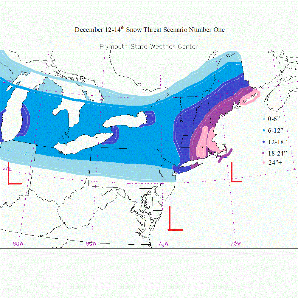
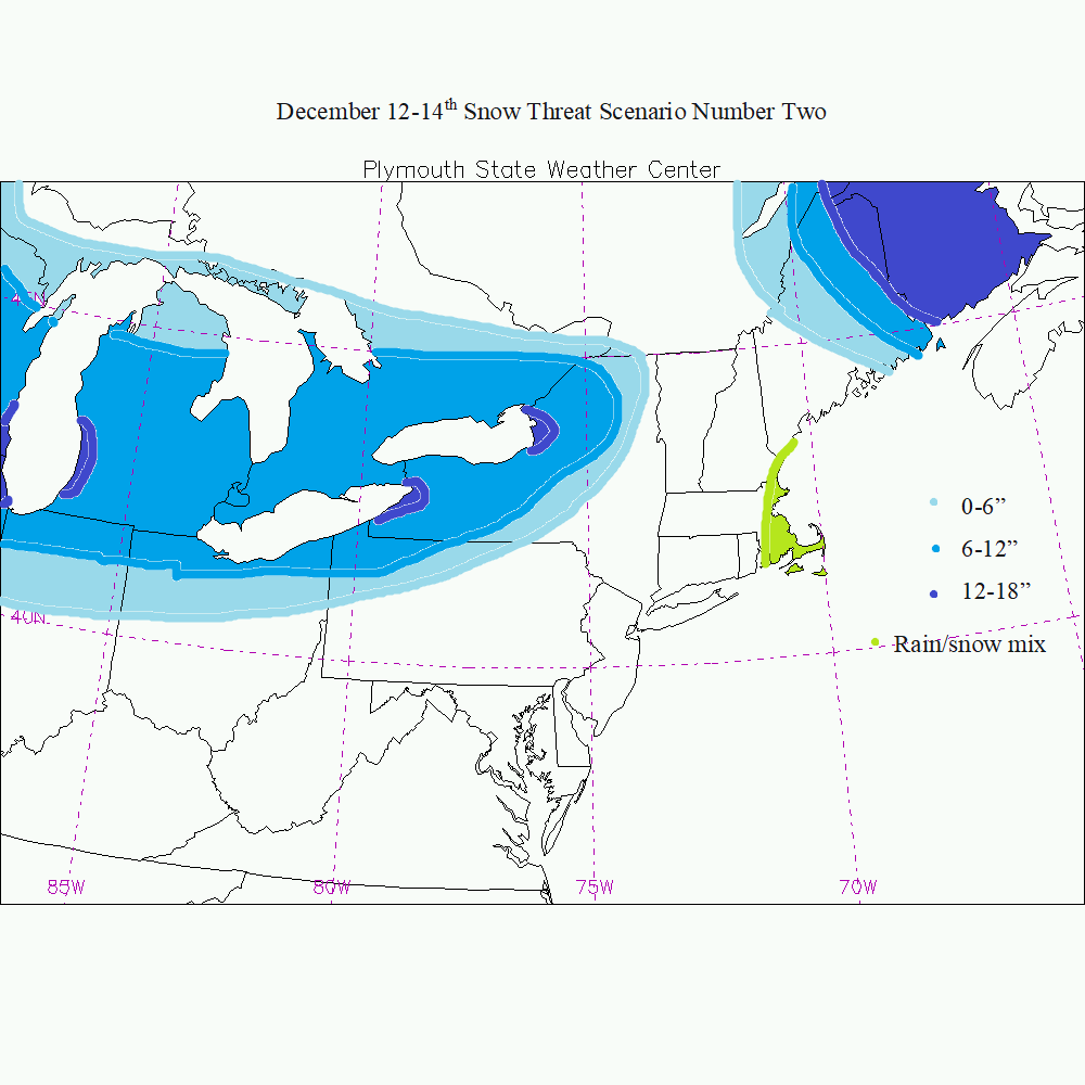
There are two camps for the scenarios on the midweek storm potential for December 12-14th 2017. I will illustrate them below. Scenario One is a full blown Blizzard from NYC to BOS to Bangor, ME. Scenario Two favors the Great Lakes and NNE with the heaviest snows. Which one happens will be determined by jet dynamics, phase potential, and baroclinic zone potential placement as well as track of clipper and arctic shortwave troughs in the flow. Scenarios are not forecasts, they are there to show potential either way. I will be updating the blog with my newest snow fall map for this weekend's storm shortly.
0 Comments
Recommended Comments
There are no comments to display.
Create an account or sign in to comment
You need to be a member in order to leave a comment
Create an account
Sign up for a new account in our community. It's easy!
Register a new accountSign in
Already have an account? Sign in here.
Sign In Now