
Comparing the Last Two GFS runs for Fantasy storm 2

Entry posted by USCAPEWEATHERAF ·
1,324 views
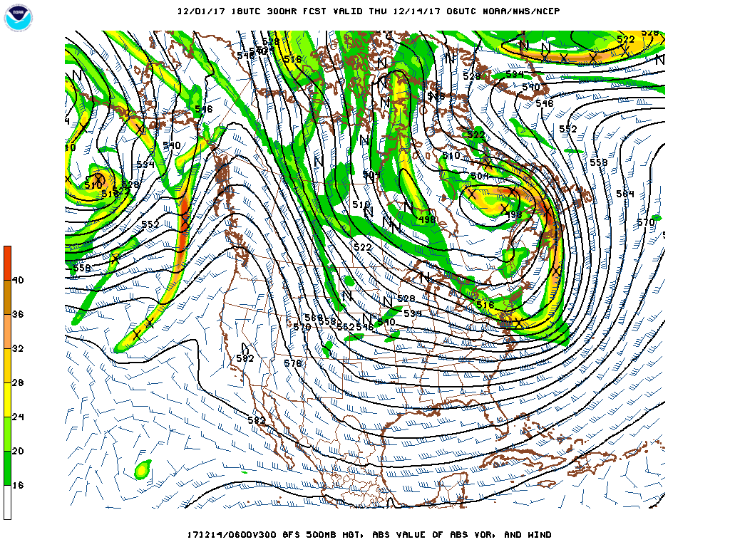
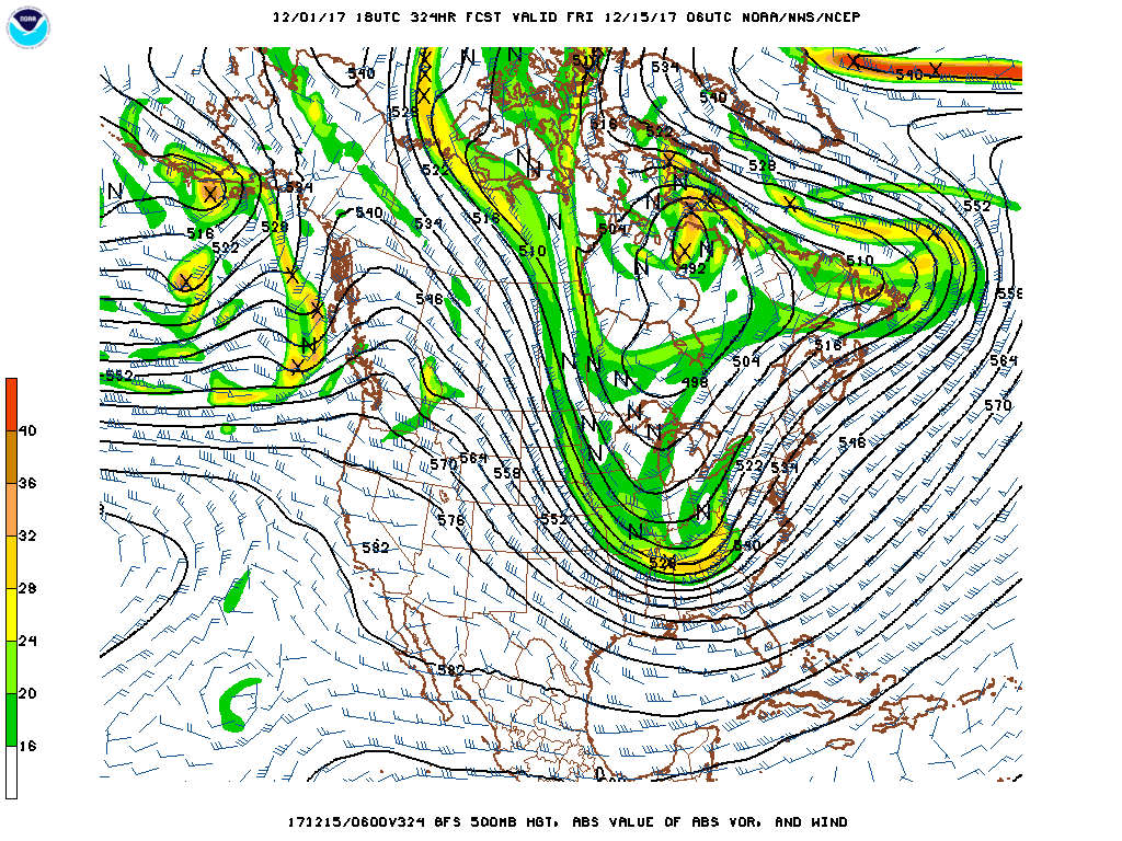
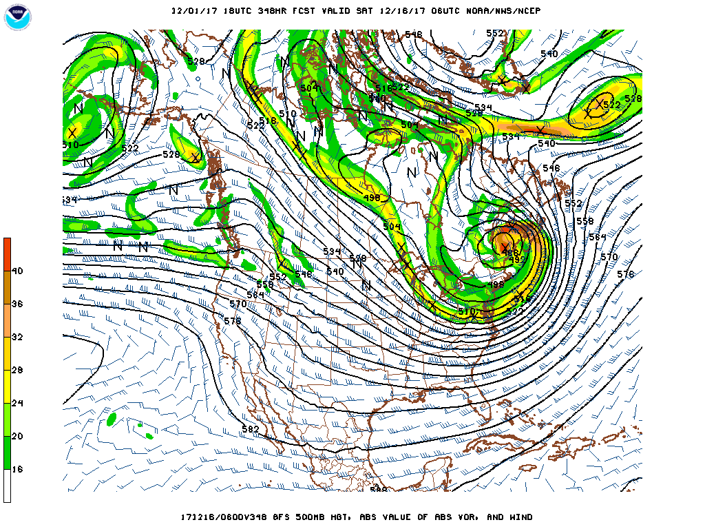
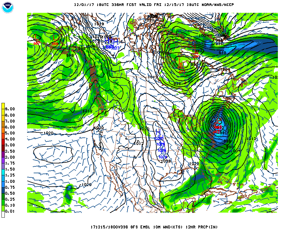
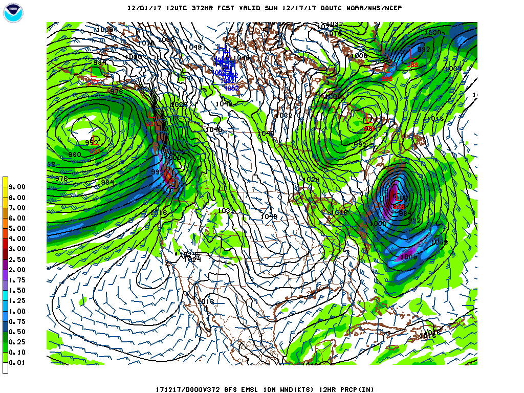
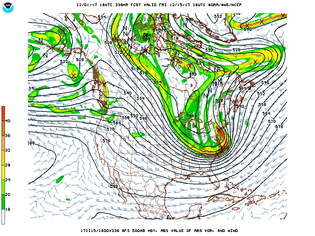
These images on top are from the 18z GFS run tonight, from hours 300-348, they show the evolution of our southern stream disturbance phasing with the large northern stream long wave trough, acting as at least a double phased jet structured storm if not three jets with the arctic jet also getting involved. Only triple phased streams allow a 940mb surface low to develop over DE ME. Could a storm of this magnitude evolve in this pattern for mid month? Absolutely, but how accurate is the model? Horribly inconsistent, but when it smells out a storm potential this is the time range it does it in. For the last two consecutive model runs for the GFS it has shown two monster storms back to back mid month of December, this first one is a triple point low, the second is a consolidated low, but we have potential for snow next week, so I won't get carried away with this shortwave, as the first shortwave with this new pattern can slam New England hard with heavy snow. So I will focus next few blogs on the short term.
0 Comments
Recommended Comments
There are no comments to display.
Create an account or sign in to comment
You need to be a member in order to leave a comment
Create an account
Sign up for a new account in our community. It's easy!
Register a new accountSign in
Already have an account? Sign in here.
Sign In Now