
Pattern Change towards arctic cold and snow returns for the first time this year

Entry posted by USCAPEWEATHERAF ·
1,106 views
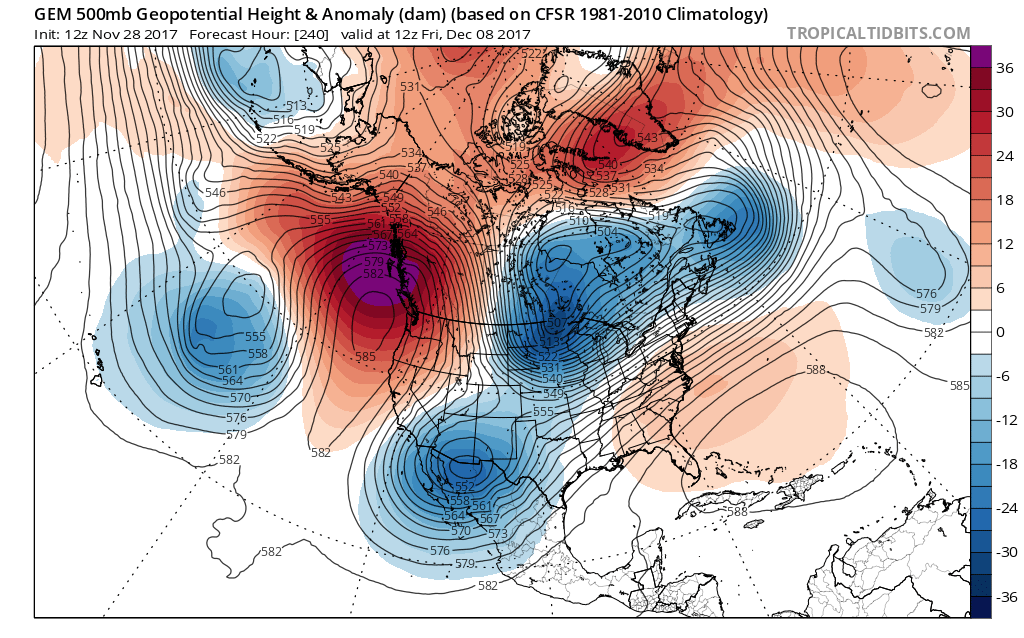
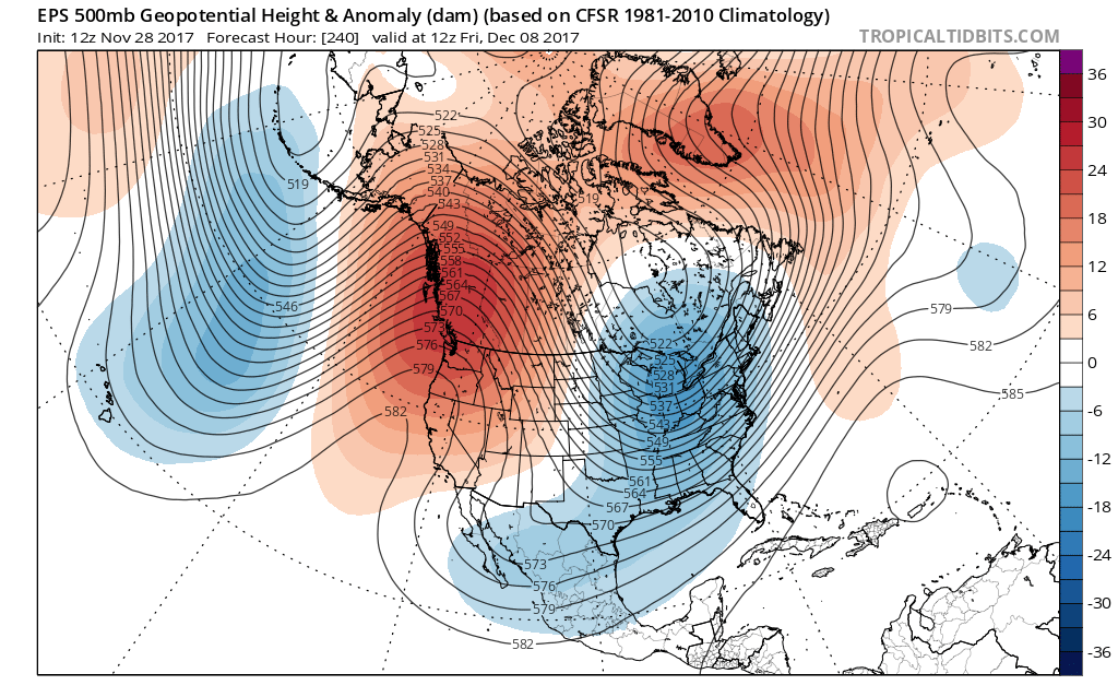
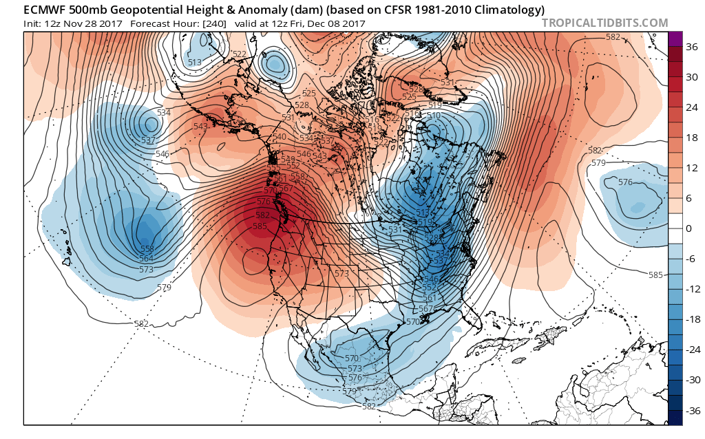
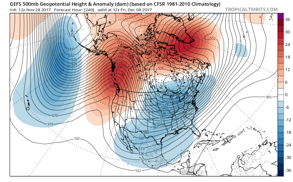
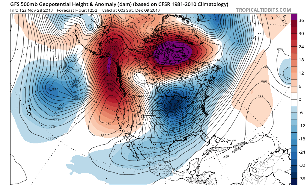
As a weather weenie, what separates our love for the weather from most people on this Earth? What triggers our emotional senses when a snowstorm doesn't go our way? What do we know of ourselves that makes us love the snow? Simply put, it is our passion. We love it as much as the next person loves candy, or his or her Boyfriend or girlfriend. We love the weather because we are passionate about it as much as we are curious when it doesn't follow our projections. So why tell you this? Because it appears in the next ten days, the weather across the northeastern USA is going through a transition period, where for the first six days this week and next week it will remain in the 40s and 50s, then it will take a coastal storm to bring rain at the coastline and snow inland to get us over the hump as a powerful arctic front will trigger temperature swings towards the 60s, then usher in the ARCTIC HOUNDS, because the chill is coming for the foreseeable future. Not only will be in a very cold pattern, we will also be in a stormy wintry pattern favoring snowfall for all of New England even coastal Cape Cod and Nantucket. Here is what I am seeing in the 12z suite this afternoon. First we have a -EPO pattern shaping up across the Eastern Pacific and Alaska were a tremendous polar ridge is setting up in the long term pattern, with the PNA region supporting a positive vibe, so ridging over BC and Western USA, favoring above normal temps in my brother's hometown for now San Diego, CA. Then we have a -NAO pattern regime coming together with the +PNA pattern supporting blocking over the North Atlantic Ocean and Greenland, this will act to amplify and slow down any coastal nor'easters that have the ability to spin up in this pattern. We also have a very negative AO pattern shaping up with a ton of ridging high pressure cells over the arctic circle allowing that arctic air to spill down the backside of the Alaskan polar ridge and into the central and eastern 2/3rds of the nation coming December 7th and beyond. We have at least two snow chances in the long term period from day ten onward. So snow lovers rejoice, our time is coming. Plus a warm GULF STREAM OSCILLATION leads to explosive cyclogenesis and extreme baroclinicity for the Eastern US seaboard, equals major snowstorms. Good luck!
0 Comments
Recommended Comments
There are no comments to display.
Create an account or sign in to comment
You need to be a member in order to leave a comment
Create an account
Sign up for a new account in our community. It's easy!
Register a new accountSign in
Already have an account? Sign in here.
Sign In Now