
Weekend Severe Threat: Dec. 12-13

Entry posted by Quincy ·
1,794 views
Another vigorous through is forecast to sweep through the south-central states over the next few days, bringing a threat of thunderstorms to the region. Although this threat looks substantially less impressive than the event in mid-November, there still exists the potential for at least a few severe thunderstorms, especially Saturday.
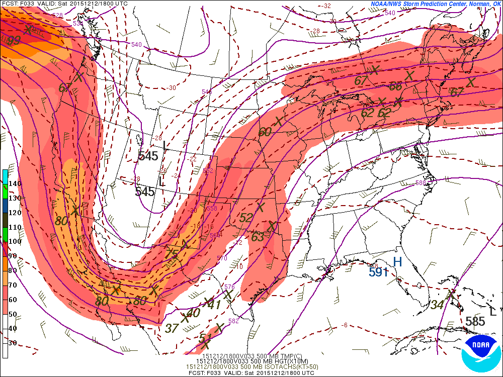
The setup for Saturday has had a lot of question marks and red flags from the start, but now that the event is approaching, things are coming into better focus. The upper level pattern is split with a fairly complex setup forecast to develop. It looks like two pieces of energy will factor into the southern Plains severe threat. The first will be a strong daytime low-level jet across eastern Texas with vorticity maxima ejecting north-northeast toward the Ozarks Saturday afternoon. The second area of energy hangs back with a cold front and the more substantial height falls across the southern High Plains.
The greatest severe threat, although still somewhat limited, should develop from eastern Texas into perhaps southeastern Oklahoma/far southwestern Arkansas during the afternoon hours on Saturday. Aided by a 40-50 knot low-level jet and modest instability, at least a few supercell thunderstorms could fire. Given the wind profiles, all severe hazards appear possible with perhaps a few tornadoes. The threat here shifts to damaging winds as storms merge and should tend to wind down after dark as daytime heating fades and the strongest forcing moves into the Ozarks and Middle Mississippi Valley.
The secondary severe threat looks to be from central to North Texas, into central and western Oklahoma. This could extend into Kansas, but with northward extent, instability will become increasingly limited. There are three issues with this area, with the first being a continued messy look to the wind profile. Model soundings have shown a veer-back profile in the mid-levels, producing some jagged, criss-crossing hodographs. Also, some warmer temperatures in the mid-levels should keep the atmosphere capped in most areas until early in the evening. Finally, the trough has slowed down a bit on the models, which also keeps the best forcing farther west until after dark. The timing is analogous to 11/16/15, but instability is significantly less impressive and shear is not as robust. Although a tornado cannot be ruled out, the threat is fairly low.
For this area, thunderstorms will try to develop around or shortly after sunset, but may have trouble organizing given the above-mentioned factors. Still, given cold advection aloft and moderate shear, a few briefly discrete/semi-discrete severe thunderstorms could develop. The most likely scenario is that thunderstorms form into a squall line and feature damaging winds as the main threat overnight.
Speaking of mid-November, the Sunday threat has a lot of similarities to 11/17/15. Not only with timing and placement, but with the synoptic setup. Keep in mind that 11/17 had more instability and was an “elevated” 10% tornado threat, but the event struggled, mainly producing sporadic damaging wind gusts, although a few overnight tornadoes were reported in Mississippi. This Sunday, the initial squall line looks to be only marginally organized (unlike the robust 11/17 AM line) and the potential for warm sector supercells out in front, across the Lower Mississippi Valley, is fairly low. Still, a few damaging wind gusts and perhaps a tornado or two appear possible. With the warm sector becoming increasingly narrow (pinched) through the day, the aerial extent of severe threat should fade during the second half of the day, despite impressive wind fields aloft.
0 Comments
Recommended Comments
There are no comments to display.
Create an account or sign in to comment
You need to be a member in order to leave a comment
Create an account
Sign up for a new account in our community. It's easy!
Register a new accountSign in
Already have an account? Sign in here.
Sign In Now