June 22 Severe Weather Threat
 There is the potential for a regional severe weather event on June 22nd. The threat zone extends from portions of the middle/upper Mississippi Valley into the western Great Lakes. All severe weather hazards are possible and given the nature of the setup, forecast trends are being closely monitored.
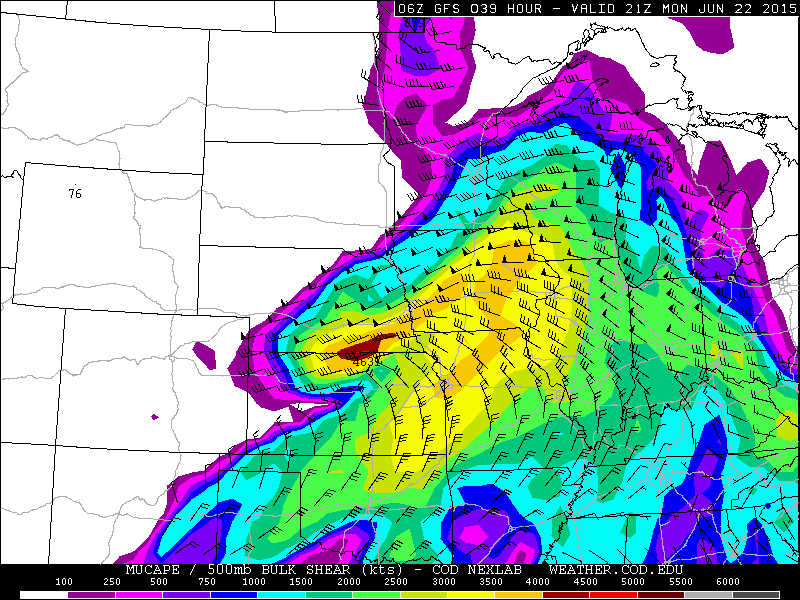
As at least two pieces of shortwave energy rotate from the upper Midwest into the Great Lakes on Monday, a surface low is forecast to deepen from Iowa/Minnesota into Wisconsin. Impressive wind fields for this time of the year will combine with strong instability to create an environment favorable for severe weather. As it stands right now, two rounds of storms are expected. The first round would most likely be in the form of a mesoscale convective system (MCS) Monday morning, moving into the Great Lakes by midday and early afternoon. The second round develops in the wake of this activity, at and shortly after peak heating, later in the afternoon.
The setup is a bit complicated and there are reasons to believe that two rounds of mixed intensity are favored over one robust atmospheric punch. The MCS during the first half of the day could pose a threat for primarily damaging winds and isolated hail. Once that system moves out, there should be modest air-mass recovery. The issue is that wind fields in the lower levels begin to veer, causing a more unidirectional shear pattern. This will likely dampen the tornado potential somewhat. Nonetheless, even forecasts on the more conservative end of the spectrum indicate a setup favorable for at least a few tornadoes. The afternoon to early evening threat may feature fairly widespread damaging winds, if storms were to merge into a linear system. Supercells still appear probable and they may extend into the early evening. However, for the reasons listed above, this does not look like an ideal setup for a major severe weather outbreak.
Trends for this event tend to move the surface low a bit quicker, which also speeds up the veering of winds. The best wind fields may also become somewhat displaced to the northeast of stronger instability to the south. The Euro has joined the GFS/NAM in developing strong instability, as earlier it was showing a less unstable setup. The RGEM is also on-board and all of the models are in general agreement in terms of timing and geographic placement.
Wisconsin is the target for the initial MCS on Monday. That system should weaken as it moves into portions of upper and lower Michigan. Later in the day, the target becomes southern Wisconsin and northern Illinois. Portions of lower Michigan and northwestern Indiana may also get in on some action. Damaging winds should be the predominant threat. The stronger cores can produce large hail and a few tornadoes seem probable.
At least one of the following scenarios would need to occur to more fully maximize the tornado threat: First, outflow from the morning MCS could work to set up one or more boundaries to locally enhance a tornado threat. If the MCS decays faster than projected, that could lead to less disruption of the wind field and even stronger instability. A mesoscale low and/or a main low tracking further south into southern Wisconsin (instead of northern sections) may maintain more backing in the lower level wind fields through the threat zone.
It should be noted that even with the projected wind fields, at least a few tornadoes remain likely. Given both a strong low level jet and 0-6km shear in excess of 50 knots, there is at least some potential for strong tornadoes. All of the factors currently forecast likely place Monday into more of a mid-range (SPC moderate risk) severe weather threat, as opposed to a higher-end (SPC high risk) outbreak. Stay tuned to later forecasts to see how the forecast setup evolves.
The NAM forecast below for 21z Monday shows winds veering substantially across Wisconsin and Illinois:


0 Comments
Recommended Comments
There are no comments to display.
Create an account or sign in to comment
You need to be a member in order to leave a comment
Create an account
Sign up for a new account in our community. It's easy!
Register a new accountSign in
Already have an account? Sign in here.
Sign In Now