
Connecticut Snowfall Totals: Mar. 20-21, 2015

Entry posted by Quincy ·
3,113 views
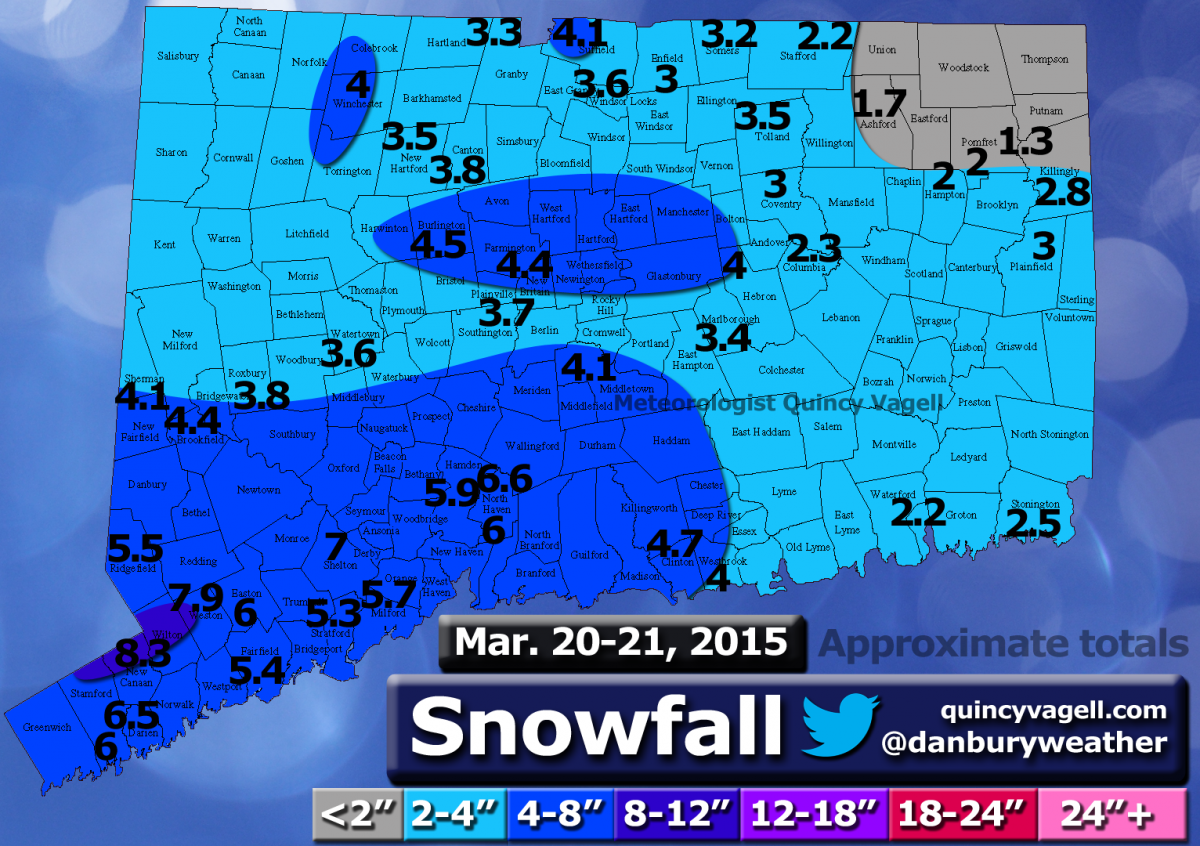
 Here is a snowfall map using reports from various sources. Many of the reports came from this forum and the National Weather Service. Only social media reports that passed through quality control were considered. All reports gathered were carefully considered and compared before being included.
Snow developed during the afternoon on March 20th across Connecticut. Dry air in place prior to the event resulted in several hours of virga until ground observations finally reported snow early in the afternoon. Snow overspread the state, but the snow was heaviest across southwestern sections. The snow continued overnight as low pressure developed east of New Jersey.
Periods of light snow continued into the morning hours on March 21st. There was some enhancement of the snow across central Connecticut before the snow tapered to flurries statewide by midday.
Snowfall totals ranged from 4 to 7 inches across southwestern Connecticut to just under 2 inches in northeastern Connecticut. Much of interior Connecticut reported 2 to 4 inches with a few isolated higher amounts in north-central portions of the state. A narrow band across the higher elevations of Fairfield County, just northwest of the Merritt Parkway, reported locally 7 to roughly 8 inches of snow.
0 Comments
Recommended Comments
There are no comments to display.
Create an account or sign in to comment
You need to be a member in order to leave a comment
Create an account
Sign up for a new account in our community. It's easy!
Register a new accountSign in
Already have an account? Sign in here.
Sign In Now