
dsnowman
-
Posts
72 -
Joined
-
Last visited
Content Type
Profiles
Blogs
Forums
American Weather
Media Demo
Store
Gallery
Posts posted by dsnowman
-
-
FWIW, 6z ICON is a bump north from 0z with snow into the MA.
-
 1
1
-
-
Forecast high for western Fairfax County today = 30. Actual high temperature = 26. A great battle between the surface and atmosphere is about to ensue.
-
2
-
-
Though not the big snowstorm we all wanted, it’s still possibly a HIGH impact event. It looks like we are in for the snow to ice solution noted yesterday for those of us west of I-95. Though there is raging warm air aloft, the CAD signal is very strong. So not the wash out many have feared. Not surprisingly, the NWS has updated the forecast this morning (I’m western Fairfax County) calling for up to .30 of ice on top of several inches of snow. It’s gonna be a great battle between the surface and upper levels!
-
1
-
-
The globals have locked into the evolution and path of the storm, now it’s time for the meso’s and the finer details. The 6z NAM in particular, but also the ICON and GFS, are recognizing that the cold air isn’t going to be scoured out very fast particularly in the western burbs, so it looks like we may be dealing with more of a snow to ice regime than snow to rain. Could make this storm impact worse than last Mon.
-
Coastal hugger. Much better than 12z!
-
The 6z GFS is interesting, there is more dig to the trough which creates more spacing between the Sun and Mon waves and allows the Mon wave to hug the coast a little more as it heads our way. Is this the start of something.
EDIT: meant 18z. Port causing slurring of my fingers.
-
6z GFS is getting a little closer for Sunday, it just doesn’t phase in time (Maine). As depicted, it’s a little hard to believe, two pieces of energy running in parallel for hundreds of miles without phasing.
-
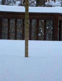
29 and just over an inch in Centreville.
Western edge of radar past I-81 looks to be filling in.
GFS won the battle of the models from earlier in the week. A EURO suppressed scenario was just plain wrong.
That said, 6z GFS has actually brought some of the CCB back towards the DC area.
-
1 hour ago, losetoa6 said:
I really don't think many people in here realize how incredible 1993 superstorm was...especially younger folks and also those who lived i95 east ...but regardless I'm glad I got to experience its incredible awesomeness 1st hand.
I’m with you on that one. A fun story ...it was my 2nd year living in the DC area, and my sister and her friend drove down from CT the day before, as we all planned to drive to Daytona Beach for Spring Break. As the storm approached, we debated on waiting a few days until it passed. But we would have missed part of Spring Break, so late that night we decided to roll. The four of us (my roommate included) piled in my tiny 1985 Nissan Sentra and drove straight through the Superstorm to Daytona Beach. Absolutely crazy. Driving through snow to rain and wind, and arriving to a ruined Spring Break with temps in the 40’s and 50’s most of the week in Daytona Beach. The craziest part was in Georgia where highways were stopped because it was raining so hard, like driving under a continuous waterfall! Never seen anything like it before or since.
-
Regarding the two camps (NAM/EURO and GFS/ICON, I'm still paying attention to the globals and how they are handling the SE ridge. The NAM has the moisture feed from the gulf going around a strong SE ridge into TX and OK and then heading towards our area (why it's projecting in MD/PA). The GFS on the other hand has a much quicker turn towards our area (thus a direct DC hit), mainly because it sees the SE ridge relaxing somewhat. I'm leaning more towards the GFS right now in terms of placement of heaviest precipitation (PA versus DC).
-
It’s interesting to see how things have evolved over last few days. We’ve been worried about the SE ridge versus the strong cold HP, and right now we can say both are winning! The latest NAM has the low forming and running through LA and OK rather than east/west Tennessee thanks to that strong SE ridge. But, the HP from the north has become much stronger too. So we are nicely sandwiched in between.
As a side note, these kind of setups may become more likely over time given global warming and likely impact in our area.
Back to this storm, a few days ago PSU mentioned the placement of moisture feed being narrow and we needed to wait a few days to see where it lands. I agreed noting we needed last nights storm to pull out for the models to get a better handle. Now, it looks like the moisture pull from the gulf will be plentiful so I think we worry less about where the heaviest precipitation lands, it should be region wide. Hence, why the WSW’s are now in effect.
-
2 minutes ago, BTRWx's Thanks Giving said:
Simplified answer is warm air is being spread from the southeast over the Atlantic towards our region.
More on that. It’s often a High centered over Bermuda (Bermuda High) that can both help and hurt with winter patterns. Too strong and it forces storms to our west, often causing it to rain. Except in this case the strong cold HP is suppressing it over our area (exactly where remains to be seen). Alternatively if the High is not too strong it can help force storms up the coast instead of out to sea.
-
2
-
-
One thing to keep in mind, the models aren’t going to have a good handle on where the moisture feed is going to land for at least another 18-24 hours until this Sunday night storm pulls out. In the the interim, we can just sit back and enjoy the battle between the strong HP and SE ridge.
-
The GFS was starting to show some transfer to the coast, thus holding things back and slowing it down. I haven’t looked at the EURO maps, are we seeing the same thing? Overall this could be a good thing. I’m more worried about temps right now, so if we get the coastal going qpf will be no problem.
-
Yeah, this confluence and further suppression is what I’ve been wanting since this morning, it actually helps Sun night and Tuesday night storms.
-
I’m sticking by my audible from this morning, we are in nomansland right now. We need the Sat storm to either swing north and give us snow now (and we lose Sun and Tues) or we push this thing way south due to the confluence and Sun and Tues are back on the table.
-
I want to audible at the line of scrimmage before the 12z GFS comes out. Let’s hope for much stronger confluence and a big push south of the Saturday storm, that sets us up better for the Sunday night storm. Right now we are stuck in nomansland with getting a slightly southern slider and a mix for the Sunday night (and Tues) storm.
-
6z GFS still a miss to the south for Saturday. 48 hours until game time so we need models to start shifting back north again today.
-
Two things. The globals are still not picking up on the CAD as evidenced by both the latest Euro and NAM(s) depicted above. Forecasted (and therefore modeled) temperatures are coming in 2-3 degrees colder for both Saturday highs and tonight’s lows across DC metro area. This is a cold airmass. And with cloud cover rolling in Sunday afternoon I doubt we reach the forecasted low/mid 40’s for DC metro area. I think we could be in for a surprise at least Sun into Mon with snow/ice for DC metro.
February Medium/Long Range Discussion
in Mid Atlantic
Posted
Mother Nature has been throwing us a bunch of sliders down and away. And so we’ve been getting a little anxious, crowding the zone, and so she throws us a few cutters (6z GEFS). Surprised to see that. Hopefully 12z gives us some meat right in our zone.