

KSWx
-
Posts
278 -
Joined
-
Last visited
Content Type
Profiles
Blogs
Forums
American Weather
Media Demo
Store
Gallery
Posts posted by KSWx
-
-
4 minutes ago, Quincy said:
Oklahoma is going off. Turns out Nadocast wasn’t that far off. Maybe just a tad east of progs, since initiation was delayed a bit. We have what, 4 PDS tornado warnings at the same time in close proximity right now? Geez.
Insane night. Sulphur under another PDS warning; I've never seen somewhere impacted back to back with PDS tors before.
-
3 minutes ago, ICEHOCEY77 said:
PDS warned now. Velo scans are off the chart
-
-
2 minutes ago, cheese007 said:
Might be about to be hit again
Yeah, they're already under another warning. This is an absolute worst case scenario. Reports of people trapped with rescue efforts underway and now they've got another potential tor coming through 10 mins later.
-
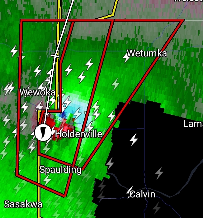
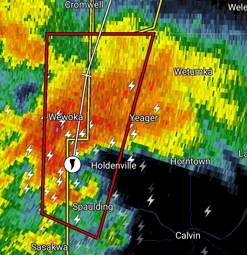
4 minutes ago, KSWx said:
Nasty CC drop on the storm going into Sulphur.
Edit: Sulphur, OK appears to have taken a direct hit; this thing needs a PDS tag.
PDS warned now.
-
Nasty CC drop on the storm going into Sulphur.
Edit: Sulphur, OK appears to have taken a direct hit; this thing needs a PDS tag.
-
Looks like multiple chasers were in the path as it occluded to the North; Hoping for the best.
-
It looks like another area of inflow may be forming east of the warned tornado; radar showing a TVS as well.
This storm motion is an absolute nightmare, I hope chasers weren't trying to zero meter this one. Reminds me too much of El Reno and is putting a pit in my stomach.
-
Texas storm PDS warned now.
-
Bad situation in Seminole; first responders are already out there helping and look to be directly in the path of another possible tornado.
-
4 minutes ago, Chinook said:
It should be a surface-based updraft. Perhaps a brief moment when I believed the CC (correlation) looked low, as if a debris signature. But I don't know if the debris signature ever happened, or I suppose, nobody ever reported a tornado.
Seems like DDC is so much more picky than any other NWS office. Reminds me of their "no." controversy from Twitter a few years ago as well.
Maybe worried about the panic a false alarm would draw given the proximity to folks near Greensburg so decided to be super diligent?
-
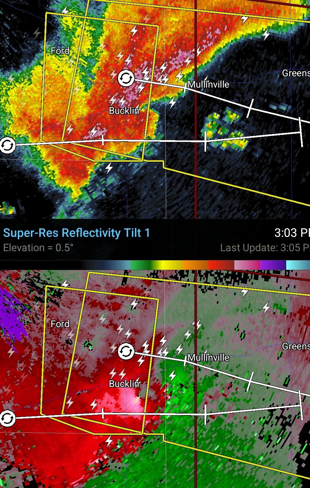
How on Earth is that Bucklin cell not tor warned?

-
 1
1
-
-
HRRR put on one of the more impressive performances I've seen; highly complex system and nearly nailed it from the hour it was in range.
-
 1
1
-
-
Downgrade to 5% tor for most of the forecast area on the Day 2 update with the 10% hatched over Iowa; Triple point seems to be the play.
-
NAM showing a nuclear cap for Tuesday over Kansas.
-
1
-
-
Supercell just W of Loup City, NE showing some pretty strong rotation.
-
Is that really a PDS severe thunderstorm watch I see?
Don't think I've ever seen one of those outside of derecho events.
-
KC storm looks to be tightening up again.
Edit: Now tor warned
-
12 minutes ago, mob1 said:
Pretty tight couplet in KS.

Looks like it tracked right over Chapman, they got hit hard in 08.
-
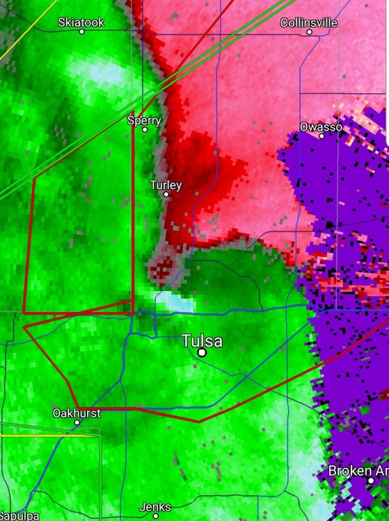
That tornado warned storm for North Tulsa has quite an inflow notch right now. Terrible timing considering how many are likely commuting.
Edit: Tornado confirmed.
-
Crosbyton cell needs a tor warning.
-
Hey Quincy, that was a great read. Thanks!

Severe Weather 4-30-24 through 5-2-24
in Central/Western States
Posted
225K delta v at one point, absolutely insane. Some of the more unique storm motion I've seen in a long time as well, there was a point where the tor was moving WNW.
Thankfully it's been over very rural areas thus far. Curious as to whether there was anything in its path at peak intensity they'll be able to use during surveys to get an accurate classification.