

WhiteoutMD
-
Posts
747 -
Joined
-
Last visited
Content Type
Profiles
Blogs
Forums
American Weather
Media Demo
Store
Gallery
Posts posted by WhiteoutMD
-
-
13 hours ago, Solution Man said:
 10 days away
Always 10 days away
-
 1
1
-
 1
1
-
-
JB go big or go home
-
 2
2
-
-
Looks like we have a nice dry period over the next 14 days time to wash the car.
-
I think we need to start wiring about flooding over the next 15 days. Anyone else think this?
.-
1
-
-
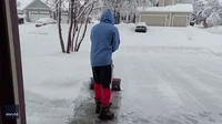
My neighbor shoveled his black driveway at sunrise SUN angle is a thing. Been snowing all day no new accumulation on it all day
-
A very slight increase in wind in Annapolis snow is starting to blow off trees. still snowing
-
Snow in Annapolis looks amazing even with light radar return overhead it is steady snow falling. Rout 50 is the pivot it looks like it to me.
about 3 inches now
-
5
-
 5
5
-
-
The only thing that matters right now is how much rain does the GFS show for Georgetown??
GFS was close
.-
1
-
-
Some models say this ends at 9am in DC others say 4pm what do most think. I noticed them moved the advisers later to 10 am.
-
Long event on euro. Doesn't end until 11 am-ish
11pm Tuesday?
. -
45 minutes ago, yoda said:
Both 12z NAM and the 12z 3km NAM bring mod snow back in by 17/18z looks like
This always looked like a 5pm to 5pm event too me. Flurries in Annapolis melting from sun rise it will start accumulating again around 5 today. 28 now in Annapolis
-
Dusting on roads in Annapolis has started to melt with sun rise.
.-
1
-
-
I guess the CMC is scaring people. No posting on it
Looks ok for Friday
. -
low looks slightly stronger ?
-
I could be way off but I see snow starting around 5 pm tomorrow ending around 5 pm Tuesday around DC. Is this way off I don't see any snow tonight. Maybe some flurry's mid day tomorrow. What am I missing?
-
2 minutes ago, yoda said:
Accumulation tonight?
Zone Forecast Product
National Weather Service Baltimore MD/Washington DC
1232 PM EST Sun Jan 14 2024

DCZ001-142100-
District of Columbia-
Including the city of Washington
1232 PM EST Sun Jan 14 2024

...WIND ADVISORY IN EFFECT UNTIL 5 PM EST THIS AFTERNOON...

.THIS AFTERNOON...Mostly sunny with isolated snow showers. Windy
with highs in the lower 40s. Temperature falling into the mid
30s. West winds 20 to 30 mph with gusts up to 45 mph. Chance of
snow 20 percent.
.TONIGHT...Partly cloudy with a slight chance of snow in the
evening, then cloudy with snow likely after midnight. Snow
accumulation around an inch. Lows in the lower 20s. Northwest
winds 10 to 15 mph with gusts up to 25 mph, diminishing to around
5 mph after midnight. Chance of snow 60 percent.
.MARTIN LUTHER KING JR DAY...Cloudy with a 50 percent chance of
snow. Additional snow accumulation around an inch possible. Highs
in the lower 30s. West winds around 5 mph, becoming southeast
around 5 mph in the afternoon.
.MONDAY NIGHT...Snow likely in the evening, then snow after
midnight. Lows in the upper 20s. East winds around 5 mph. Chance
of snow 90 percent.
.TUESDAY...Snow likely in the morning. Highs in the lower 30s.
North winds around 5 mph, becoming northwest 10 to 15 mph in the
afternoon. Chance of snow 60 percent.
What are they looking at?
-
2
-
-
-
Follow the finger of snow it points the way to a big dog.

.-
4
-
-
Flooding rains could be a problem in the next 10 days ?
-
2 minutes ago, Weather Will said:
1 am 4 am


We take!
")
-
1
-
-
-
Oh boy

Sent from my SM-A515U using Tapatalk
Woof
. -
50 minutes ago, clskinsfan said:
It seems to be that the new norm is all of the cold air being trapped on the wrong side of the hemisphere for us. This is like 5 winters in a row at this point. Historic cold in Siberia. It is getting old.

Agree yes we have had cold shot like last Christmas but the trend has been what you said.
-
1
-
-
Negative tilt does the dirty work. Precip looks to be back building Charlottesville VA.
https://weather.cod.edu/satrad/nexrad/index.php?parms=LWX-N0B-1-24-100-usa-rad


February Banter 2024
in Mid Atlantic
Posted
I put my snow shovel away this weekend. I used it twice this winter. The last say 7 years I didn’t even take it out of the shed. It is what it is.
.