

Thrasher Fan
-
Posts
1,227 -
Joined
-
Last visited
Content Type
Profiles
Blogs
Forums
American Weather
Media Demo
Store
Gallery
Posts posted by Thrasher Fan
-
-
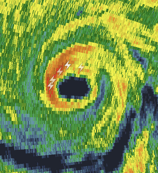
Last few radar scans indicate lightning now showing in the eyewall. Bidness is pick'n up.
-
From the Lee County Sheriff's Office...
-
 3
3
-
 1
1
-
-
For what it's worth...
-
-
Spring time.... please hurry.
Tired of this severe clear and 28° mornings and 55° highs
-
Remember when NFL teams played defense at the end of games? Yeah... me neither.
-
2
-
-
For the Metro ATL and N GA folks. A thread from Ryan Maue...
-
2
-
 1
1
-
-
Large debris sig as it moved through Tupelo proper.
-
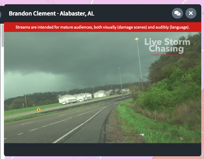
Approaching 100 miles on the path of the Birmingham mesocyclone. Historical storm.
-
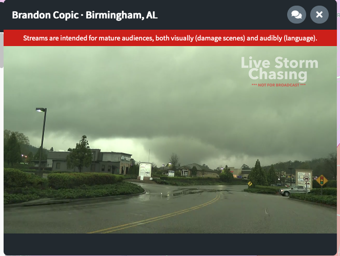
Copic has the tornado on the ground on stream.
-
2
-
-
TOR Emergency issued.
-
rain wrapped special
-
1
-
-
The entire mesocyclone could be nearly on the ground. Massive.
-
21 minutes ago, Thrasher Fan said:
Ingesting a lot of clutter convection now. Let see if it can overcome that...
It did and its a monster moving into the Hoover and Birmingham south metro.
-
Ingesting a lot of clutter convection now. Let see if it can overcome that...
-
TOR Warning southeast of Laurel, MS
Southwest of Birmingham is most concerning me right now.
-
Heading to my safe place.
-
2
-
-
1 minute ago, MUWX said:
Possible CC drop on the Atlanta storm
Indeed....
-
1
-
-
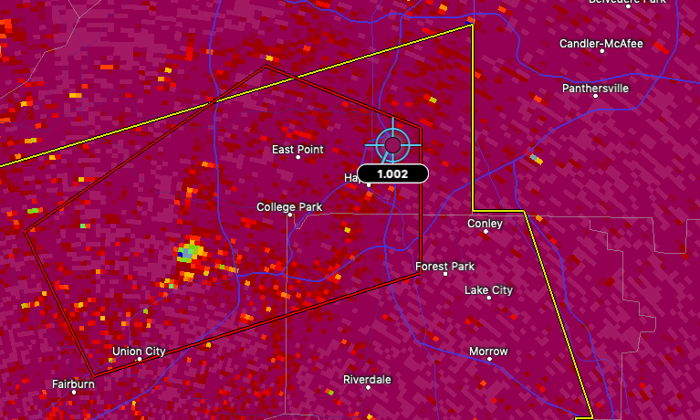
1 minute ago, Chreeyiss said:
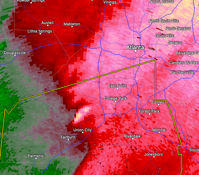
Couplet intensifying sw of Atlanta
TOR Warned
-
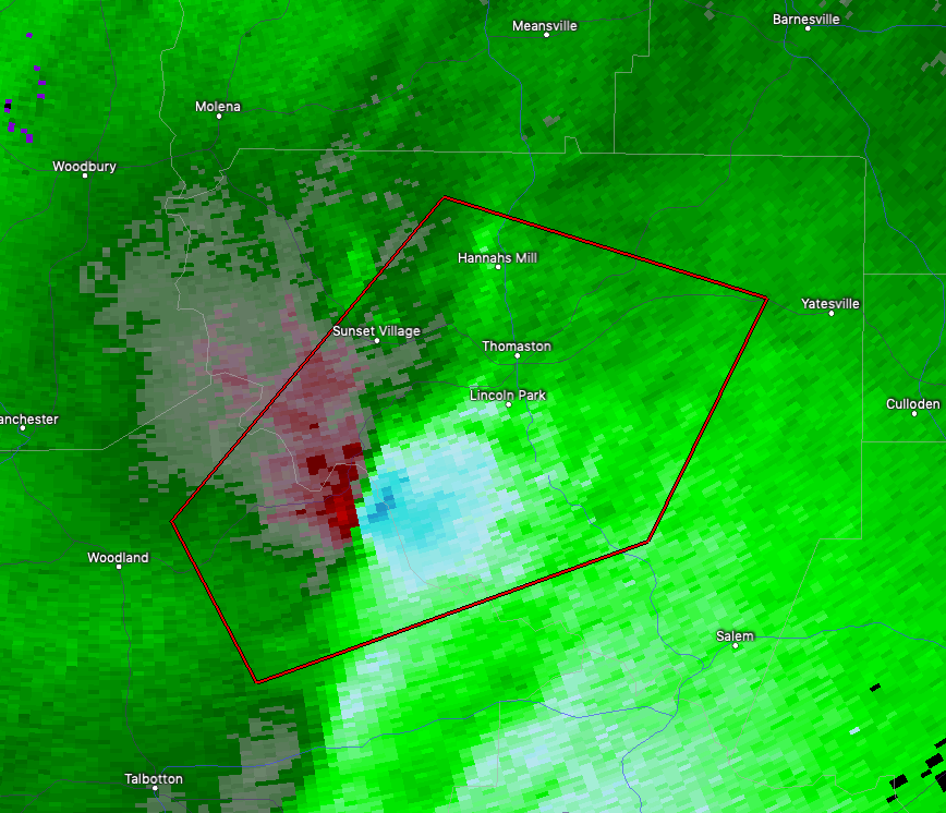
Debris ball sig now east of Thomaston/Lincoln Park. Huge!!
-
3 minutes ago, andyhb said:
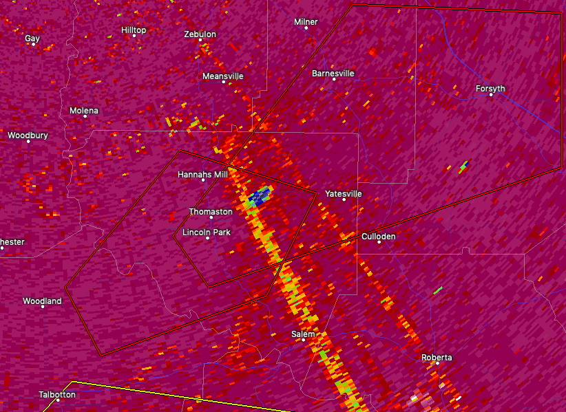
Cell near Thomaston, GA looks close to producing and it could be a sig tor if it does.
-
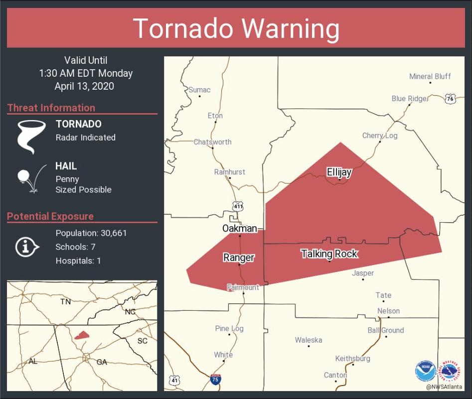
Small debris sig to the west of Waleska, GA inside the TOR warned storm.
-
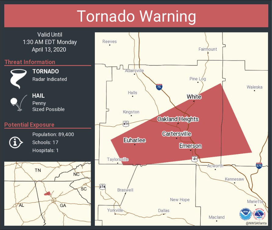
Pulsed up on Velo over Cartersville. Nothing on CC yet.
-
Mid to Long Range Discussion ~ 2024
in Southeastern States
Posted
Heck... if that map plays out, the Sc beaches will do just fine.