SouthernNJ
-
Posts
1,247 -
Joined
-
Last visited
Content Type
Profiles
Blogs
Forums
American Weather
Media Demo
Store
Gallery
Posts posted by SouthernNJ
-
-
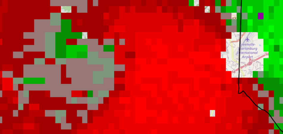
GSP Radar 8:35 PM Scan: Near Pickens SC
-
Far from JAN radar, but a small circulation is also moving through Meridian MS
right now. Hopefully nothing is down with that one.
-
New Orleans Radar 4:06 AM Scan: 10 miles west of McComb MS

-
New Orleans Radar 4:02 AM Scan: Near Liberty MS
-
Pretty broad but strong circulation near Liberty MS. Baton Rouge has a powerful
thunderstorm heading their way as well.
-
Near JAN radar, looks curious: 1:53 AM Scan
-
The mesocyclone exited the first Rapides Parish polygon over Woodworth at 9:21 PM CDT, picked
up a debris signature, and was not warned again until it was over Chambers at 9:28 PM CDT, seven
minutes later. Other warnings prior were not extended until varying debris balls were about 1 or 2
minutes away from exiting polygons, hence the frustration from many folks regarding LCH. Almost
as if they are using the original AWIPS system tonight.
-
Debris maybe beginning to show west of Woodworth.
-
The storm nearing Ringgold LA is trying to get going it appears.
-
The storm west of Alexandria LA beginning to turn right a bit more. Should be
warned soon I believe.
-
Looks like a big area of damaging winds, with a possible circulation just south of Troy AL.
-
Some noticeable circulations near Gantt and Heath NE of Andalusia in AL.
-
Looks like a pretty good signature in Lowndes county AL west of Gordonville.
-
Still small circulation over Lisman AL with the Quitman-originated storm. No extension
of the warning from MOB at this time.
-
Houston Hobby TDWR showing occasional circulation flare-ups in West Columbia hinting
that a tornado is occurring based upon what is being reported.
-
TDWR possible circulation maybe over Olney.
-
Big wind signature moved over the Dulles TDWR near Leesburg.
-
 1
1
-
-
GSP getting busy now. They have one storm warned, and also looks like an area to watch is
moving into Toccoa GA.
-
Almost looks as if the strongest winds/circulation are near the TDWR site
near Lake City with the Atlanta storm.
-
Looks like intense circulation possible again over Forsyth GA.
-
GSP likely watching the mini-storm south of Hickory NC closely.
-
ATL TDWR suggests something could be happening just NE of Cartersville.
-
Circulation on the bow apex getting more organized SW of Rome GA.
-
The former Chattanooga storm could put another down in Cleveland if
the bookend circulation condenses.
Severe weather threat April 25th
in Southeastern States
Posted
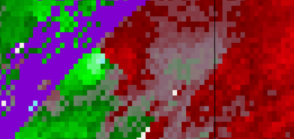
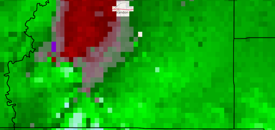
So far, this is the only known radar confirmed tornado in the area. This had a TDS on it, and was just before the warning was issued. It appeared to form
in the bookend portion of the outflow tail, along the back of the hook echo. This is the 9:09 PM GSP scan near Wade Hampton, just west of the radar: