

Crazieman
-
Posts
164 -
Joined
-
Last visited
Content Type
Profiles
Blogs
Forums
American Weather
Media Demo
Store
Gallery
Posts posted by Crazieman
-
-
18 minutes ago, andyhb said:
In my best Maxwell Smart voice, missed it by that much.
-
Is there a discord or something everyone wandered away to? First nice looking severe event in my area in years and I come in to find it virtually dead?
-
 1
1
-
-
-
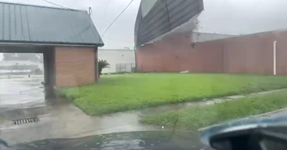
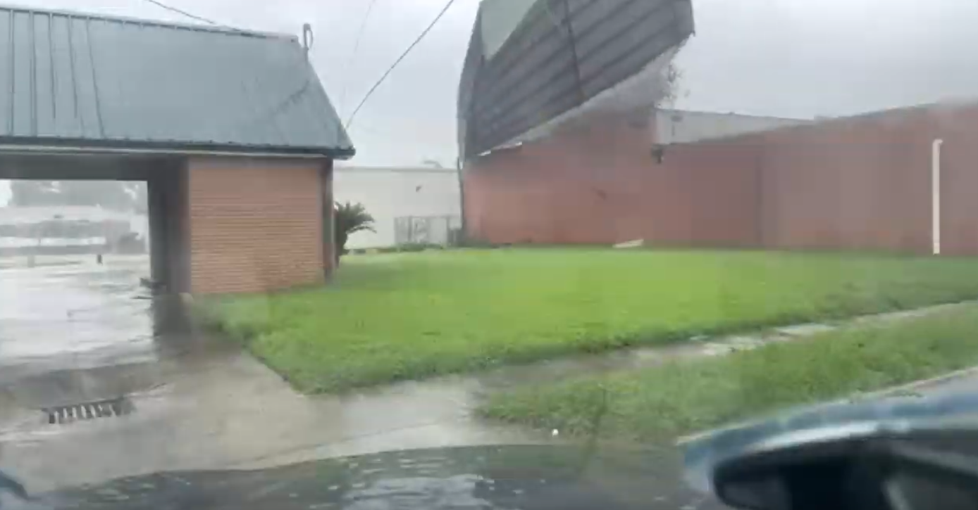
Sheet metal just struck Timmer's car.
-
1 minute ago, Bostonseminole said:
yikes roof just blew off right in front of timmer.. crazy
-
 2
2
-
2
-
-
2 minutes ago, turtlehurricane said:
Underwater cam in Grand Isle is definitely back live https://www.severestudios.com/storm-chasers/john.humphress2.html
IT LIVES!
-
4
-
-
Grand Isle camera is the blue shed moment.
This needs to be repeated for every hurricane. Make, model, and setup.
-
15
-
1
-
-
Grand Isle camera has been under some waves now. How high is it mounted?
-
Jeff is live.
-
2
-

May 16 - June 4, 2024 Severe Weather
in Central/Western States
Posted
There is another board, found Andy on it.