
icebreaker5221
-
Posts
1,459 -
Joined
-
Last visited
Content Type
Profiles
Blogs
Forums
American Weather
Media Demo
Store
Gallery
Posts posted by icebreaker5221
-
-
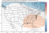
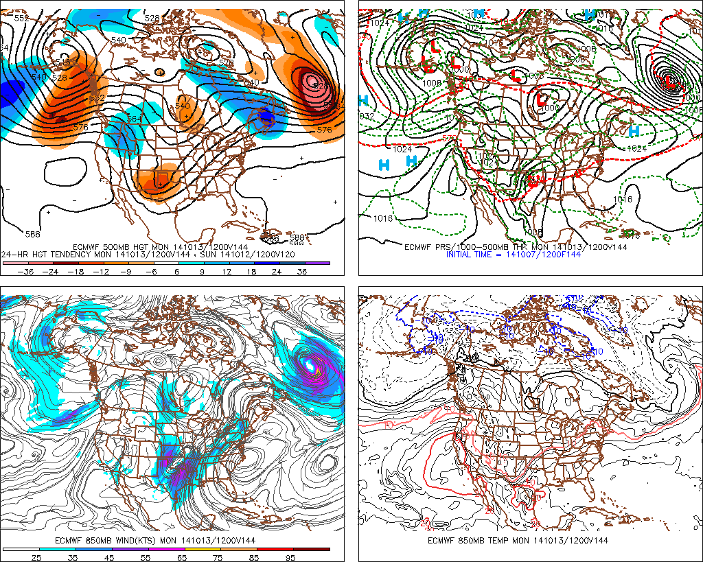
A lot of western troughing/ridging over the eastern 2/3 of the country. Speaking for possible severe wx implications of course.
I apologize for the initial vagueness there.
Ok cool, thanks!
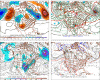
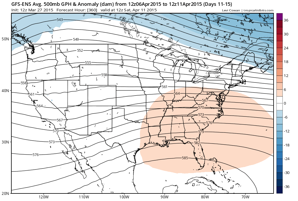
I'd also say that the 11-15day GEFS mean has some potential - I can picture a few embedded shortwaves digging nicely out of that trough in the TX/NM/OK region with decent return flow out of the Gulf.
-
Latest Euro weeklies are pretty "wow" through much of April.
I haven't seen them; why are they "wow"?
-
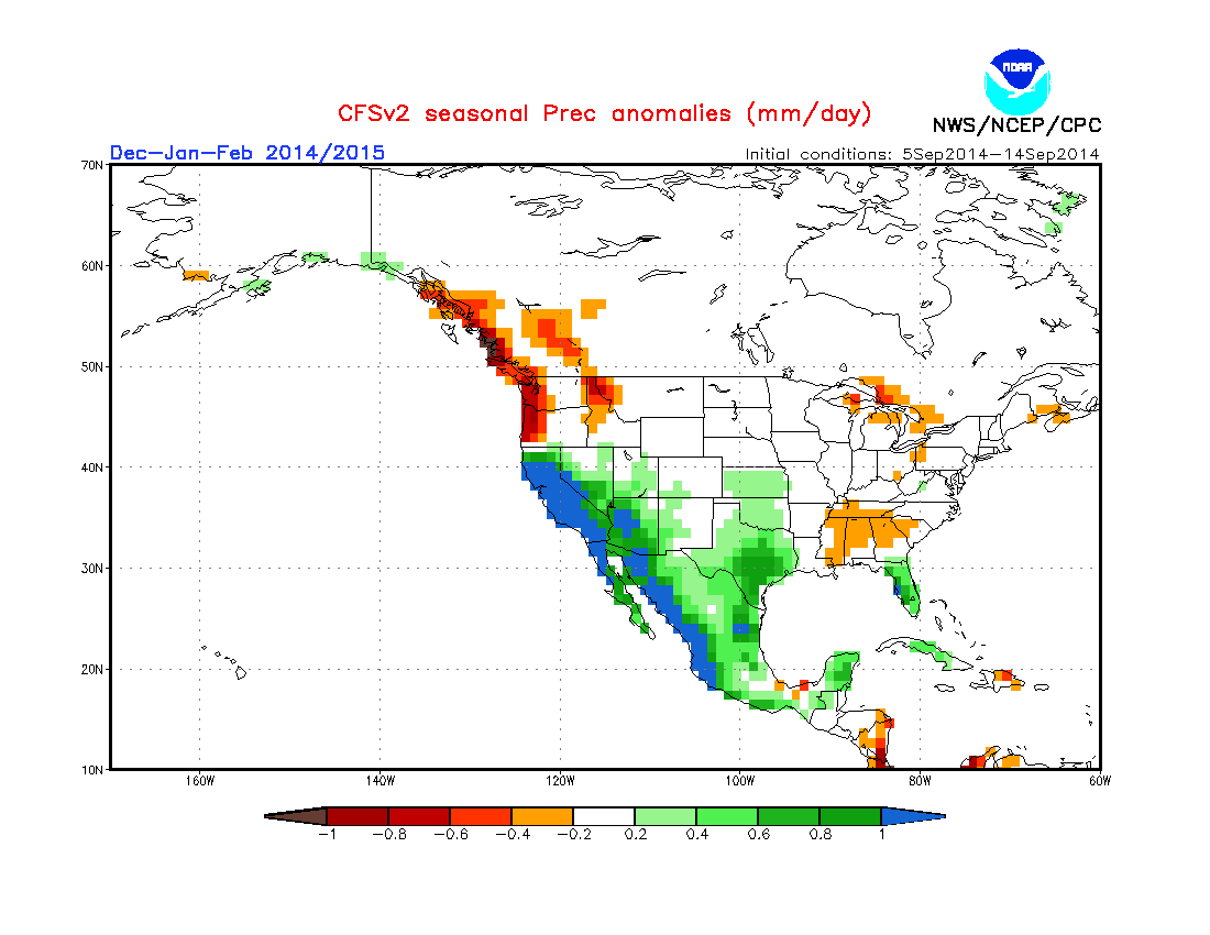
A welcomed change is ahead for the Pacific NW into N California as the pattern changes increasing a tropical connection from the Central Pacific and a zonal flow brings welcomed rains to a Region that has been very dry.
Hopefully the active jet sets up just a little bit further south than that this winter so central CA can get into the action. Of course it's still too early for that right now, climatologically speaking.
-
Looks like a decent setup for severe weather for October. We'd probably want to see greater height falls (as a rough proxy for surface pressure falls) to really back surface winds enough for widespread tornadoes, but that LLJ is nonetheless impressive. Bares watching.
-
Can we just lock this in now please? kthx
-
Relatively insane temperature records set today. Can't believe we had snow less than a month ago.
PUBLIC INFORMATION STATEMENT
NATIONAL WEATHER SERVICE ANCHORAGE AK
415 PM AKDT MON JUN 17 2013
...ALL TIME RECORD HIGHS FALL AT SEVERAL LOCATIONS ACROSS SOUTH
CENTRAL ALASKA...
A EXPANSIVE RIDGE OF HIGH PRESSURE OVER SOUTHERN ALASKA IS CONTINUING
THE STRING OF UNUSUALLY HOT DAYS. TEMPERATURES AT MANY LOCATIONS WERE
IN THE 80S TO MID 90S.
THE FOLLOWING STATIONS SET ALL-TIME HIGH TEMPERATURE RECORDS TODAY:
TALKEETNA....94 DEGREES. PREVIOUS RECORD WAS 91 SET ON JUNE 16
2013...JUNE 14 1969...AND JUNE 26 1953.
CORDOVA......90 DEGREES. PREVIOUS RECORD WAS 89 SET ON JULY 16 1995.
VALDEZ.......90 DEGREES. PREVIOUS RECORD WAS 87 SET ON JUNE 26 1953
AND JUNE 25 1953.
SEWARD.......88 DEGREES. PREVIOUS RECORD WAS 87 SET ON JULY 4 1999.
THE VALDEZ TEMPERATURE WAS RECORDED IN THE CITY OF VALDEZ. THE HIGH
TEMPERATURE AT THE AIRPORT WAS 84 DEGREES.
TEMPERATURES WILL REMAIN ABOVE NORMAL ON TUESDAY BUT WILL BE COOLER
THAN TODAY. THE COOLING TREND WILL CONTINUE ON WEDNESDAY.
MORE CLIMATE INFORMATION FOR SELECT SITES IN SOUTHCENTRAL ALASKA MAY
BE FOUND AT PAFC.ARH.NOAA.GOV/CLIMATE.PHP
SNIDER/LUDWIG
$
Well, if summer is short, it might as well be hot, right? (sort of the opposite philosophy I apply to FL winters)
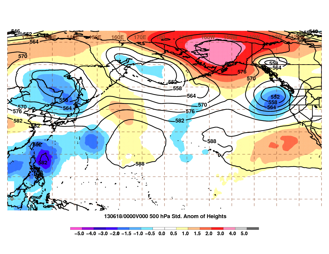
Flirting with +4 sigma at 500 mb:
-
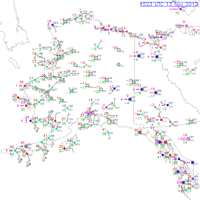
Starting to look quite wintry up there, with -24 F at Fairbanks and some snow moving in tonight for Anchorage. Cold arctic high pressure should slide in from the Chukchi by Fri.
Any local obs to report Baro?
-
Next 10 days are looking pretty chilly up there in AK.
The pattern since basically last year of AK being the only persistently cold spot continues. Hopefully we don't see a semi-permanent AK vortex this winter.
-
I moved here as a journey met. Will be here for a while, excited and incredibly intimidated. All the pattern recognition of the lower 48 is gone. Fells like starting all over again
Cool! Have fun up there!
Hey, it's prbably not as bad as getting used to moving to the southern hemisphere

On another note, we need more obs from MTBLANC.
-
Well I am officially in Alaska now. About time to revive this thread. I would say something weather savvy, but I know nothing about Alaska weather. It is going to be a process. A couple pictures from the Chugach.
Nice pics!
 Are you just visiting or did you move there?
 -
Only in my wildest dreams...
Really nice gallery!
Valdez reporting a snow depth of 81".

-
While the rest of the US yearns for snow, it's been an epic year so far in Valdez.
SNOWFALL (DEPARTURE)
YESTERDAY 3.7" (+1.3)
SINCE DEC 1 141.7" (+77.2)
SINCE JUL 1 213.1" (+94.8)
SNOW DEPTH 54"
-
Good morning everybody,
Today, low of -28.1C, we now have -24.3C with some light snow.
Lows between -40C (Dawson) and -22C (Old Crow) in the territory this morning. It warmed up, but we will keep the cold all the week (apart here in around Wednesday and Thursday).
Here are some pictures I took yesterday around Fish Lake (between -32 and -36C):
It was between 2:30 and 4:00 in the afternoon at sunset. You can see some ice crystals fog patches, a sundog, the creek never freezes.
I could understand if it never freezes solid, but does it at least develop a layer of ice on top in the winter? Mixing would certainly delay the freezing process, but I couldn't imagine not getting some surface ice at those temperatures!
-
Good morning,
I am back after two weeks off in Vancouver.
We have -8.5C actually, with temperatures ranging between -29 and -3 in the Yukon.
Some snow and colder temperatures are expected for this week.
Winter seems to be late compared to 2009 and 2010, but I still expect it to be colder than normal.
Wait & See !
Looking super cold if the long range forecasts pan out!

Post some more pics when you get the chance!
-
-0.9C this morning, we should have got an aditionnal 1 to 2 cm on the ground.
Temperatures ranging from -13 and +3 on the territory, here we have a low of -0.9C.
If it is not too mild and we keep some snow on ground, it may be cold on Thursday night with a low close to -10C.
Wait & See
 !
!I see that it's a webcam, but take some pics during the day! We all want to see them...
By the way, what's your average annual snowfall up there?
-
Also surprised that nuclear engineering is ranked high amongst unemployed, there is a big market for them right now
Not to mention Mathematics and Computer Science? Something sounds screwy about that! Maybe Mathematics majors are doing ok (ones I know from my experience are) and Computer Science majors are ok (dido), but people with the combined degree are not getting a job specific to that major? IDK...
-
Does anyone have 12Z ECMWF QPF for ALB and POU? Thanks!
Central/Western Medium-Long Range Discussion
in Central/Western States
Posted
Probably better for the CA drought thread, since this isn't about the medium-range forecast.
In any event, a small percentage of the state being ~1" above average for the latest 30-day period is just a drop in the bucket compared to the 5-10"+ deficits accumulated this winter. Also, being slightly below last year when last year was one of the worst drought years ever actually is still pretty bad.
But I will concede that a slightly wetter pattern recently is certainly better than the alternative, with some more threats this week.