

ST21
-
Posts
157 -
Joined
-
Last visited
Content Type
Profiles
Blogs
Forums
American Weather
Media Demo
Store
Gallery
Posts posted by ST21
-
-
8 minutes ago, Cheeznado said:
Heavy snow band in ATL, Looks like it is about to end, picked up the forecasted dusting, just never expected these kind of rates. EDIT: the back end was advancing, now it is not. We may get an ibnch or two. Amazing.
Congrats! I’m probably 40 miles North of Atlanta, just had some flurries. Really sharp cutoff of snow. Hoping the green area in Gadsden holds up until it gets here so maybe we get a light dusting up here. Congrats to everyone who got some, especially the people who never get to see snow
-
Flurries here in Forsyth County!
-
 1
1
-
-
2 minutes ago, NorthHillsWx said:
The “snow hole” on ATL radar is starting to shrink, implying we are seeing a more Rapid moistening of the atmosphere and getting closer to them seeing flakes
You’re welcome. I’ve been spraying the water hose in the air to moisten the atmosphere
-
 9
9
-
 1
1
-
-
3 minutes ago, wake4est said:
GFS will raise some eyebrows triangle west
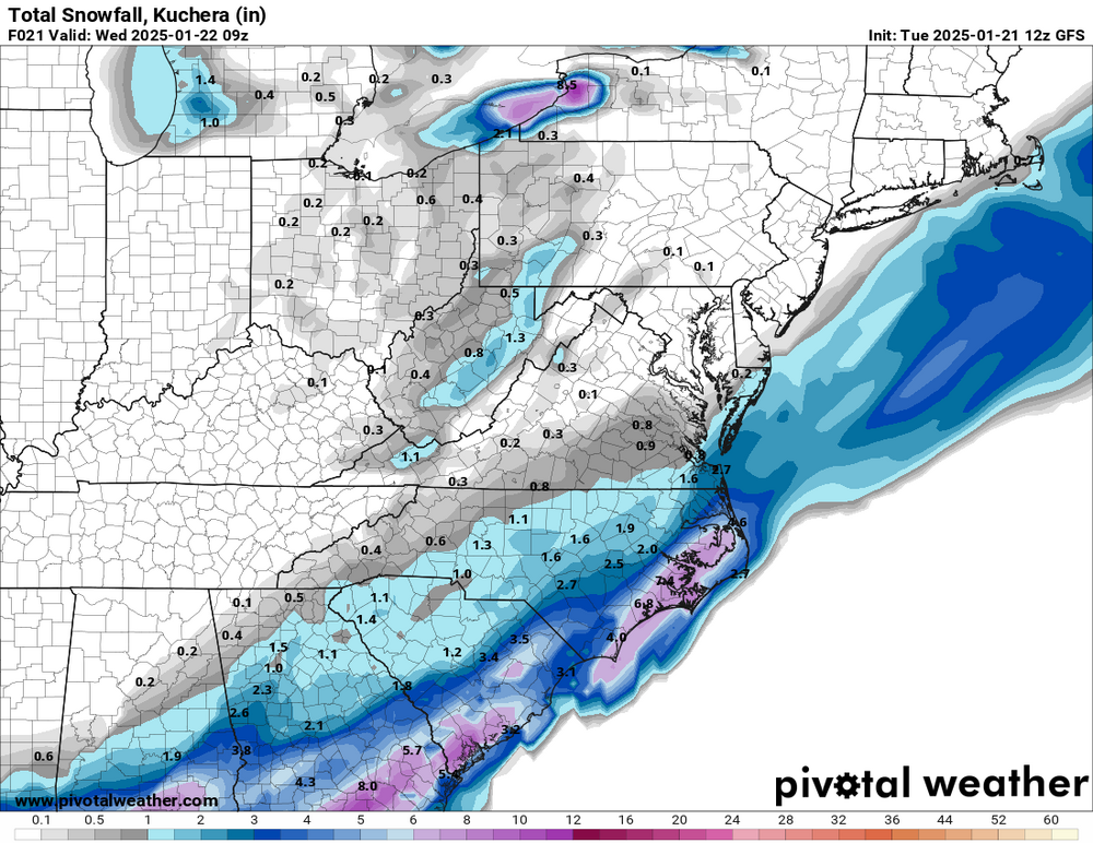
I’d take that, but does GFS include Virga?
-
1
-
-
2 minutes ago, olafminesaw said:

Would be nice to get at least dusting up here north of Atlanta. I’ve seen it go from nothing to .3 inches. I’d take that, all depends if these northern precip returns can reach the ground
-
Seeing a blizzard warning on the gulf coast is blowing my mind
-
3
-
-
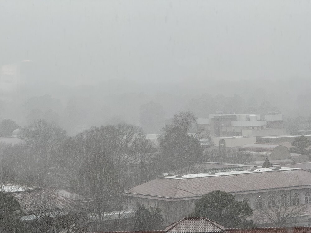
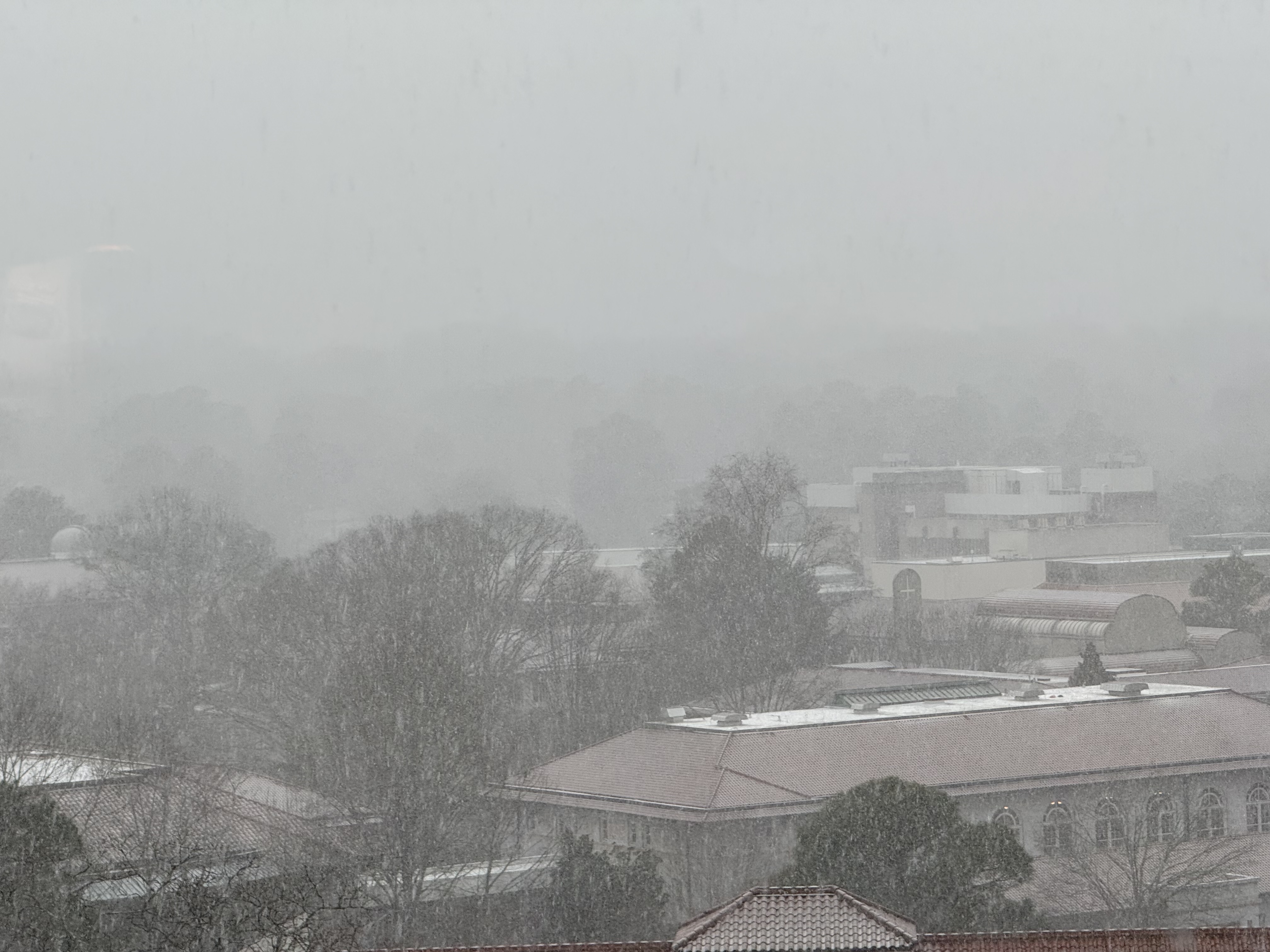
Mostly snow, little bit of sleet in Smyrna, GA
-
Need to get some more yellow and orange returns to keep the snow from changing over in Gwinnett, Jackson, Barrow and Hall Counties.
-
I've got the biggest flakes I've ever seen coming down now. Grass and everything but roads are turning white
-
1
-
-
Big ol flakes and some sleet coming down. Trying not to turn into a weenie because our Mets say it won't last but it looks extremely promising
-
Already surpassed my low for the night. Down to 35 snow and sleet continues to fall
-
Moderate-heavy snow in Braselton
-
2
-
-
Temp down to 40. Its been dropping like a rock since I first reported I had sleet. Down from 49
-
2 minutes ago, burrel2 said:
3km nam has douglasville, Georgia at 42/37 with rain at 4pm. At 4pm, Douglas cold is 37.2/34.0 with .03 inches in the bucket.
Interesting....
Would love for this to completely bust in a good way for metro Atlanta and everywhere else
EDIT: As I post this, sleet has started in Jackson County
-
1
-
-
Per Brad Nitz, lots of sleep reports in metro Atlanta
-
Are Atlanta mets thinking that the models are too cold? I keep seeing snow totals over metro atlanta from the models but they just have it as rain
-
Not sure if it matters but my forecast low was 33 and I'm already at 30
-
14 minutes ago, burrel2 said:
03z rap holds firm and smokes the upstate.

Give me this and call it a winter

-
6 minutes ago, Snow dog said:
GSP with the sweet spot!
It looks like our Atlanta local is going with the NAM model. Theirs looks like it has the warm nose
-
4 minutes ago, wncsnow said:
RGEM isn't that good here, misses us with the heaviest front end precip. Not many models are showing legit warning criteria except for higher elevations north of 40 and in VA
(12).thumb.png.2e2a2c7adbc6d66d9aafdfb81e41a995.png)
Puts 1-1.5" in my back yard. I would take it here given how this winter is. I'm in Hoscton, GA
-
Precip moved in and temp has dropped 2 degrees so far. Down to 43
-
Braselton, GA 50/41 right now.
-
3 minutes ago, CntrTim85 said:

Still happy here in Virginia Beach!
I'll take that map for GA
-
2
-
-
Low looks further south


(12).png.07195bb8786ed8c788053de680e0ea2d.png)
1/21 - 1/22 Winter Storm Threat
in Southeastern States
Posted
They just extended a WSW into my county, I don’t think we have anywhere that’s had much stick in the county. Unless they expect another band to come through, not sure why they did that