

susqushawn
-
Posts
36 -
Joined
-
Last visited
Content Type
Profiles
Blogs
Forums
American Weather
Media Demo
Store
Gallery
Posts posted by susqushawn
-
-
3 minutes ago, MJO812 said:
6z ggem

Is that origin stamped 0z?
-
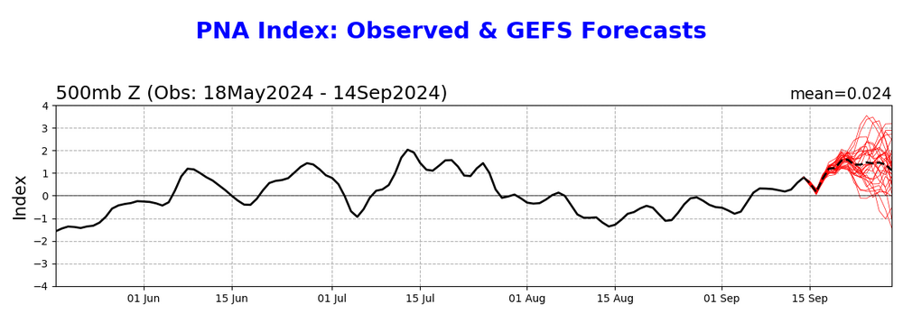
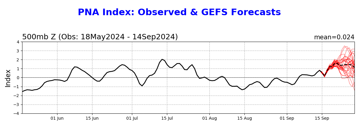
15 hours ago, bluewave said:
The PNA was weakly positive on the CPC site in January 2023.
2023 0.21
Bit of a tangent here ...The CPC methodology for calculating the PNA index may be subject to flaws. This week ahead is a case in point. It projects a +PNA despite an unmistakable trough modeled out west.
It was pointed out to me that the CPC formula for + phase looks for above normal heights from Hawaii to the intermountain west, and below normal heights over the Alleutians and SE Conus.
The week ahead is an anomaly as it does indeed have below normal heights in the SE but obviously not resultant from a west coast ridge, rather, a stagnant rex block. I suspect that's the main anomaly "fooling" the formula into believing we have a notable +PNA, when from a sensible wx standpoint it's the complete opposite. If this was winter the CPC projection would be under greater scrutiny. That would be an exciting +PNA projection in DJF but sensibly it couldn't be farther from reality.
-
 1
1
-
-
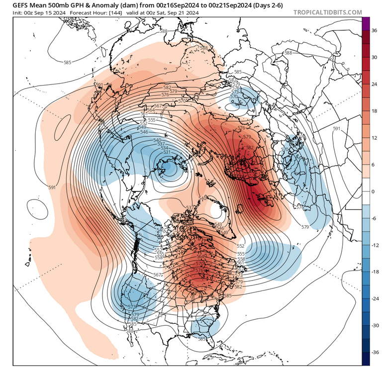
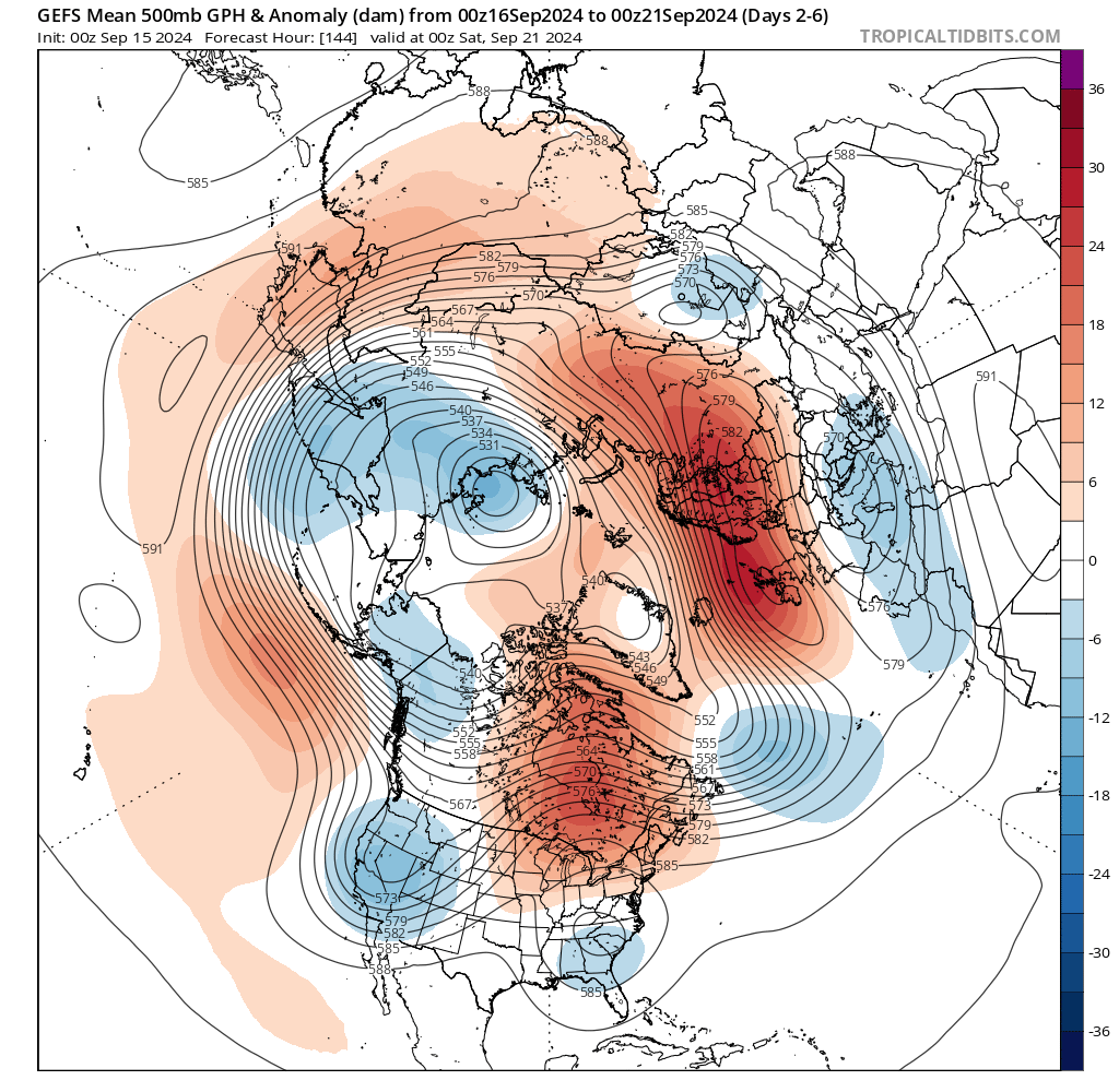
1 hour ago, bluewave said:
The key with the La Niña background state and +PNAs is that we need very strong +PNAs to prevent an upper low from undercutting the +PNA ridge. This coming week is an example of the +PNA not being strong enough to prevent the upper low from undercutting the ridge. This is the issue we have had during many recent winters. We need a stronger monthly +PNA to prevent the upper low from undercutting the ridge.
Jan 2023 La Niña and the +PNA was too weak at only +0.21 for the month allowing deep trough underneath and +10 warmest January on record in the Northeast

December 2011 +PNA too weak at only +0.36 allowing Baja Trough underneath and one of the warmest Decembers on record

Jan 2022+1.01 +PNA allowed heavy snows especially east of NYC
Dec 2020 +1.58 +PNA one of the strongest on record allowing historic 40” snow for BGM with -AO
A raging Pac jet tickling the coast certainly doesn't aid in sustaining a +PNA, been a common theme the past several winters. Ridge rolls over or lops off. Chill that thing out a bit and hope springs eternal
-
3
-
-
1 hour ago, 40/70 Benchmark said:
Haven't you posted on several occasions something to the effect that +NAO has been coinciding with +PNA and -NAO with RNA??
I analyzed pna nao cycles earlier in the season, it was something like 10-12% of the time did we have a +PNA/-NAO couplet the past 10 winters or so
-
1
-
-
-
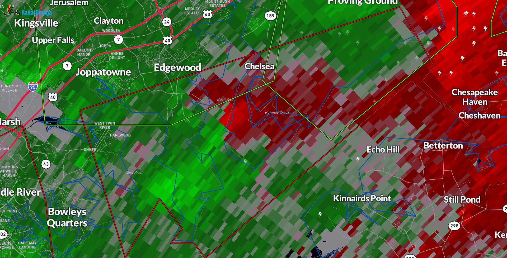
Possible debris signature on CC S of Baltimore
-
1
-
-
15 minutes ago, Ralph Wiggum said:
Wth is the 6z gfs doing on Christmas eve?

oh you know just your typical retrograde of an Atlantic low hundreds of miles before phasing with northern stream energy, stall/loop, bring some flakes then off it goes. no biggie lol. nice to see HP anchored in E Canada that long, of course it's only the op...
-
43 minutes ago, EastonSN+ said:
Remember the EURO MJO always plays catch up to the GEFS.
Euro sniffed out the upcoming stronger pass in phase 4 before the gefs which was in the COD before adjusting
-
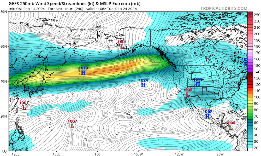
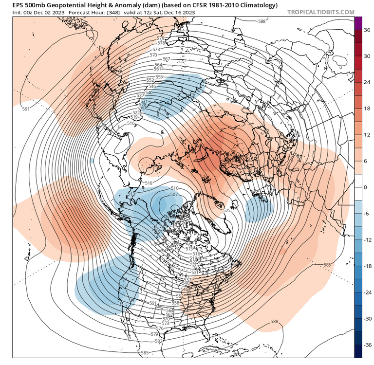
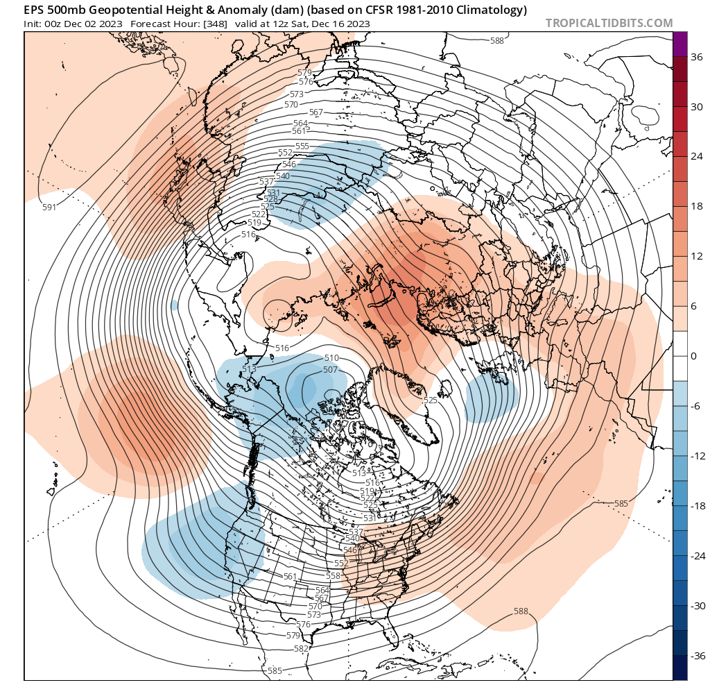
13 minutes ago, CAPE said:
I left out last December because other aspects of the pattern were favorable enough and the massive ridge wasn't quite established early on, so we actually had a shot. Just didn't work out. Beyond that during our actual winter period we literally had no chance.

An eps projection for comparison. That sea of okhotsk trough had been a staple
-
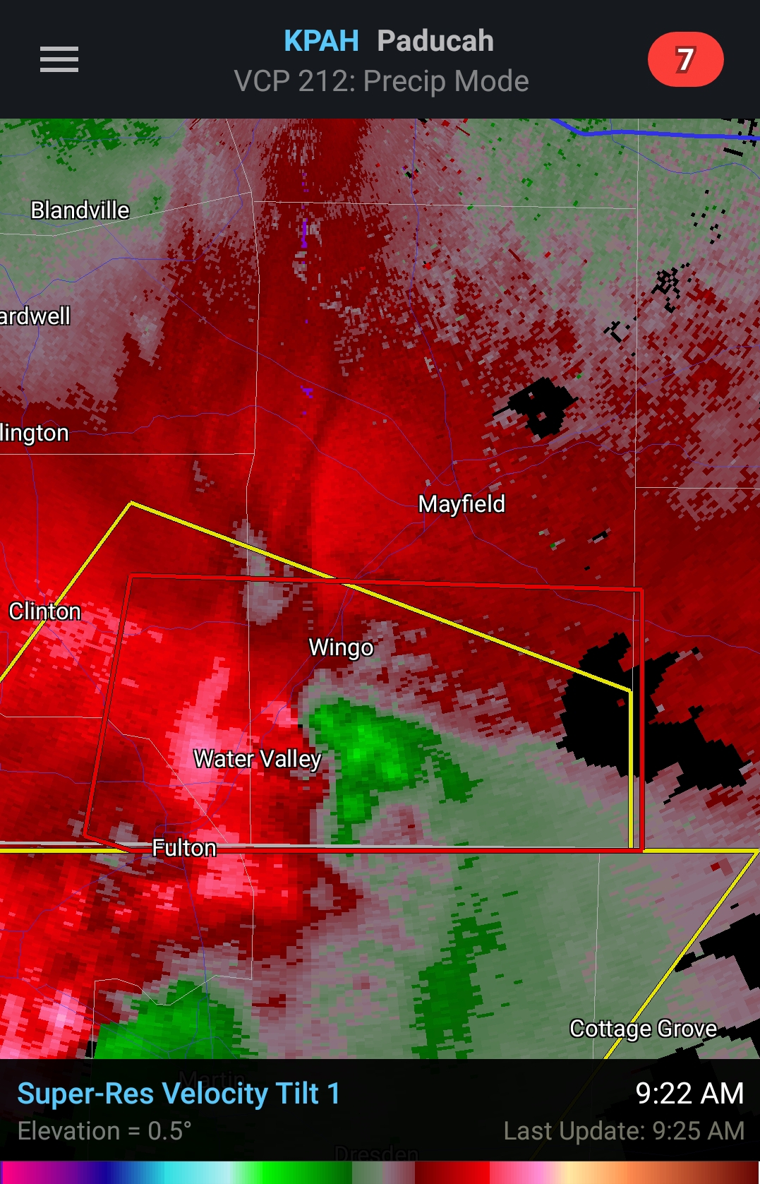
Brief couplet

-
1
-
 1
1
-
-
26 minutes ago, BristowWx said:
Man, I haven’t heard that in a long time. Who was that?
Colin
-
2
-


February Medium/Long Range Thread
in Mid Atlantic
Posted