

Low Pressure Lunacy
-
Posts
22 -
Joined
-
Last visited
Content Type
Profiles
Blogs
Forums
American Weather
Media Demo
Store
Gallery
Posts posted by Low Pressure Lunacy
-
-
7 hours ago, Floydbuster said:
We shall see. Still a bit north though. I really think the ITCZ being so far north is a big factor in why August was quiet.
Saw this pop up on Youtube a few hours ago when looking at the news. They agree with you about the ITCZ.
-
 2
2
-
 1
1
-
-
6 hours ago, WxWatcher007 said:

Thanks for this. I just opened it in another tab and zoomed in 500% and it has 18 inches on top of Ft Myers!
.thumb.png.2729670b1cedd5e881b0e29759111b06.png)
-
1
-
-
And the flood watch is on the east coast of Florida, think it is off by 100 miles, we are getting nailed in the Ft Myers area.
-
I have been going to the Frying Pan Tower's Youtube channel this summer to see any waves that the hurricanes might have produced as they went by way off the coast and there was not much wave activity that I saw. Use to live in Hawaii and I miss the waves at Pipeline beach. But today with this storm being so close there are some waves 30 miles off the coast of Cape Fear and the ocean looks angry, so does the atmosphere. Really poor visibility looking across the ocean compared to the last month or so.
The Belly Cam shows the bottom pipe frame of the structure near the water and it is usually lined with seagulls but today they are not there!
Must be a real trip to ride out a storm in this tower.
Link to the buoy that can be seen from the tower, wave heights are 12 feet.
https://www.ndbc.noaa.gov/station_page.php?station=41013
https://www.youtube.com/@FPTower
-
3
-
1
-
-
As if we don't have enough problems in Floriduh, here is another, just in time to make your hurricane planning much more of a nightmare. They put diesel in the gas, BJs, 7Eleven etc. This article has a list of stations and says "Citgo sells gas to BJs, 7-Eleven, and also some unbranded stations. FDACS will send a more accurate list as it becomes available."
Good luck to everyone dealing with Idalia.
Gas stations in SWFL impacted by fuel contamination at the Port of Tampa; Citgo releases list
WGCU | By WGCU StaffPublished August 27, 2023 at 2:18 PM EDT-
1
-
-
On 4/3/2023 at 9:42 AM, WxWatcher007 said:
Thanks for posting this. I keep forgetting to go look for it. Have been busy dealing with the ongoing aftermath of Ian, and will be cleaning up tree and other debris for a long, long time on our 5 acres of prime swampland, over 30 trees came down and smashed lots of stuff.
As I am reading through this document I noticed they use Max Olson's videos as a reference, on page 50 of the PDF under Figure 10-Deployed USGS Water Level Sensor, and photos from his videos are on page 51 under Figure 11. Josh Morgerman's images are on page 61 Figure 21, and data on page 7. I have seen a bit of criticism thrown at the chasers on this and the previous forum over the past decade and a half. So I would like to thank Max and Josh very much, and all the other responsible chasers who provide visual images and other information for our government and the general public to learn from.
I also want to thank the owners and moderators of this forum for providing a centralized place to discuss the weather and share information. I have found it to be invaluable and necessarily for obtaining the earliest information to start planning for a potential storm, never mind my obsession and love hate relationship with the weather on this planet. So fascinating to watch and so miserable to endure.
-
2
-
-
New lemon is making my stomach hurt.

-
1
-
-
16 hours ago, Normandy said:
Like I said in the Ian thread, this hurricane season might change things for Florida and how they operate with respect to development on coastlines. All of those lows I imagine get dragged north by something.
Desicion makers in Floriduh will never do the right thing, because they are corrupt and their moto is private proffits over public interests. Have sat across the table from them & the developers too many years begging them to do the right thing and they never do, they pay millions for studies they ignore, and use greed as their guide. Too many humans get their rocks off over death and destruction, and create war to continue that high, and to feed the greed. Think that may be why tropical cyclones are given human names, humans envy the power of destruction. Ian destroyed this area, and it fu#%ing sucks.
-
5
-
1
-
 1
1
-
 1
1
-
-
I just wanted to thank everyone for all the work they do posting information about all the storms on this forum, as it makes it much easier to monitor what is going on when all the info is in one place. I also appreciate all the storm chasers who show us videos of what we can expect, which is both educational and motivating, it helps one to gauge what they can handle and to get things done in a hurry when preparing for a storm. I would also like to thank the chasers like Josh who help collect important information about these storms. So often the chasers are demeaned but I have learned a lot from the chase posts and videos. To anyone else who may be affected by this storm I wish you the best. Going to go freak out now and start trimming branches, and tying things down.
-
1
-
-
4 hours ago, jjwxman said:
The 00z CMC also shows the stall over Florida and then north into the SE US.

.Thanks for posting this, even though it is freaking me out. I am just north of the Caloosahatchee river near the Charlotte/Lee County line about 25 miles inland and we are in what South Florida Water Management District calls the Northern Everglades with seasonal sheetflow flooding. We flood every summer for 3 to 16 1/2 months [with an added wet winter}, and the county keeps allowing development and the filling of the floodplain so instead of the average 18 inches of water found in the Everglades we have had 20-22 inches the past few weeks with all the recent heavy rain and during a major event there can 31-33 inches{can last a week or two or go down a 1/2 inch a day} as there was for TS Ernesto 2006, and Irma. So it will be really interesting and terrifying if this model comes to fruition.
I am still trying to figure out why I moved to Florida when I was 20 something in 1981, thought it would be like Hawaii{Army brat in high school there}, I was mortally wrong, as it more resembles hell in the twilight zone, a more intense version of damnation.
-
 1
1
-
-
21 minutes ago, GaWx said:
I just noticed that the sky here in Savannah, GA, is milky and the sun looks filtered. It has the look of smoke or haze. But something about it looks different. Is this possibly from SAL? Anyone know if SAL is currently extending all of the way to the GA and SC coast? If so, this is fascinating as I don't think it gets here all the way here at this intensity more than rarely.
The Area Forcast Discussion pasted below for the Tampa area mentions the SAL. It is hazy here in the FT Myers/SW Florida area too. You can also see it on the Satellite images.

Area Forecast Discussion
National Weather Service Tampa Bay Ruskin FL
246 PM EDT Wed Aug 10 2022

...New DISCUSSION, AVIATION, MARINE, FIRE WEATHER...

.DISCUSSION...
Issued at 243 PM EDT Wed Aug 10 2022

Ridging will remain to our north for the rest of the work week
however the bigger factor of the weather across the area will be the
Saharan Dust Layer that will be over the area. This will help to
keep us drier with PW`s generally at or below 1.5. This will help to
shut down almost all of our seabreeze thunderstorm activity for the
rest of the week. However, it is summer so will still keep an
isolated chance of showers and storms each day as a few storms will
manager to get through the drier air.
-
2
-
1
-
-
Some Geocolor perspective.
-
5 hours ago, STxVortex said:
Delta's southern outflow arm is streaming into the Pacific Gulf of Tehuantepec [as if pulled]; using the NHC/NESDIS GOES16 Geocolor image, which is too big to insert here [tried various ways?].
The northern outflow doesn't seem as defined or vigorous, may account for the slower development?
Delta has also been making a more westerly course than progged, this worries me here in Coastal Bend Texas; the extra westering may scootch the ultimate track over too far for us.
Do I need to give the boat the full 'batten down' in the slip, schedule a haulout? Decisions decisions ...
Made a screen shot of Delta's tail. Wishing you luck in dealing with this storm.
-
1
-
1
-
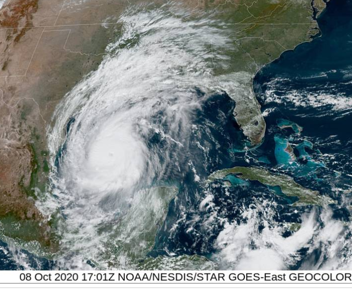
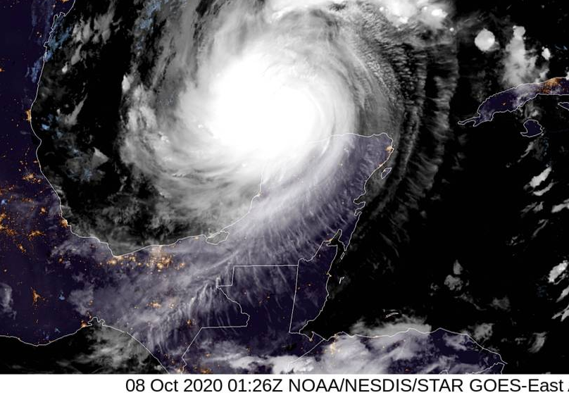
Major Hurricane Milton
in Tropical Headquarters
Posted
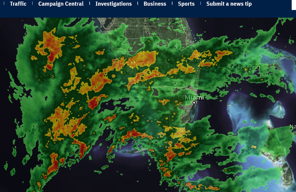
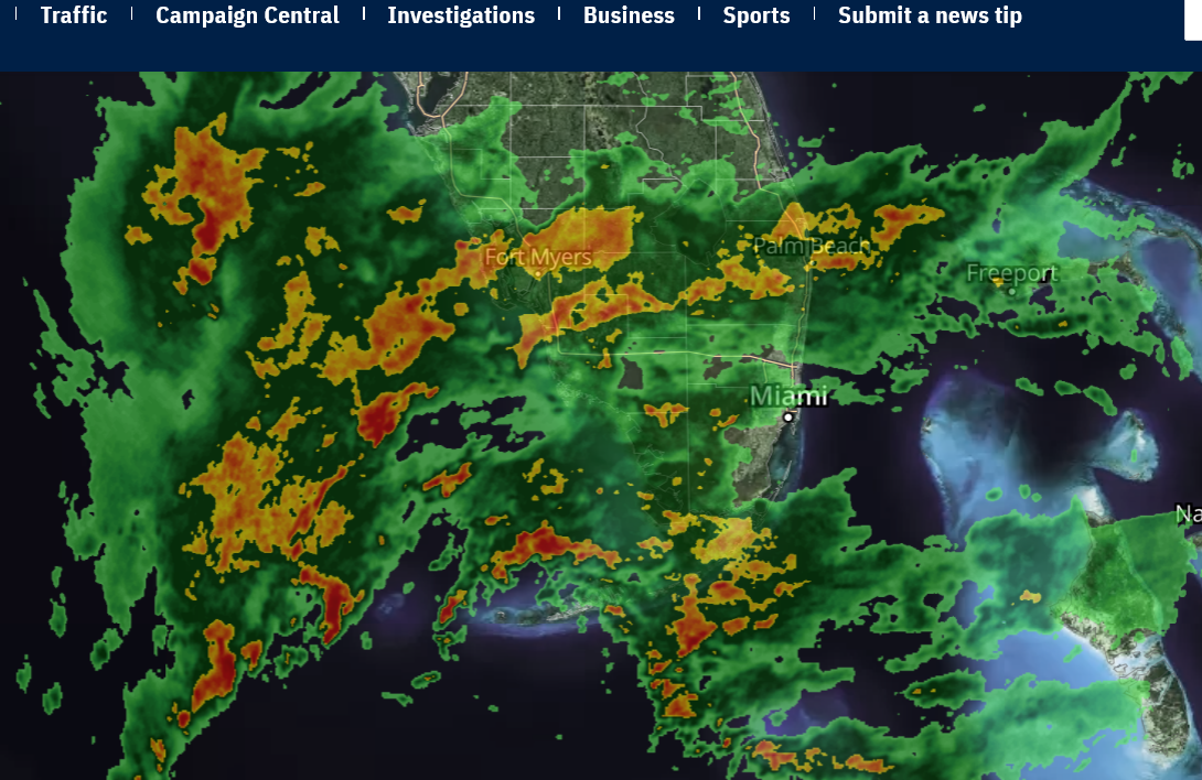
Weather radio and tornado warning woke me up. It is now on the local radar. Funny how that little green blob I see will make so many, maybe even myself, say goodbye to the world we thought we lived in.
The lyrics of Mika's song, Any other world, seem to go with the mood right now. It's time to finish getting ready for Milton's unwanted visit. Good luck to all those in it's path.
You could tell the difference
And let it all unfurl
Into broken remnants
And let yourself let go
Say goodbye to the world you thought you lived in
Take a bow, play the part of a lonely, lonely heart
Say goodbye to the world you thought you lived in
To the world you thought you lived in