UABweather
-
Posts
21 -
Joined
-
Last visited
Content Type
Profiles
Blogs
Forums
American Weather
Media Demo
Store
Gallery
Everything posted by UABweather
-

-
-
-
Hell yes we do. I have my helmet right beside me.
-
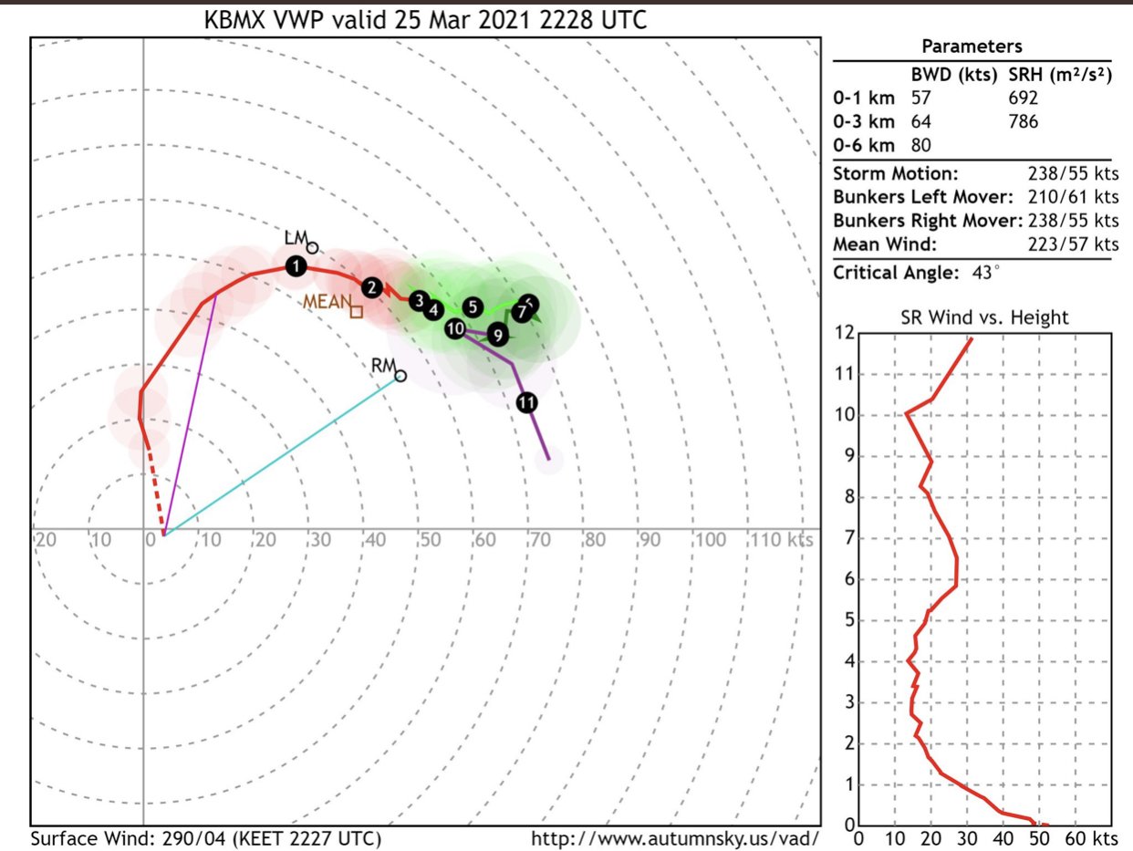
https://www.spc.noaa.gov/products/md/md0261.html oh my god. DISCUSSION...An intense tornadic supercell located over Hale County will likely remain unimpeded as it moves to the east-northeast across central AL during the next 1-2 hours. The near-storm environment is currently primed across central AL with 0-1 km SRH at 600 m2/s2 per observed storm motion according to the KBMX VAD. Given the very moist/strongly sheared environment, expecting a long-track intense (EF3+) and potentially violent tornado to continue east-northeast and reach the I-65 corridor over the next hour or so.
-
-
Hodograph evolution over the last 30 mins from BMX NWS.
-
Wow. You don’t see that often.
-
spectacular video! Makes me thankful it went south of me, but sad it happened.
-
https://mobile.twitter.com/pendejoCristian/status/1375176994355343364 holy cow!
-
The high risk contracts and ends at the Miss-AL border.
-
Smithville . . . .
-
Bust, huh . . . .
-
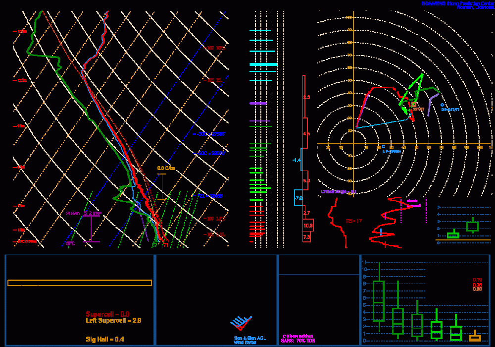
Bham NWS sounding
-
-
It’s bigger than most cities. Thousands of employees. I would not compare it to a Walmart Distro.
-
That’s not a car dealership. It’s one of the largest auto plants in the world.